


<< Our Photo Pages >> Culroy Farm Cairn - Cairn in Scotland in Dumfries and Galloway
Submitted by markj99 on Sunday, 18 November 2018 Page Views: 975
Neolithic and Bronze AgeSite Name: Culroy Farm CairnCountry: Scotland County: Dumfries and Galloway Type: Cairn
Nearest Town: Stranraer Nearest Village: Glenluce
Map Ref: NX25165383
Latitude: 54.848649N Longitude: 4.72477W
Condition:
| 5 | Perfect |
| 4 | Almost Perfect |
| 3 | Reasonable but with some damage |
| 2 | Ruined but still recognisable as an ancient site |
| 1 | Pretty much destroyed, possibly visible as crop marks |
| 0 | No data. |
| -1 | Completely destroyed |
| 5 | Superb |
| 4 | Good |
| 3 | Ordinary |
| 2 | Not Good |
| 1 | Awful |
| 0 | No data. |
| 5 | Can be driven to, probably with disabled access |
| 4 | Short walk on a footpath |
| 3 | Requiring a bit more of a walk |
| 2 | A long walk |
| 1 | In the middle of nowhere, a nightmare to find |
| 0 | No data. |
| 5 | co-ordinates taken by GPS or official recorded co-ordinates |
| 4 | co-ordinates scaled from a detailed map |
| 3 | co-ordinates scaled from a bad map |
| 2 | co-ordinates of the nearest village |
| 1 | co-ordinates of the nearest town |
| 0 | no data |
Internal Links:
External Links:
")
Culroy Farm Cairn lies around 300 yards SE of Culroy Farm. It is a grassy mound around 4 feet high and 60 feet in diameter. There are many scattered rocks on the flattened plateau of the cairn. It is listed as Canmore ID 62231.
Canmore tells us this is a "partially grass covered cairn 22.0m east-west by 19.0m north-south and 1.7m high".
You may be viewing yesterday's version of this page. To see the most up to date information please register for a free account.
")
Do not use the above information on other web sites or publications without permission of the contributor.
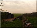
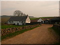
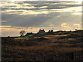
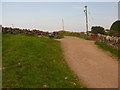
Nearby Images from Geograph Britain and Ireland:
©2011(licence)
©2011(licence)
©2008(licence)
©2011(licence)
©2011(licence)
The above images may not be of the site on this page, they are loaded from Geograph.
Please Submit an Image of this site or go out and take one for us!
Click here to see more info for this site
Nearby sites
Key: Red: member's photo, Blue: 3rd party photo, Yellow: other image, Green: no photo - please go there and take one, Grey: site destroyed
Download sites to:
KML (Google Earth)
GPX (GPS waypoints)
CSV (Garmin/Navman)
CSV (Excel)
To unlock full downloads you need to sign up as a Contributory Member. Otherwise downloads are limited to 50 sites.
Turn off the page maps and other distractions
Nearby sites listing. In the following links * = Image available
533m N 11° Culroy White Cairn* Cairn (NX25285435)
607m NNW 333° Culroy Cairn 1* Cairn (NX24905438)
731m NW 319° Machermore Cairns* Cairn (NX247544)
1.2km SSW 210° Gillespie Stone Standing Stone (Menhir) (NX245528)
1.3km SSW 208° Steeps Park Stone Circle (NX245527)
1.4km SSE 163° High Gillespie* Passage Grave (NX25525245)
1.5km WSW 255° Culquhasen* Cairn (NX23655350)
1.9km WNW 302° Whitefield Loch Crannog* Crannog (NX23555493)
2.0km N 8° Knock Hill Fort* Hillfort (NX25505577)
2.4km NW 308° Barnsallie Fell* Cairn (NX23355535)
2.5km SSE 149° Craignarget Hill* Cairn (NX26365166)
2.6km SW 229° Mull of Sinniness* Standing Stone (Menhir) (NX23095220)
3.1km SSE 152° Green House Bridge Cairn* Cairn (NX26485105)
3.3km SSE 148° Cairn Buy* Cairn (NX26835094)
3.6km ENE 75° Castle Loch* Cairn (NX28695460)
3.9km WSW 243° Laigh Sinniness* Promontory Fort / Cliff Castle (NX21575219)
4.0km W 278° Chapel Well (St Fillan's) Holy Well or Sacred Spring (NX21195457)
4.3km W 261° Stairhaven Broch* Broch or Nuraghe (NX2090353351)
5.4km N 6° Barhapple Crannogs* Crannog (NX25955915)
5.5km ESE 114° The May Cairn* Cairn (NX30095141)
5.5km ESE 116° Lang Riggs (The May) Cairn (NX29995119)
5.5km NW 321° Coffin Stone (Glenluce)* Natural Stone / Erratic / Other Natural Feature (NX2183158227)
5.6km SSE 149° Chapel Finian Well* Holy Well or Sacred Spring (NX27834892)
5.6km SE 126° Brae Moor Cairn* Cairn (NX29595041)
5.6km SE 128° High Moor Hut Circle* Misc. Earthwork (NX29485024)
View more nearby sites and additional images


 We would like to know more about this location. Please feel free to add a brief description and any relevant information in your own language.
 Wir möchten mehr über diese Stätte erfahren. Bitte zögern Sie nicht, eine kurze Beschreibung und relevante Informationen in Deutsch hinzuzufügen.
 Nous aimerions en savoir encore un peu sur les lieux. S'il vous plaît n'hesitez pas à ajouter une courte description et tous les renseignements pertinents dans votre propre langue.
 Quisieramos informarnos un poco más de las lugares. No dude en añadir una breve descripción y otros datos relevantes en su propio idioma.