<< Our Photo Pages >> Frenni Fach - Round Barrow(s) in Wales in Pembrokeshire
Submitted by vicky on Sunday, 29 September 2002 Page Views: 6037
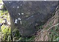
Neolithic and Bronze AgeSite Name: Frenni FachCountry: Wales County: Pembrokeshire Type: Round Barrow(s)
Nearest Town: Cardigan Nearest Village: Crymych
Map Ref: SN226349 Landranger Map Number: 145
Latitude: 51.984156N Longitude: 4.584735W
Condition:
| 5 | Perfect |
| 4 | Almost Perfect |
| 3 | Reasonable but with some damage |
| 2 | Ruined but still recognisable as an ancient site |
| 1 | Pretty much destroyed, possibly visible as crop marks |
| 0 | No data. |
| -1 | Completely destroyed |
| 5 | Superb |
| 4 | Good |
| 3 | Ordinary |
| 2 | Not Good |
| 1 | Awful |
| 0 | No data. |
| 5 | Can be driven to, probably with disabled access |
| 4 | Short walk on a footpath |
| 3 | Requiring a bit more of a walk |
| 2 | A long walk |
| 1 | In the middle of nowhere, a nightmare to find |
| 0 | No data. |
| 5 | co-ordinates taken by GPS or official recorded co-ordinates |
| 4 | co-ordinates scaled from a detailed map |
| 3 | co-ordinates scaled from a bad map |
| 2 | co-ordinates of the nearest village |
| 1 | co-ordinates of the nearest town |
| 0 | no data |
Internal Links:
External Links:
")
Have you visited this site? Please add a comment below.
You may be viewing yesterday's version of this page. To see the most up to date information please register for a free account.
")
")
Do not use the above information on other web sites or publications without permission of the contributor.
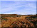
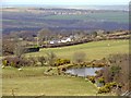
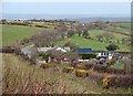
Nearby Images from Geograph Britain and Ireland:
©2008(licence)
©2009(licence)
©2008(licence)
©2008(licence)
©2020(licence)
The above images may not be of the site on this page, they are loaded from Geograph.
Please Submit an Image of this site or go out and take one for us!
Click here to see more info for this site
Nearby sites
Key: Red: member's photo, Blue: 3rd party photo, Yellow: other image, Green: no photo - please go there and take one, Grey: site destroyed
Download sites to:
KML (Google Earth)
GPX (GPS waypoints)
CSV (Garmin/Navman)
CSV (Excel)
To unlock full downloads you need to sign up as a Contributory Member. Otherwise downloads are limited to 50 sites.
Turn off the page maps and other distractions
Nearby sites listing. In the following links * = Image available
2.6km ENE 74° St Clydau's Church* Early Christian Sculptured Stone (SN251355)
2.6km W 270° Frenni Fawr top* Barrow Cemetery (SN2035)
2.9km WSW 252° Frenni Fawr foot Round Barrow(s) (SN198341)
3.5km NNW 342° Maen Colman Stone* Standing Stone (Menhir) (SN21633824)
3.8km SSW 195° Rhyd-y-Gath* Early Christian Sculptured Stone (SN21503125)
3.9km WNW 300° Blaenfos 1 Standing Stone (Menhir) (SN193370)
3.9km SSW 206° Llanfyrnach A* Standing Stone (Menhir) (SN20753141)
4.0km WNW 303° Blaenfos 2 Standing Stone (Menhir) (SN193372)
4.1km SSW 204° Llanfyrnach B* Standing Stone (Menhir) (SN20793121)
4.1km SSW 198° Llanfyrnach C* Standing Stone (Menhir) (SN21163105)
4.4km SSE 158° Castell y Blaidd* Cairn (SN241308)
4.5km W 277° Maen Gwyn Menhir* Standing Stone (Menhir) (SN18123560)
4.5km WSW 253° Crymych Wayside Barrow* Round Barrow(s) (SN18203375)
4.9km WNW 281° Parc Maen Gwyn Issa Standing Stone (Menhir) (SN17853604)
5.4km NW 320° Mynydd Crogwy Standing Stone (Menhir) (SN19323916)
5.7km E 92° Hen Caerau Misc. Earthwork (SN283345)
5.8km WSW 244° Crug yr Hwch Round Cairn (SN173325)
6.0km WSW 252° Croesmihangel Ancient Village or Settlement (SN168333)
6.1km S 170° Crugel Win* Round Barrow(s) (SN23492888)
6.3km WSW 252° Croesmihangel Barrow* Round Barrow(s) (SN165332)
6.4km WSW 249° Mountain Burial Chamber* Burial Chamber or Dolmen (SN16573285)
6.6km NW 306° Saint Meugans Well Holy Well or Sacred Spring (SN17403897)
6.6km SW 224° Ffynon Delyn Henge (SN178303)
6.7km NNE 34° Cilfod Fach Maen Hir Standing Stone (Menhir) (SN265403)
6.7km SSE 150° Pencastell Promontory Fort / Cliff Castle (SN25722899)
View more nearby sites and additional images


 We would like to know more about this location. Please feel free to add a brief description and any relevant information in your own language.
 Wir möchten mehr über diese Stätte erfahren. Bitte zögern Sie nicht, eine kurze Beschreibung und relevante Informationen in Deutsch hinzuzufügen.
 Nous aimerions en savoir encore un peu sur les lieux. S'il vous plaît n'hesitez pas à ajouter une courte description et tous les renseignements pertinents dans votre propre langue.
 Quisieramos informarnos un poco más de las lugares. No dude en añadir una breve descripción y otros datos relevantes en su propio idioma.