

<< Text Pages >> East Moor Enclosure - Ancient Village or Settlement in England in Cornwall
Submitted by TheCaptain on Saturday, 04 December 2010 Page Views: 3894
Multi-periodSite Name: East Moor EnclosureCountry: England County: Cornwall Type: Ancient Village or Settlement
Nearest Town: Launceston Nearest Village: Altarnun
Map Ref: SX223778
Latitude: 50.572847N Longitude: 4.510905W
Condition:
| 5 | Perfect |
| 4 | Almost Perfect |
| 3 | Reasonable but with some damage |
| 2 | Ruined but still recognisable as an ancient site |
| 1 | Pretty much destroyed, possibly visible as crop marks |
| 0 | No data. |
| -1 | Completely destroyed |
| 5 | Superb |
| 4 | Good |
| 3 | Ordinary |
| 2 | Not Good |
| 1 | Awful |
| 0 | No data. |
| 5 | Can be driven to, probably with disabled access |
| 4 | Short walk on a footpath |
| 3 | Requiring a bit more of a walk |
| 2 | A long walk |
| 1 | In the middle of nowhere, a nightmare to find |
| 0 | No data. |
| 5 | co-ordinates taken by GPS or official recorded co-ordinates |
| 4 | co-ordinates scaled from a detailed map |
| 3 | co-ordinates scaled from a bad map |
| 2 | co-ordinates of the nearest village |
| 1 | co-ordinates of the nearest town |
| 0 | no data |
Internal Links:
External Links:
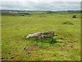
To the northwest of the cairns and row blocking stone on the top of the hill in middle East Moor, can be found the remains of a prehistoric enclosure, said to be in the shape of a “D” and made up of small stones mostly hidden under the turf.
I have read that this is very difficult to find, so just had a quick look for this but found nothing obvious, and didn’t spend much time looking.
You may be viewing yesterday's version of this page. To see the most up to date information please register for a free account.
Do not use the above information on other web sites or publications without permission of the contributor.
Nearby Images from Geograph Britain and Ireland:
©2007(licence)
©2020(licence)
©2007(licence)
©2021(licence)
©2021(licence)
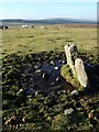
The above images may not be of the site on this page, they are loaded from Geograph.
Please Submit an Image of this site or go out and take one for us!
Click here to see more info for this site
Nearby sites
Key: Red: member's photo, Blue: 3rd party photo, Yellow: other image, Green: no photo - please go there and take one, Grey: site destroyed
Download sites to:
KML (Google Earth)
GPX (GPS waypoints)
CSV (Garmin/Navman)
CSV (Excel)
To unlock full downloads you need to sign up as a Contributory Member. Otherwise downloads are limited to 50 sites.
Turn off the page maps and other distractions
Nearby sites listing. In the following links * = Image available
73m SSE 162° East Moor Row blocking stone* Standing Stone (Menhir) (SX22327773)
125m SSE 150° East Moor ring cairn* Ring Cairn (SX22367769)
194m S 178° East Moor Stone D* Standing Stone (Menhir) (SX2230077606)
206m SSE 164° East Moor stone B* Standing Stone (Menhir) (SX22357760)
211m SSE 147° East Moor cairn* Round Cairn (SX22417762)
269m SSE 147° East Moor stone C* Standing Stone (Menhir) (SX22447757)
286m NE 34° East Moor stone row* Stone Row / Alignment (SX22477803)
339m SSW 192° East Moor menhir* Standing Stone (Menhir) (SX22227747)
632m SSE 160° Greymare Rock* Natural Stone / Erratic / Other Natural Feature (SX225772)
1.1km ESE 109° Redmoor Marsh* Misc. Earthwork (SX23327742)
1.1km NE 39° Fox Tor stone setting* Standing Stones (SX23027863)
1.1km SSE 160° Colquite Menhir* Standing Stone (Menhir) (SX22657675)
1.3km ENE 73° Nine Stones (Altarnun)* Stone Circle (SX23617814)
1.4km NNE 22° Tregune Menhir* Standing Stone (Menhir) (SX2286379095)
1.9km ENE 76° Clitters Cairn* Cairn (SX24157821)
2.0km NNW 328° Spettigue Menhir* Standing Stone (Menhir) (SX21307952)
2.0km E 87° The Ridge Cairn* Cairn (SX24337785)
2.1km WSW 253° Carneglos Barrow* Ring Cairn (SX20287725)
2.4km WSW 253° Carneglos settlement* Ancient Village or Settlement (SX19957715)
2.5km WSW 258° Carneglos row* Stone Row / Alignment (SX19887737)
2.5km E 93° Bowda Stone Circle* Stone Circle (SX24757757)
2.5km ENE 61° Upton Castle* Artificial Mound (SX2454178961)
2.7km SE 139° King Arthur's Bed* Natural Stone / Erratic / Other Natural Feature (SX24057568)
2.9km SW 220° Smiths Moor Field System and Cairns Cairn (SX20357562)
2.9km SW 219° Smiths Moor Cairn Cairn (SX20367560)
View more nearby sites and additional images


 We would like to know more about this location. Please feel free to add a brief description and any relevant information in your own language.
 Wir möchten mehr über diese Stätte erfahren. Bitte zögern Sie nicht, eine kurze Beschreibung und relevante Informationen in Deutsch hinzuzufügen.
 Nous aimerions en savoir encore un peu sur les lieux. S'il vous plaît n'hesitez pas à ajouter une courte description et tous les renseignements pertinents dans votre propre langue.
 Quisieramos informarnos un poco más de las lugares. No dude en añadir una breve descripción y otros datos relevantes en su propio idioma.