<< Our Photo Pages >> Glacbain - Cairn in Scotland in Highlands
Submitted by markj99 on Monday, 13 September 2021 Page Views: 970
Neolithic and Bronze AgeSite Name: GlacbainCountry: Scotland County: Highlands Type: Cairn
Nearest Town: Ullapool Nearest Village: Elphin
Map Ref: NC2231112011
Latitude: 58.061462N Longitude: 5.013481W
Condition:
| 5 | Perfect |
| 4 | Almost Perfect |
| 3 | Reasonable but with some damage |
| 2 | Ruined but still recognisable as an ancient site |
| 1 | Pretty much destroyed, possibly visible as crop marks |
| 0 | No data. |
| -1 | Completely destroyed |
| 5 | Superb |
| 4 | Good |
| 3 | Ordinary |
| 2 | Not Good |
| 1 | Awful |
| 0 | No data. |
| 5 | Can be driven to, probably with disabled access |
| 4 | Short walk on a footpath |
| 3 | Requiring a bit more of a walk |
| 2 | A long walk |
| 1 | In the middle of nowhere, a nightmare to find |
| 0 | No data. |
| 5 | co-ordinates taken by GPS or official recorded co-ordinates |
| 4 | co-ordinates scaled from a detailed map |
| 3 | co-ordinates scaled from a bad map |
| 2 | co-ordinates of the nearest village |
| 1 | co-ordinates of the nearest town |
| 0 | no data |
Internal Links:
External Links:
")
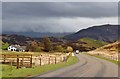
Glacbain is a kerb cairn c. 200 yards S of the A835 on the E edge of Elphin. It situated on a natural knoll measuring c. 18 ft across by 1 ft high according to Canmore ID 4644 . There is a kerb with 4 large stones in the SE Arc and an exposed cist in the centre orientated on a SW-NE Axis. The c. 2.5x 1.5 ft capstone lies at c. 45 degrees in the cist. There are extensive views to the S and W from Glacbain Cairn.
You may be viewing yesterday's version of this page. To see the most up to date information please register for a free account.
")
")
")
")
Do not use the above information on other web sites or publications without permission of the contributor.
Nearby Images from Geograph Britain and Ireland:
©2011(licence)
©2022(licence)
©2023(licence)
©2014(licence)
©2015(licence)
The above images may not be of the site on this page, they are loaded from Geograph.
Please Submit an Image of this site or go out and take one for us!
Click here to see more info for this site
Nearby sites
Key: Red: member's photo, Blue: 3rd party photo, Yellow: other image, Green: no photo - please go there and take one, Grey: site destroyed
Download sites to:
KML (Google Earth)
GPX (GPS waypoints)
CSV (Garmin/Navman)
CSV (Excel)
To unlock full downloads you need to sign up as a Contributory Member. Otherwise downloads are limited to 50 sites.
Turn off the page maps and other distractions
Nearby sites listing. In the following links * = Image available
1.5km E 82° Ledmore* Chambered Cairn (NC23821215)
1.6km NE 42° Cam Loch B Chambered Cairn (NC23431314)
1.6km NE 44° Cam Loch A Cairn (NC23501312)
3.3km NE 48° Ledbeg River* Chambered Cairn (NC24891411)
3.5km E 98° Loch Borralan Crannog* Crannog (NC25741138)
3.8km E 101° Loch Borralan West* Chambered Cairn (NC2603811142)
4.0km E 99° Loch Borralan East* Chambered Cairn (NC26241118)
4.3km E 101° Altnacealgach* Chambered Cairn (NC2652811033)
6.7km NE 39° Allt nan Uamh Bone Caves* Cave or Rock Shelter (NC268170)
8.4km ESE 113° Cnoc Chaornaidh North West* Chambered Cairn (NC299084)
8.7km ESE 113° Cnoc Chaornaidh Central* Cairn (NC30170818)
9.0km ESE 114° Cnoc Chaornaidh South-east* Chambered Cairn (NC30320793)
10.4km NNE 19° Carrachan Dubh Chambered Cairn (NC26102176)
11.6km SSW 207° An Dun, Strath Canaird Stone Fort or Dun (NC16530196)
11.8km N 6° Ardvreck* Chambered Cairn (NC24142371)
13.5km N 2° Allt Sgiathaig* Chambered Cairn (NC23412552)
14.4km NNW 332° Loch Assynt Crannog (NC1603225018)
15.8km SW 222° Dun Canna* Stone Fort or Dun (NC11160080)
16.0km W 280° Inverpolly Stone Fort or Dun (NC06611551)
18.2km SW 222° Isle Martin Cross Stone* Ancient Cross (NH096989)
18.8km E 90° Dail Langwell Broch or Nuraghe (NC41161121)
20.0km WSW 253° Achlochan Broch* Broch or Nuraghe (NC029069)
20.6km W 272° Brae of Achnahaird Stone Fort or Dun (NC01701380)
21.8km ESE 118° Torr Chorcain Vitrified Fort (NC412009)
21.9km NNW 343° An Dun (Loch Ardbhair)* Broch or Nuraghe (NC16893324)
View more nearby sites and additional images


 We would like to know more about this location. Please feel free to add a brief description and any relevant information in your own language.
 Wir möchten mehr über diese Stätte erfahren. Bitte zögern Sie nicht, eine kurze Beschreibung und relevante Informationen in Deutsch hinzuzufügen.
 Nous aimerions en savoir encore un peu sur les lieux. S'il vous plaît n'hesitez pas à ajouter une courte description et tous les renseignements pertinents dans votre propre langue.
 Quisieramos informarnos un poco más de las lugares. No dude en añadir una breve descripción y otros datos relevantes en su propio idioma.