<< Our Photo Pages >> Goodaver Round Cairn - Cairn in England in Cornwall
Submitted by coldrum on Tuesday, 13 October 2009 Page Views: 3337
Neolithic and Bronze AgeSite Name: Goodaver Round CairnCountry: England County: Cornwall Type: Cairn
Map Ref: SX20927509
Latitude: 50.548078N Longitude: 4.52907W
Condition:
| 5 | Perfect |
| 4 | Almost Perfect |
| 3 | Reasonable but with some damage |
| 2 | Ruined but still recognisable as an ancient site |
| 1 | Pretty much destroyed, possibly visible as crop marks |
| 0 | No data. |
| -1 | Completely destroyed |
| 5 | Superb |
| 4 | Good |
| 3 | Ordinary |
| 2 | Not Good |
| 1 | Awful |
| 0 | No data. |
| 5 | Can be driven to, probably with disabled access |
| 4 | Short walk on a footpath |
| 3 | Requiring a bit more of a walk |
| 2 | A long walk |
| 1 | In the middle of nowhere, a nightmare to find |
| 0 | No data. |
| 5 | co-ordinates taken by GPS or official recorded co-ordinates |
| 4 | co-ordinates scaled from a detailed map |
| 3 | co-ordinates scaled from a bad map |
| 2 | co-ordinates of the nearest village |
| 1 | co-ordinates of the nearest town |
| 0 | no data |
Be the first person to rate this site - see the 'Contribute!' box in the right hand menu.
Internal Links:
External Links:
")
From Pastscape:
"The remains of a large hilltop cairn situated in
enclosed moorland. The cairn comprises a turf-covered
stoney mound approximately 19.5m in diameter and up to 0.7m high;
there is no surface evidence of a kerb or cist."
http://www.pastscape.org.uk/hob.aspx?hob_id=435668
You may be viewing yesterday's version of this page. To see the most up to date information please register for a free account.
")
")
")
")
Do not use the above information on other web sites or publications without permission of the contributor.
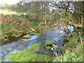
Nearby Images from Geograph Britain and Ireland:
©2008(licence)
©2015(licence)
©2015(licence)
©2011(licence)
©2009(licence)
The above images may not be of the site on this page, they are loaded from Geograph.
Please Submit an Image of this site or go out and take one for us!
Click here to see more info for this site
Nearby sites
Key: Red: member's photo, Blue: 3rd party photo, Yellow: other image, Green: no photo - please go there and take one, Grey: site destroyed
Download sites to:
KML (Google Earth)
GPX (GPS waypoints)
CSV (Garmin/Navman)
CSV (Excel)
To unlock full downloads you need to sign up as a Contributory Member. Otherwise downloads are limited to 50 sites.
Turn off the page maps and other distractions
Nearby sites listing. In the following links * = Image available
78m NW 318° Goodaver* Stone Circle (SX20877515)
325m WSW 257° East Dozmary Hut Circles and Field System Ancient Village or Settlement (SX20607503)
594m WSW 239° Goodaver Settlement and Cairn Ancient Village or Settlement (SX204748)
661m NW 306° Smiths Moor Settlement Ancient Village or Settlement (SX204755)
756m NW 310° Smiths Moor Cairn Cairn (SX20367560)
777m NW 311° Smiths Moor Field System and Cairns Cairn (SX20357562)
928m NW 308° Smiths Moor Hut Circles Ancient Village or Settlement (SX20217569)
1.2km NW 309° Smiths Moor Field System Misc. Earthwork (SX20037585)
1.5km WSW 245° Dozmary Pool* Holy Well or Sacred Spring (SX195745)
1.6km WSW 246° Dozmary Round Barrow Round Barrow(s) (SX19467450)
1.6km SSW 205° Harrowbridge Hill Ancient Village or Settlement (SX20187364)
1.9km NE 47° Rushyford Cairns* Barrow Cemetery (SX22357633)
2.0km WSW 253° Pinnockshill Tumulus Round Barrow(s) (SX18957456)
2.3km NNW 342° Carneglos Barrow* Ring Cairn (SX20287725)
2.3km NNW 333° Carneglos settlement* Ancient Village or Settlement (SX19957715)
2.4km NE 44° Colquite Menhir* Standing Stone (Menhir) (SX22657675)
2.4km SSW 203° Browngelly Downs* Ancient Village or Settlement (SX199729)
2.4km WSW 254° Pinnockshill Hut Circle Ancient Village or Settlement (SX18577450)
2.5km NNW 334° Carneglos row* Stone Row / Alignment (SX19887737)
2.6km NE 35° Greymare Rock* Natural Stone / Erratic / Other Natural Feature (SX225772)
2.7km NNE 27° East Moor menhir* Standing Stone (Menhir) (SX22227747)
2.9km NNE 27° East Moor Stone D* Standing Stone (Menhir) (SX2230077606)
2.9km NNE 28° East Moor stone B* Standing Stone (Menhir) (SX22357760)
2.9km NE 47° Carey Tor Settlement* Ancient Village or Settlement (SX23117698)
2.9km NNE 29° East Moor stone C* Standing Stone (Menhir) (SX22447757)
View more nearby sites and additional images


 We would like to know more about this location. Please feel free to add a brief description and any relevant information in your own language.
 Wir möchten mehr über diese Stätte erfahren. Bitte zögern Sie nicht, eine kurze Beschreibung und relevante Informationen in Deutsch hinzuzufügen.
 Nous aimerions en savoir encore un peu sur les lieux. S'il vous plaît n'hesitez pas à ajouter une courte description et tous les renseignements pertinents dans votre propre langue.
 Quisieramos informarnos un poco más de las lugares. No dude en añadir una breve descripción y otros datos relevantes en su propio idioma.