<< Our Photo Pages >> Fauldinchie E - Misc. Earthwork in Scotland in Dumfries and Galloway
Submitted by markj99 on Tuesday, 10 May 2022 Page Views: 417
Multi-periodSite Name: Fauldinchie ECountry: Scotland County: Dumfries and Galloway Type: Misc. Earthwork
Nearest Town: Stranraer Nearest Village: New Luce
Map Ref: NX19406496
Latitude: 54.946501N Longitude: 4.821347W
Condition:
| 5 | Perfect |
| 4 | Almost Perfect |
| 3 | Reasonable but with some damage |
| 2 | Ruined but still recognisable as an ancient site |
| 1 | Pretty much destroyed, possibly visible as crop marks |
| 0 | No data. |
| -1 | Completely destroyed |
| 5 | Superb |
| 4 | Good |
| 3 | Ordinary |
| 2 | Not Good |
| 1 | Awful |
| 0 | No data. |
| 5 | Can be driven to, probably with disabled access |
| 4 | Short walk on a footpath |
| 3 | Requiring a bit more of a walk |
| 2 | A long walk |
| 1 | In the middle of nowhere, a nightmare to find |
| 0 | No data. |
| 5 | co-ordinates taken by GPS or official recorded co-ordinates |
| 4 | co-ordinates scaled from a detailed map |
| 3 | co-ordinates scaled from a bad map |
| 2 | co-ordinates of the nearest village |
| 1 | co-ordinates of the nearest town |
| 0 | no data |
Internal Links:
External Links:
I have visited· I would like to visit
markj99 visited on 8th May 2022 - their rating: Cond: 3 Amb: 4 Access: 3 The Southern Upland Way is usually muddy so wellies are recommended. The location of the burnt mound in marshy ground make wellies essential.
")
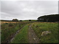
Fauldinchie E Burnt Mound is c. 100 yards N of the Fauldinchie Farm Track c. 50 yards after the junction with the Southern Upland Way. The mound is 110 m E of Fauldinchie W Burnt Mound according to Canmore ID 61587. It measures c. 15 feet across by 2 feet high on the edge of marshy ground.
You may be viewing yesterday's version of this page. To see the most up to date information please register for a free account.
")
")
")
Do not use the above information on other web sites or publications without permission of the contributor.
Nearby Images from Geograph Britain and Ireland:
©2012(licence)
©2012(licence)
©2012(licence)
©2012(licence)
©2019(licence)
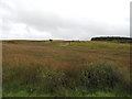
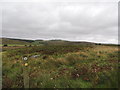
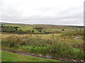
The above images may not be of the site on this page, they are loaded from Geograph.
Please Submit an Image of this site or go out and take one for us!
Click here to see more info for this site
Nearby sites
Key: Red: member's photo, Blue: 3rd party photo, Yellow: other image, Green: no photo - please go there and take one, Grey: site destroyed
Download sites to:
KML (Google Earth)
GPX (GPS waypoints)
CSV (Garmin/Navman)
CSV (Excel)
To unlock full downloads you need to sign up as a Contributory Member. Otherwise downloads are limited to 50 sites.
Turn off the page maps and other distractions
Nearby sites listing. In the following links * = Image available
120m W 272° Fauldinchie W* Misc. Earthwork (NX19286497)
294m SSW 195° Dranigower Hut Circle E* Ancient Village or Settlement (NX19316468)
317m SSW 206° Dranigower Hut Circle W* Ancient Village or Settlement (NX19256468)
320m S 178° Knockcraven Wood* Carving (NX19406464)
703m SE 139° Caves of Kilhern* Chambered Cairn (NX19846441)
750m SSW 211° Hardcroft* Cairn (NX18996433)
1.0km SE 138° Kilhern Spa Well (New Luce)* Holy Well or Sacred Spring (NX20066418)
1.0km WNW 290° Barnshangan E* Cairn (NX18436536)
1.2km WNW 288° Barnshangan W* Cairn (NX18296536)
1.3km WSW 239° Balneil Cairn* Cairn (NX18266435)
1.3km SE 137° Kilhern SE* Cairn (NX20266396)
1.9km SW 216° Cruise E* Cairn (NX18236348)
2.0km SW 218° Cruise W* Cairn (NX18116342)
2.0km WSW 249° Lady Well (New Luce) Holy Well or Sacred Spring (NX17466432)
2.9km SSW 210° Littlepark* Cairn (NX17836250)
3.0km W 268° Mains of Larg NE* Cairn (NX16406497)
3.0km WSW 246° Mains of Larg cairn* Cairn (NX16616385)
3.0km W 267° Mains of Larg NW* Cairn (NX16356493)
3.1km NE 35° Cairn na Gath* Cairn (NX21266741)
3.1km NW 307° Barlure* Cairn (NX17036693)
3.1km W 273° Gowk Nest Wood* Cairn (NX16306523)
3.1km SSW 205° Cruise Back Fell* Hillfort (NX17946219)
3.1km SW 221° Cairn McNeilie* Cairn (NX17246266)
3.5km SW 217° Low Airyolland* Cairn (NX17186225)
4.0km S 186° Mid Gleniron 4* Cairn (NX18856100)
View more nearby sites and additional images


 We would like to know more about this location. Please feel free to add a brief description and any relevant information in your own language.
 Wir möchten mehr über diese Stätte erfahren. Bitte zögern Sie nicht, eine kurze Beschreibung und relevante Informationen in Deutsch hinzuzufügen.
 Nous aimerions en savoir encore un peu sur les lieux. S'il vous plaît n'hesitez pas à ajouter une courte description et tous les renseignements pertinents dans votre propre langue.
 Quisieramos informarnos un poco más de las lugares. No dude en añadir una breve descripción y otros datos relevantes en su propio idioma.