<< Our Photo Pages >> Knockcraven Wood - Carving in Scotland in Dumfries and Galloway
Submitted by markj99 on Friday, 29 July 2022 Page Views: 361
Multi-periodSite Name: Knockcraven WoodCountry: Scotland County: Dumfries and Galloway Type: Carving
Nearest Town: Stranraer Nearest Village: New Luce
Map Ref: NX19406464
Latitude: 54.943629N Longitude: 4.821146W
Condition:
| 5 | Perfect |
| 4 | Almost Perfect |
| 3 | Reasonable but with some damage |
| 2 | Ruined but still recognisable as an ancient site |
| 1 | Pretty much destroyed, possibly visible as crop marks |
| 0 | No data. |
| -1 | Completely destroyed |
| 5 | Superb |
| 4 | Good |
| 3 | Ordinary |
| 2 | Not Good |
| 1 | Awful |
| 0 | No data. |
| 5 | Can be driven to, probably with disabled access |
| 4 | Short walk on a footpath |
| 3 | Requiring a bit more of a walk |
| 2 | A long walk |
| 1 | In the middle of nowhere, a nightmare to find |
| 0 | No data. |
| 5 | co-ordinates taken by GPS or official recorded co-ordinates |
| 4 | co-ordinates scaled from a detailed map |
| 3 | co-ordinates scaled from a bad map |
| 2 | co-ordinates of the nearest village |
| 1 | co-ordinates of the nearest town |
| 0 | no data |
Internal Links:
External Links:
I have visited· I would like to visit
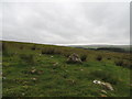
markj99 visited on 22nd May 2022 - their rating: Cond: 5 Amb: 4 Access: 4 I discovered this carved rock by observing an unusually large carved cup on a stone adjacent to the SUW on the edge of Knockcraven Wood. The smooth sides and depth of the cup carving are possibly caused by a natural depression on the surface used for grinding. The bonus discovery of a smooth groove probably used for scraping increases the evidence for domestic activity.
")
Knockcraven Wood Cup Carved Stone lies on the edge of Knockcraven Wood, c. 1.25 miles E of New Luce. The Southern Upland Way (SUW) follows the W edge of Knockcraven Wood. The carved stone is located between the SUW and the edge of the wood c. 50 yards from the SW corner of Knockcraven Wood. It is c. 7 yards W of the wood edge and c. 7 yards E of the SUW.
There are two carvings on Knockcraven Wood Cup Carved Stone, an irregular earthset stone measuring c. 4 by 3 feet, with a rounded top c. 1 foot high. There is a deep oval cup carving on the W edge of the stone measuring c. 6 inches on the N-S Axis and 4 inches on the E-W Axis. It is c. 4 inches deep with smooth walls suggesting some kind of grinding activity. On the E edge of the rock there is a long shallow groove measuring c. 8 by 3 inches and up to 1.5 inches deep in the centre. This groove is smoother than the surrounding rock, perhaps due to a repetitive scraping action.
Knockcraven Wood Cup Carved Stone could be associated with domestic activity of the occupants of the adjacent Dranigower Hut Circles.
You may be viewing yesterday's version of this page. To see the most up to date information please register for a free account.
")
")
")
")
Do not use the above information on other web sites or publications without permission of the contributor.
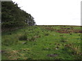
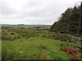
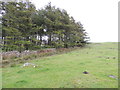
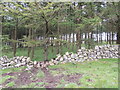
Nearby Images from Geograph Britain and Ireland:
©2012(licence)
©2012(licence)
©2012(licence)
©2012(licence)
©2012(licence)
The above images may not be of the site on this page, they are loaded from Geograph.
Please Submit an Image of this site or go out and take one for us!
Click here to see more info for this site
Nearby sites
Key: Red: member's photo, Blue: 3rd party photo, Yellow: other image, Green: no photo - please go there and take one, Grey: site destroyed
Download sites to:
KML (Google Earth)
GPX (GPS waypoints)
CSV (Garmin/Navman)
CSV (Excel)
To unlock full downloads you need to sign up as a Contributory Member. Otherwise downloads are limited to 50 sites.
Turn off the page maps and other distractions
Nearby sites listing. In the following links * = Image available
98m WNW 292° Dranigower Hut Circle E* Ancient Village or Settlement (NX19316468)
155m WNW 283° Dranigower Hut Circle W* Ancient Village or Settlement (NX19256468)
320m N 358° Fauldinchie E* Misc. Earthwork (NX19406496)
351m NNW 338° Fauldinchie W* Misc. Earthwork (NX19286497)
495m ESE 115° Caves of Kilhern* Chambered Cairn (NX19846441)
513m SW 231° Hardcroft* Cairn (NX18996433)
802m ESE 123° Kilhern Spa Well (New Luce) Holy Well or Sacred Spring (NX20066418)
1.1km SE 126° Kilhern SE* Cairn (NX20266396)
1.2km NW 304° Barnshangan E* Cairn (NX18436536)
1.3km WNW 301° Barnshangan W* Cairn (NX18296536)
1.6km SW 223° Cruise E* Cairn (NX18236348)
1.8km SW 224° Cruise W* Cairn (NX18116342)
2.0km WSW 258° Lady Well (New Luce) Holy Well or Sacred Spring (NX17466432)
2.6km SW 214° Littlepark* Cairn (NX17836250)
2.8km SSW 208° Cruise Back Fell* Hillfort (NX17946219)
2.9km WSW 252° Mains of Larg cairn* Cairn (NX16616385)
2.9km SW 225° Cairn McNeilie* Cairn (NX17246266)
3.0km W 274° Mains of Larg NE* Cairn (NX16406497)
3.1km W 273° Mains of Larg NW* Cairn (NX16356493)
3.1km W 278° Gowk Nest Wood* Cairn (NX16306523)
3.3km NW 312° Barlure* Cairn (NX17036693)
3.3km NNE 32° Cairn na Gath* Cairn (NX21266741)
3.7km S 186° Mid Gleniron 4* Cairn (NX18856100)
3.7km S 189° Mid Gleniron 1* Chambered Cairn (NX18676100)
3.8km S 187° Mid Gleniron 2* Chambered Cairn (NX18776093)
View more nearby sites and additional images


 We would like to know more about this location. Please feel free to add a brief description and any relevant information in your own language.
 Wir möchten mehr über diese Stätte erfahren. Bitte zögern Sie nicht, eine kurze Beschreibung und relevante Informationen in Deutsch hinzuzufügen.
 Nous aimerions en savoir encore un peu sur les lieux. S'il vous plaît n'hesitez pas à ajouter une courte description et tous les renseignements pertinents dans votre propre langue.
 Quisieramos informarnos un poco más de las lugares. No dude en añadir una breve descripción y otros datos relevantes en su propio idioma.