<< Our Photo Pages >> Leskernick SE - Stone Circle in England in Cornwall

Submitted by TheCaptain on Tuesday, 14 October 2008  Page Views: 20811

Neolithic and Bronze AgeSite Name: Leskernick SE Alternative Name: Leskernick 1, Leskernick South
Country: England County: Cornwall Type: Stone Circle
Nearest Town: Launceston  Nearest Village: Bolventor
Map Ref: SX18827964  Landranger Map Number: 201
Latitude: 50.588308N  Longitude: 4.560897W
Condition:
5Perfect
4Almost Perfect
3Reasonable but with some damage
2Ruined but still recognisable as an ancient site
1Pretty much destroyed, possibly visible as crop marks
0No data.
-1Completely destroyed
3 Ambience:
5Superb
4Good
3Ordinary
2Not Good
1Awful
0No data.
4 Access:
5Can be driven to, probably with disabled access
4Short walk on a footpath
3Requiring a bit more of a walk
2A long walk
1In the middle of nowhere, a nightmare to find
0No data.
2 Accuracy:
5co-ordinates taken by GPS or official recorded co-ordinates
4co-ordinates scaled from a detailed map
3co-ordinates scaled from a bad map
2co-ordinates of the nearest village
1co-ordinates of the nearest town
0no data
5

Internal Links:
External Links:

I have visited· I would like to visit

LordMureth visited on 30th Mar 2017 - their rating: Cond: 2 Amb: 4 Access: 2

TheCaptain have visited here
Leskernick SE
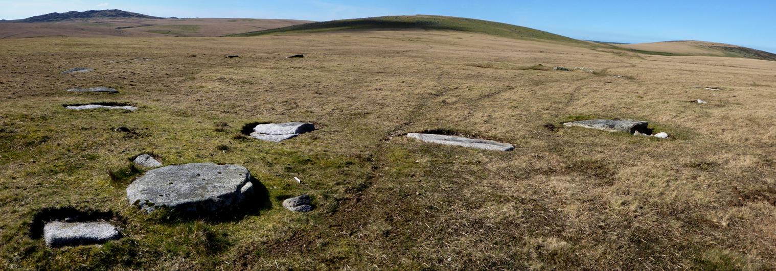
Leskernick SE submitted by TheCaptain : Leskernick SE stone circle in its entirety by stitching three pictures together. Viewed here early April 2017 looking northwest, with Brown Willy and Leskernick Hill in the background. Great to see all of the stones uncovered by RoyG and the TimeSeekers. (Vote or comment on this photo)
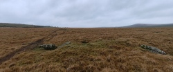
Near to the eastern edge of Bodmin Moor, on the saddle of land between Leskernick Hill to the north and Beacon Hill to the south, the two Leskernick stone circles can be found. Written records I have seen for this circle state that it was only discovered in 1973, and that there are remains of 22 stones in a true circle with diameter 30.6 metres.

Following the controversial new white granite trackway west from Westmoorgate, I thought that finding the first circle would be easy using the OS map, the circle being marked just to the north of the trackway. However, I could find nothing, as I later discovered the new trackway is not where the old tracks are marked on the maps. So I resorted to my gps and the four fig grid ref I had for the circle. But don’t believe the grid reference for this circle as recorded in the RCMH Bodmin Moor survey, it is not correct, and this lead me further away from the true site. So I resorted to my own judgement of where I thought the circle should be, and I was able to find it fairly easily on the saddle of land between Leskernick Hill to the north and Beacon Hill to the south, right where it should be.

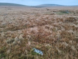
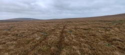
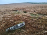
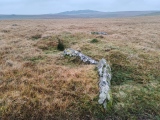
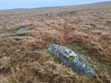
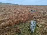
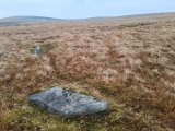
I counted 20 stones, all fallen and some buried, however there was one very slightly leaning stone, and one broken stump at the east. I paced out the diameter of the circle to be about 27 metres, with the stones, each between 1 and 1.5 metres in length approximately equally spaced at about 3 metres from each other. At the west of the circle is the almost obligatory “Bodmin Triangle”, fallen and half buried, but very definitely there.

There are the possible remains of a couple of cairns and cists nearby, with perhaps a capstone just outside the circle to the south.

Note: Pictures and details of this little known, and even less visited, stone circle on Bodmin Moor now posted to the Megalithic Portal.
You may be viewing yesterday's version of this page. To see the most up to date information please register for a free account.


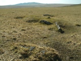
Leskernick SE
Leskernick SE submitted by TheCaptain : April 2017. The circle has been beautifully uncovered. This is the northern arc, looking W towards Brown WIlly (Vote or comment on this photo)

Leskernick SE
Leskernick SE submitted by TheCaptain : April 2017. The circle has been beautifully uncovered. This is the southern arc, looking SW towards Bolventor (Vote or comment on this photo)

Leskernick SE
Leskernick SE submitted by TheCaptain : April 2017. The circle has been beautifully uncovered. This is the southwestern arc, looking NW towards Leskernick Hill (Vote or comment on this photo)

Leskernick SE
Leskernick SE submitted by TheCaptain : April 2017. The circle has been beautifully uncovered. This is the eastern arc, looking north towards Bray Down (Vote or comment on this photo)

Leskernick SE
Leskernick SE submitted by TheCaptain : April 2017. The circle has been beautifully uncovered. This is the southern arc, looking SE towards The Beacon

Leskernick SE
Leskernick SE submitted by TheCaptain : April 2017. The circle has been beautifully uncovered. This is the northeastern arc, looking SE towards The Beacon

Leskernick SE
Leskernick SE submitted by Bladup : Leskernick SE stone circle.

Leskernick SE
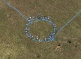
Leskernick SE submitted by theCaptain : I walked around the circle and made a waypoint on my gps for each of the stones. I have plotted these onto Google Earth

Leskernick SE
Leskernick SE submitted by thecaptain : Leskernick 1 stone circle seen here in its entirety, looking towards the northwest. Leskernick Hill, with its very well preserved ancient settlement is beyond, in front of which is the second Leskernick stone circle (which can be made out in the original picture). The stone row starts near the fairly large cairn, which can be seen here as the darker green mound in front of the hill, and run...

Leskernick SE
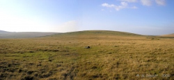
Leskernick SE submitted by Bladup : Leskernick SE Stone Circle with Leskernick Hill (on the left) and Bray Down (on the right) in the background

Leskernick SE
Leskernick SE submitted by Bladup : Leskernick SE Stone Circle with Leskernick Hill in the background

Leskernick SE
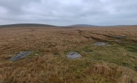
Leskernick SE submitted by Bladup : Leskernick SE Stone Circle, In the foreground is a Possible outlier with the circle in the background

Leskernick SE
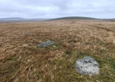
Leskernick SE submitted by Bladup : Leskernick SE Stone Circle

Leskernick SE
Leskernick SE submitted by Bladup

Leskernick SE
Leskernick SE submitted by Bladup

Leskernick SE
Leskernick SE submitted by Bladup

Leskernick SE
Leskernick SE submitted by Bladup

Leskernick SE
Leskernick SE submitted by Bladup

Leskernick SE
Leskernick SE submitted by Bladup

Leskernick SE
Leskernick SE submitted by Bladup

Leskernick SE
Leskernick SE submitted by Bladup : Leskernick SE Stone Circle with Leskernick Hill (right of center) and Brown Willy (on the left) in the background

Leskernick SE
Leskernick SE submitted by Bladup : Leskernick SE Stone Circle with Leskernick Hill in the background

Leskernick SE
Leskernick SE submitted by Bladup : Leskernick SE Stone Circle

Leskernick SE
Leskernick SE submitted by Bladup

These are just the first 25 photos of Leskernick SE. If you log in with a free user account you will be able to see our entire collection.

Do not use the above information on other web sites or publications without permission of the contributor.
Click here to see more info for this site

Nearby sites

Click here to view sites on an interactive OS map

Key: Red: member's photo, Blue: 3rd party photo, Yellow: other image, Green: no photo - please go there and take one, Grey: site destroyed

Download sites to:
KML (Google Earth)
GPX (GPS waypoints)
CSV (Garmin/Navman)
CSV (Excel)

To unlock full downloads you need to sign up as a Contributory Member. Otherwise downloads are limited to 50 sites.


Turn off the page maps and other distractions

Nearby sites listing. In the following links * = Image available
 194m NW 324° Leskernick* Ancient Village or Settlement (SX18717980)
 228m NW 320° Leskernick cairn* Cairn (SX18687982)
 247m N 5° Leskernick Hill Row* Stone Row / Alignment (SX1884979885)
 368m NW 317° Leskernick NW* Stone Circle (SX18587992)
 552m WNW 288° Leskernick cist* Cist (SX18307983)
 591m NW 306° Leskernick Hill Settlement* Ancient Village or Settlement (SX18358000)
 711m NW 311° Leskernick 2* Natural Stone / Erratic / Other Natural Feature (SX1829880125)
 750m S 176° Trezelland stone setting* Standing Stones (SX18857889)
 779m NW 314° Leskernick Quoit* Natural Stone / Erratic / Other Natural Feature (SX1827980202)
 861m ESE 101° The Beacon Cist* Cist (SX19667944)
 867m NW 323° Leskernick Hill cairn* Cairn (SX18328035)
 921m ESE 111° The Beacon Cairns* Cairn (SX19677928)
 937m SE 127° Elephant Rock* Natural Stone / Erratic / Other Natural Feature (SX19557905)
 1.1km NNE 16° Westmoor Cairns* Cairn (SX19178070)
 1.8km NE 34° West Moor Possible Menhir* Standing Stone (Menhir) (SX1987081077)
 1.8km NE 51° Westmoorgate circle* Stone Circle (SX20258073)
 1.8km NE 46° Westmoorgate cairn* Cairn (SX2020680866)
 1.9km SW 234° Catshole Quoit* Chambered Tomb (SX17227856)
 2.0km SSW 199° Tolborough Standing Stone* Standing Stone (Menhir) (SX1807877741)
 2.1km SW 228° Catshole Downs long cairn* Chambered Cairn (SX172783)
 2.2km SW 215° Tolborough Tor Cairn* Cairn (SX175779)
 2.2km SW 214° Tolborough Tor stone row* Stone Row / Alignment (SX17547787)
 2.4km NW 324° Buttern Hill Cairns* Cairn (SX17478167)
 2.5km E 91° Spettigue Menhir* Standing Stone (Menhir) (SX21307952)
 2.5km SSE 153° Carneglos row* Stone Row / Alignment (SX19887737)
View more nearby sites and additional images

<< St Anthony's Well (Llansteffan)

Treen Barrows >>

Please add your thoughts on this site

Cornwall in Prehistory

Cornwall in Prehistory

Sponsors

Auto-Translation (Google)

Translate from English into:

"Leskernick SE" | Login/Create an Account | 5 News and Comments
  
Go back to top of page    Comments are owned by the poster. We aren't responsible for their content.
Roy G and TimeSeekers Leskernick Field Reports by Andy B on Thursday, 25 May 2017
(User Info | Send a Message)
Roy G writes: Some Leskernick updates for you.

We have completed the work on both circles now and have just commenced on the stone row. For the moment the stones are evenly spaced making them 'easy' to find using a thin spike.

https://theheritagetrust.wordpress.com/2016/06/30/leskernick-stone-circles-and-stone-row-clearance-update/

Here is the link to my completed Field Report of Leskernick's South stone circle.
https://files.acrobat.com/a/preview/fae48890-2b80-4642-81eb-3c6a9d25aa59

Here is the link to the Leskernick North Circle clearance report:
https://files.acrobat.com/a/preview/ac734639-463f-4001-8818-8858d09fe665

Here is the third and final link to the Leskernick clearance. This time it's the Stone Row.

We had a fabulous time out there and when I say 'out there' I really mean it. This must be one of the least most visited parts of Bodmin Moor even though its only a 20 minute walk from Westmoorgate to the east. The views from ground level are spectacular and from the top of Leskernick Hill unbelievable. Do visit as there is now so much to see. This is a special place with the most wonderful mainly Bronze-Age Settlement on the hill itself.

https://files.acrobat.com/a/preview/8abea351-e6b0-43dc-a7c7-40dce266992f

Cheers
Roy
[ Reply to This ]

Re: Leskernick SE by coldrum on Wednesday, 07 October 2009
(User Info | Send a Message)
Pastscape:

http://www.pastscape.org.uk/hob.aspx?hob_id=432900
[ Reply to This ]

Re: Leskernick SE by enjaytom on Saturday, 25 October 2008
(User Info | Send a Message)
The Captain seems to have found a most valuable megalthic site. Of great significance is the accurate true north - south alignment as it applies to the circle. Also of significance is the number of stones , twenty-two was apparently used to imply a degree of sacred nature, thirty-three more so. The latter has been used since 3500 BC to define the limits of a scared site. The perimeter of Stonehenge as defined by the 56 Aubrey Holes, c.3100 BC, is 4 x 33 old faethms, Thom's megalithic rods.
I would value an opportunity to study a site plan of the Leskernick site, hopefully to identify quite significant symbolism linked with the area.
An email would be welcome.
[ Reply to This ]

Re: Leskernick SE by TheCaptain on Wednesday, 08 October 2008
(User Info | Send a Message)
From Tom Bullock, Sept 2002.

Circle diameter: ?, Number of stones: ?
I searched for 2 hours for evidence of the two circles and a row shown on the OS Map, but found nothing. There are many rock outcroppings, but nothing suggestive of circles or rows.
[ Reply to This ]

Re: Leskernick SE by TheCaptain on Monday, 29 September 2008
(User Info | Send a Message)
Bad luck Tom !!! I went and had a look for these over the weekend, and also had trouble finding them. I first off tried finding them by my usual method of following the OS map and trying to find things from that, but found nothing.

Then I resorted to cheating, and used my my GPS and the 4 fig grid ref I had copied from the RCHM Bodmin Moor Archaeological Survey, but this seemed to take me further away from any likely position, and I again found nothing.

So, I then resorted to my general judgment and stonehunting experience, and found both of the circles without too much trouble, on the saddle between the two hills, right where they should be.

I have to say that the positions marked on the OS 1:25000 map are not too bad (using gps once I had found them) - the trouble is that the trackways across the moor are nowhere near where they are marked on the maps, which leads to failure to find anything else !!!
[ Reply to This ]

Your Name: Anonymous [ Register Now ]
Subject:


Add your comment or contribution to this page. Spam or offensive posts are deleted immediately, don't even bother

<<< What is five plus one as a number? (Please type the answer to this question in the little box on the left)
You can also embed videos and other things. For Youtube please copy and paste the 'embed code'.
For Google Street View please include Street View in the text.
Create a web link like this: <a href="https://www.megalithic.co.uk">This is a link</a>  

Allowed HTML is:
<p> <b> <i> <a> <img> <em> <br> <strong> <blockquote> <tt> <li> <ol> <ul> <object> <param> <embed> <iframe>

We would like to know more about this location. Please feel free to add a brief description and any relevant information in your own language.
Wir möchten mehr über diese Stätte erfahren. Bitte zögern Sie nicht, eine kurze Beschreibung und relevante Informationen in Deutsch hinzuzufügen.
Nous aimerions en savoir encore un peu sur les lieux. S'il vous plaît n'hesitez pas à ajouter une courte description et tous les renseignements pertinents dans votre propre langue.
Quisieramos informarnos un poco más de las lugares. No dude en añadir una breve descripción y otros datos relevantes en su propio idioma.