<< Text Pages >> Y Gaer (Pembrokeshire) - Hillfort in Wales in Pembrokeshire
Submitted by coldrum on Thursday, 07 January 2010 Page Views: 3718
Iron Age and Later PrehistorySite Name: Y Gaer (Pembrokeshire)Country: Wales
NOTE: This site is 1.1 km away from the location you searched for.
County: Pembrokeshire Type: Hillfort
Map Ref: SN16024097
Latitude: 52.036528N Longitude: 4.683704W
Condition:
| 5 | Perfect |
| 4 | Almost Perfect |
| 3 | Reasonable but with some damage |
| 2 | Ruined but still recognisable as an ancient site |
| 1 | Pretty much destroyed, possibly visible as crop marks |
| 0 | No data. |
| -1 | Completely destroyed |
| 5 | Superb |
| 4 | Good |
| 3 | Ordinary |
| 2 | Not Good |
| 1 | Awful |
| 0 | No data. |
| 5 | Can be driven to, probably with disabled access |
| 4 | Short walk on a footpath |
| 3 | Requiring a bit more of a walk |
| 2 | A long walk |
| 1 | In the middle of nowhere, a nightmare to find |
| 0 | No data. |
| 5 | co-ordinates taken by GPS or official recorded co-ordinates |
| 4 | co-ordinates scaled from a detailed map |
| 3 | co-ordinates scaled from a bad map |
| 2 | co-ordinates of the nearest village |
| 1 | co-ordinates of the nearest town |
| 0 | no data |
Be the first person to rate this site - see the 'Contribute!' box in the right hand menu.
Internal Links:
External Links:
Hillfort in Pembrokeshire (Sir Benfro)
From Coflein site:
"An earthwork enclosure, occupying the tip of a south-facing promontory, defined by two lines of degraded ramparts on the north, with a single line on the south & defined elsewhere by natural scarps."
Source: Coflein
You may be viewing yesterday's version of this page. To see the most up to date information please register for a free account.
Do not use the above information on other web sites or publications without permission of the contributor.
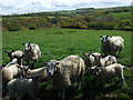
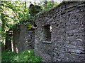
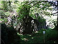
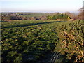
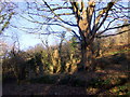
Nearby Images from Geograph Britain and Ireland:
©2010(licence)
©2010(licence)
©2010(licence)
©2007(licence)
©2007(licence)
The above images may not be of the site on this page, they are loaded from Geograph.
Please Submit an Image of this site or go out and take one for us!
Click here to see more info for this site
Nearby sites
Key: Red: member's photo, Blue: 3rd party photo, Yellow: other image, Green: no photo - please go there and take one, Grey: site destroyed
Download sites to:
KML (Google Earth)
GPX (GPS waypoints)
CSV (Garmin/Navman)
CSV (Excel)
To unlock full downloads you need to sign up as a Contributory Member. Otherwise downloads are limited to 50 sites.
Turn off the page maps and other distractions
Nearby sites listing. In the following links * = Image available
1.3km SSW 196° Bwlch Garreg-Llwyd Standing Stone (Menhir) (SN15613972)
1.3km SSE 161° Parc y Mean Llwyd Standing Stone (Menhir) (SN164397)
1.9km NE 52° Bridell Churchyard* Standing Stone (Menhir) (SN176421)
2.4km SE 143° Saint Meugans Well Holy Well or Sacred Spring (SN17403897)
2.8km SSE 162° Castell Coch (Pembrokeshire) Hillfort (SN16783824)
3.3km SW 217° Ffynnon Fair (Pembrokeshire) Holy Well or Sacred Spring (SN13953843)
3.5km W 276° Crugiau Cemaes* Barrow Cemetery (SN125415)
3.7km NE 53° Cilgerran Churchyard* Standing Stone (Menhir) (SN19074306)
3.8km ESE 117° Mynydd Crogwy Standing Stone (Menhir) (SN19323916)
3.8km ENE 62° Cilgerran stone* Standing Stone (Menhir) (SN1945942671)
3.9km SW 216° Cerrig-Y-Derwyddon* Standing Stone (Menhir) (SN13593790)
4.4km WSW 242° Penpedwast Ancient Village or Settlement (SN12013903)
4.7km WSW 244° Castell Henllys* Promontory Fort / Cliff Castle (SN11723905)
4.8km WNW 292° Trefaes Ganol Standing Stone Standing Stone (Menhir) (SN1167042952)
4.8km WSW 240° St Dogfaels Well Holy Well or Sacred Spring (SN11773874)
4.9km W 277° Caer Bayvil* Hillfort (SN112417)
5.0km N 2° St Dogmael's Church* Early Christian Sculptured Stone (SN1640745909)
5.0km SE 137° Blaenfos 2 Standing Stone (Menhir) (SN193372)
5.1km SE 138° Blaenfos 1 Standing Stone (Menhir) (SN193370)
5.2km NNE 17° Cardigan Eisteddfod Commemorative Stone Modern Stone Circle etc (SN1774645894)
5.2km SW 230° Castell Mawr (Pembrokeshire)* Hillfort (SN11873776)
5.2km N 2° Blessingstone* Natural Stone / Erratic / Other Natural Feature (SN164462)
5.3km SSE 158° Parc Maen Gwyn Issa Standing Stone (Menhir) (SN17853604)
5.4km W 281° Tumulus at Pantygroes farm* Round Barrow(s) (SN107422)
5.5km SW 226° Penybenglog fort Hillfort (SN119373)
View more nearby sites and additional images


 We would like to know more about this location. Please feel free to add a brief description and any relevant information in your own language.
 Wir möchten mehr über diese Stätte erfahren. Bitte zögern Sie nicht, eine kurze Beschreibung und relevante Informationen in Deutsch hinzuzufügen.
 Nous aimerions en savoir encore un peu sur les lieux. S'il vous plaît n'hesitez pas à ajouter une courte description et tous les renseignements pertinents dans votre propre langue.
 Quisieramos informarnos un poco más de las lugares. No dude en añadir una breve descripción y otros datos relevantes en su propio idioma.