<< Our Photo Pages >> Showery Tor North Cairn 1 - Round Cairn in England in Cornwall
Submitted by TheCaptain on Wednesday, 10 June 2015 Page Views: 1707
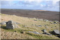
Neolithic and Bronze AgeSite Name: Showery Tor North Cairn 1Country: England County: Cornwall Type: Round Cairn
Nearest Town: Camelford Nearest Village: Camelford
Map Ref: SX14978178
Latitude: 50.606325N Longitude: 4.616292W
Condition:
| 5 | Perfect |
| 4 | Almost Perfect |
| 3 | Reasonable but with some damage |
| 2 | Ruined but still recognisable as an ancient site |
| 1 | Pretty much destroyed, possibly visible as crop marks |
| 0 | No data. |
| -1 | Completely destroyed |
| 5 | Superb |
| 4 | Good |
| 3 | Ordinary |
| 2 | Not Good |
| 1 | Awful |
| 0 | No data. |
| 5 | Can be driven to, probably with disabled access |
| 4 | Short walk on a footpath |
| 3 | Requiring a bit more of a walk |
| 2 | A long walk |
| 1 | In the middle of nowhere, a nightmare to find |
| 0 | No data. |
| 5 | co-ordinates taken by GPS or official recorded co-ordinates |
| 4 | co-ordinates scaled from a detailed map |
| 3 | co-ordinates scaled from a bad map |
| 2 | co-ordinates of the nearest village |
| 1 | co-ordinates of the nearest town |
| 0 | no data |
Internal Links:
External Links:
")
Two metres within its present perimeter are some upright stones which may indicate a retaining circle.
Pastscape Monument 434459.
You may be viewing yesterday's version of this page. To see the most up to date information please register for a free account.
")
")
Do not use the above information on other web sites or publications without permission of the contributor.
Nearby Images from Geograph Britain and Ireland:
©2017(licence)
©2008(licence)
©2008(licence)
©2008(licence)
©2012(licence)
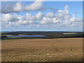
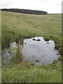
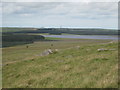
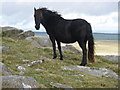
The above images may not be of the site on this page, they are loaded from Geograph.
Please Submit an Image of this site or go out and take one for us!
Click here to see more info for this site
Nearby sites
Key: Red: member's photo, Blue: 3rd party photo, Yellow: other image, Green: no photo - please go there and take one, Grey: site destroyed
Download sites to:
KML (Google Earth)
GPX (GPS waypoints)
CSV (Garmin/Navman)
CSV (Excel)
To unlock full downloads you need to sign up as a Contributory Member. Otherwise downloads are limited to 50 sites.
Turn off the page maps and other distractions
Nearby sites listing. In the following links * = Image available
344m WSW 251° Roughtor NW cairn* Cairn (SX14648168)
354m WSW 258° Showery Tor Northwest enclosure 1* Ancient Village or Settlement (SX14628172)
371m N 353° Showery Tor North Standing Stone* Standing Stone (Menhir) (SX14948215)
470m S 181° Showery Tor propped stone* Natural Stone / Erratic / Other Natural Feature (SX1494281311)
472m S 184° Showery Tor Ring Cairn* Ring Cairn (SX14928131)
530m W 272° Showery Tor Northwest Standing Stone* Standing Stone (Menhir) (SX14448182)
544m W 260° Showery Tor Northwest enclosure 2* Ancient Village or Settlement (SX14438170)
577m WSW 238° Showery Tor Northwest Cairn 1* Round Cairn (SX14478149)
616m WSW 243° Showery Tor Northwest enclosure 3* Ancient Village or Settlement (SX14418152)
652m WSW 244° Rough Tor Cairn 3287.30* Cairn (SX14378152)
671m W 263° Roughtor long cairn* Cairn (SX14308172)
734m SSW 202° Roughtor well* Holy Well or Sacred Spring (SX14678111)
786m S 190° Little Roughtor Cairns* Cairn (SX14818101)
828m W 271° Roughtor North cairn X* Round Cairn (SX14148182)
911m WSW 250° Roughtor north* Ancient Village or Settlement (SX141815)
925m SSW 193° Little Roughtor propped stone* Natural Stone / Erratic / Other Natural Feature (SX1472580887)
942m SSW 195° Roughtor settlement* Ancient Village or Settlement (SX14698088)
997m SSW 213° Roughtor 1 Cairn (SX14408096)
1.0km SSE 164° Maiden Tor hut circle* Ancient Village or Settlement (SX15228080)
1.0km SSW 200° Roughtor Cairn 2 Cairn (SX14598082)
1.1km SSW 212° Roughtor 2 Ring Cairn (SX14378091)
1.1km SSW 202° Roughtor Summit Cairns* Cairn (SX14548080)
1.1km SSW 194° Roughtor 4 Cairn (SX14688075)
1.1km SSW 204° Roughtor* Ancient Village or Settlement (SX14498080)
1.2km S 170° Roughtor East Cairn Group* Cairn (SX15148057)
View more nearby sites and additional images


 We would like to know more about this location. Please feel free to add a brief description and any relevant information in your own language.
 Wir möchten mehr über diese Stätte erfahren. Bitte zögern Sie nicht, eine kurze Beschreibung und relevante Informationen in Deutsch hinzuzufügen.
 Nous aimerions en savoir encore un peu sur les lieux. S'il vous plaît n'hesitez pas à ajouter une courte description et tous les renseignements pertinents dans votre propre langue.
 Quisieramos informarnos un poco más de las lugares. No dude en añadir una breve descripción y otros datos relevantes en su propio idioma.