<< Our Photo Pages >> Starapark Barrows - Barrow Cemetery in England in Cornwall
Submitted by dooclay on Monday, 07 August 2023 Page Views: 315
Neolithic and Bronze AgeSite Name: Starapark BarrowsCountry: England County: Cornwall Type: Barrow Cemetery
Nearest Village: Davidstow
Map Ref: SX13188642
Latitude: 50.647436N Longitude: 4.643899W
Condition:
| 5 | Perfect |
| 4 | Almost Perfect |
| 3 | Reasonable but with some damage |
| 2 | Ruined but still recognisable as an ancient site |
| 1 | Pretty much destroyed, possibly visible as crop marks |
| 0 | No data. |
| -1 | Completely destroyed |
| 5 | Superb |
| 4 | Good |
| 3 | Ordinary |
| 2 | Not Good |
| 1 | Awful |
| 0 | No data. |
| 5 | Can be driven to, probably with disabled access |
| 4 | Short walk on a footpath |
| 3 | Requiring a bit more of a walk |
| 2 | A long walk |
| 1 | In the middle of nowhere, a nightmare to find |
| 0 | No data. |
| 5 | co-ordinates taken by GPS or official recorded co-ordinates |
| 4 | co-ordinates scaled from a detailed map |
| 3 | co-ordinates scaled from a bad map |
| 2 | co-ordinates of the nearest village |
| 1 | co-ordinates of the nearest town |
| 0 | no data |
Internal Links:
External Links:
")
Four of a group of Barrows - none in great condition.
HER 249.10, 249.20, 249.30 & 250.10
Of Barrow 250.10 the HER says, 'There were seven or eight stones on end" including three with cup-marks, pit-marks and meandering grooves' these are now removed from the site w/ one of the cupmarkedstones being lost or not having existed in the first place! - noone is sure.
You may be viewing yesterday's version of this page. To see the most up to date information please register for a free account.
")
")
")
Do not use the above information on other web sites or publications without permission of the contributor.
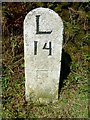
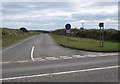
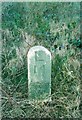
Nearby Images from Geograph Britain and Ireland:

©2008(licence)

©2008(licence)
©2020(licence)
©2008(licence)
©2017(licence)
The above images may not be of the site on this page, they are loaded from Geograph.
Please Submit an Image of this site or go out and take one for us!
Click here to see more info for this site
Nearby sites
Key: Red: member's photo, Blue: 3rd party photo, Yellow: other image, Green: no photo - please go there and take one, Grey: site destroyed
Download sites to:
KML (Google Earth)
GPX (GPS waypoints)
CSV (Garmin/Navman)
CSV (Excel)
To unlock full downloads you need to sign up as a Contributory Member. Otherwise downloads are limited to 50 sites.
Turn off the page maps and other distractions
Nearby sites listing. In the following links * = Image available
393m E 79° Nettings Park Barrows* Round Barrow(s) (SX13578648)
1.8km N 359° Hendraburnick Quoit* Chambered Cairn (SX13218818)
2.2km ENE 62° Davidstow Well* Holy Well or Sacred Spring (SX1516187366)
2.2km NE 39° Tich Barrow Tumuli* Barrow Cemetery (SX14678810)
2.4km WSW 248° King Arthur Stone* Early Christian Sculptured Stone (SX109856)
2.5km WSW 247° Slaughterbridge Enclosure Misc. Earthwork (SX108855)
2.6km NE 37° Hendra Tumuli* Barrow Cemetery (SX14828841)
2.6km NW 308° Waterpit Down* Ancient Cross (SX11198807)
3.0km NW 318° Tregatherall Barrow* Round Barrow(s) (SX11258870)
3.1km SSE 168° Advent Triple Barrow* Round Cairn (SX137834)
3.2km N 352° Tregrylls Cross* Ancient Cross (SX1281989619)
3.3km S 169° LowerMoor Tumuli* Barrow Cemetery (SX137832)
3.3km SW 215° Tregoodwell Cross* Ancient Cross (SX11228380)
3.4km SW 222° Trefrew Road Spring/Well* Holy Well or Sacred Spring (SX1082083956)
3.4km S 184° Higher Parkwalls Tumulus* Round Barrow(s) (SX128830)
3.7km SE 125° Davidstow Moor Barrow* Round Barrow(s) (SX16168417)
3.8km N 355° Lesnewth Cross* Ancient Cross (SX130902)
4.1km S 183° Advent Ring Cairn* Ring Cairn (SX12858235)
4.2km W 278° Condolden Barrow* Round Barrow(s) (SX09058718)
4.2km SW 224° Camelford Cross* Ancient Cross (SX10128346)
4.4km E 83° Lambrenny Cross* Ancient Cross (SX17558677)
4.5km ESE 123° Trevillian's Gate Barrow* Round Barrow(s) (SX16858384)
4.6km WSW 247° Trethern Camp* Ancient Village or Settlement (SX089848)
4.6km SSW 194° Moorgate quartz cairns.* Barrow Cemetery (SX119820)
4.6km SSE 156° Showery Tor North Standing Stone* Standing Stone (Menhir) (SX14948215)
View more nearby sites and additional images


 We would like to know more about this location. Please feel free to add a brief description and any relevant information in your own language.
 Wir möchten mehr über diese Stätte erfahren. Bitte zögern Sie nicht, eine kurze Beschreibung und relevante Informationen in Deutsch hinzuzufügen.
 Nous aimerions en savoir encore un peu sur les lieux. S'il vous plaît n'hesitez pas à ajouter une courte description et tous les renseignements pertinents dans votre propre langue.
 Quisieramos informarnos un poco más de las lugares. No dude en añadir una breve descripción y otros datos relevantes en su propio idioma.