<< Our Photo Pages >> Glynsaithmaen SW - Standing Stone (Menhir) in Wales in Pembrokeshire
Submitted by TheCaptain on Tuesday, 13 October 2015 Page Views: 1582
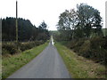
Neolithic and Bronze AgeSite Name: Glynsaithmaen SWCountry: Wales County: Pembrokeshire Type: Standing Stone (Menhir)
Nearest Town: Cardigan Nearest Village: Maenclochog
Map Ref: SN11173021
Latitude: 51.938269N Longitude: 4.7484W
Condition:
| 5 | Perfect |
| 4 | Almost Perfect |
| 3 | Reasonable but with some damage |
| 2 | Ruined but still recognisable as an ancient site |
| 1 | Pretty much destroyed, possibly visible as crop marks |
| 0 | No data. |
| -1 | Completely destroyed |
| 5 | Superb |
| 4 | Good |
| 3 | Ordinary |
| 2 | Not Good |
| 1 | Awful |
| 0 | No data. |
| 5 | Can be driven to, probably with disabled access |
| 4 | Short walk on a footpath |
| 3 | Requiring a bit more of a walk |
| 2 | A long walk |
| 1 | In the middle of nowhere, a nightmare to find |
| 0 | No data. |
| 5 | co-ordinates taken by GPS or official recorded co-ordinates |
| 4 | co-ordinates scaled from a detailed map |
| 3 | co-ordinates scaled from a bad map |
| 2 | co-ordinates of the nearest village |
| 1 | co-ordinates of the nearest town |
| 0 | no data |
Internal Links:
External Links:
")
You may be viewing yesterday's version of this page. To see the most up to date information please register for a free account.
")
Do not use the above information on other web sites or publications without permission of the contributor.
Nearby Images from Geograph Britain and Ireland:

©2022(licence)

©2008(licence)

©2022(licence)

©2008(licence)
©2008(licence)
The above images may not be of the site on this page, they are loaded from Geograph.
Please Submit an Image of this site or go out and take one for us!
Click here to see more info for this site
Nearby sites
Key: Red: member's photo, Blue: 3rd party photo, Yellow: other image, Green: no photo - please go there and take one, Grey: site destroyed
Download sites to:
KML (Google Earth)
GPX (GPS waypoints)
CSV (Garmin/Navman)
CSV (Excel)
To unlock full downloads you need to sign up as a Contributory Member. Otherwise downloads are limited to 50 sites.
Turn off the page maps and other distractions
Nearby sites listing. In the following links * = Image available
124m NNW 344° Gate Standing Stone* Standing Stone (Menhir) (SN11143033)
438m NE 46° Glynsaithmaen* Standing Stones (SN115305)
1.0km NE 37° Cwm Garw* Standing Stones (SN11823102)
1.2km NNW 335° Waun Clyn Coch Ancient Village or Settlement (SN107313)
1.6km S 170° Penmorgan* Standing Stone (Menhir) (SN114286)
1.6km S 170° Rhosfach Stone Standing Stone (Menhir) (SN114286)
1.9km S 174° Parc Maen Barrow Round Barrow(s) (SN113283)
1.9km S 174° Parc Maen Stone* Standing Stone (Menhir) (SN113283)
2.0km WNW 297° Foel Cwmcerwyn* Cairn (SN094312)
2.1km N 349° Cerrigmarchogion* Rock Outcrop (SN10853225)
2.1km NE 49° Carn Sian - unknown* Cairn (SN1282431539)
2.1km WSW 254° Mynydd Crwn Standing Stone Standing Stone (Menhir) (SN091297)
2.1km NE 50° Carn Sian Linear feature* Stone Row / Alignment (SN1286831525)
2.2km NE 52° Carn Sian Cairn* Not Known (by us) (SN1294231474)
2.2km WSW 241° Eithbed Circles* Stone Circle (SN092292)
2.3km E 81° Mynachlog-ddu stones* Standing Stones (SN13433049)
2.3km E 86° Waldo Memorial* Modern Stone Circle etc (SN13523027)
2.4km SSE 157° Llangolman Round Barrow(s) (SN1228)
2.4km E 84° Bluestones Monument* Modern Stone Circle etc (SN13533038)
2.4km W 275° Cnwc Barrow 1 Round Barrow(s) (SN088305)
2.4km ENE 61° Craig Talfynedd Ancient Village or Settlement (SN133313)
2.4km NNW 334° Foel Feddau Cairn (SN102324)
2.4km ESE 108° Gors Fawr Stone Circle* Stone Circle (SN13462938)
2.4km ESE 105° Gors Fawr Outliers* Standing Stones (SN13512950)
2.6km W 270° Cnwc Barrow 2 Round Barrow(s) (SN086303)
View more nearby sites and additional images


 We would like to know more about this location. Please feel free to add a brief description and any relevant information in your own language.
 Wir möchten mehr über diese Stätte erfahren. Bitte zögern Sie nicht, eine kurze Beschreibung und relevante Informationen in Deutsch hinzuzufügen.
 Nous aimerions en savoir encore un peu sur les lieux. S'il vous plaît n'hesitez pas à ajouter une courte description et tous les renseignements pertinents dans votre propre langue.
 Quisieramos informarnos un poco más de las lugares. No dude en añadir una breve descripción y otros datos relevantes en su propio idioma.