<< Our Photo Pages >> Beoch Hill Cairn - Cairn in Scotland in Dumfries and Galloway
Submitted by markj99 on Wednesday, 11 September 2019 Page Views: 704
Neolithic and Bronze AgeSite Name: Beoch Hill CairnCountry: Scotland County: Dumfries and Galloway Type: Cairn
Nearest Town: Stranraer Nearest Village: Cairnryan
Map Ref: NX09336654
Latitude: 54.956932N Longitude: 4.979395W
Condition:
| 5 | Perfect |
| 4 | Almost Perfect |
| 3 | Reasonable but with some damage |
| 2 | Ruined but still recognisable as an ancient site |
| 1 | Pretty much destroyed, possibly visible as crop marks |
| 0 | No data. |
| -1 | Completely destroyed |
| 5 | Superb |
| 4 | Good |
| 3 | Ordinary |
| 2 | Not Good |
| 1 | Awful |
| 0 | No data. |
| 5 | Can be driven to, probably with disabled access |
| 4 | Short walk on a footpath |
| 3 | Requiring a bit more of a walk |
| 2 | A long walk |
| 1 | In the middle of nowhere, a nightmare to find |
| 0 | No data. |
| 5 | co-ordinates taken by GPS or official recorded co-ordinates |
| 4 | co-ordinates scaled from a detailed map |
| 3 | co-ordinates scaled from a bad map |
| 2 | co-ordinates of the nearest village |
| 1 | co-ordinates of the nearest town |
| 0 | no data |
Internal Links:
External Links:
I have visited· I would like to visit
markj99 visited on 7th Sep 2019 - their rating: Cond: 2 Amb: 4 Access: 1 It is illogical to put so much effort into such a small hidden cairn. Then again, when did common sense influence the antiquarian seeking a new target. I have an unfortunate attraction to remote sites.
")
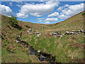
Beoch Hill cairn is 300 yards S of White Cairn, Beoch Hill. It's a smaller cairn, around 10 yards across with a hollowed out centre.
See White Cairn, Beoch Hill for directions. From the White Cairn walk S towards a gate around 200 yards away. Beoch Hill cairn is a grassy bank 100 yards S from the gate in rough moorland.
For more information see Canmore ID 60701.
You may be viewing yesterday's version of this page. To see the most up to date information please register for a free account.
")
Do not use the above information on other web sites or publications without permission of the contributor.
Nearby Images from Geograph Britain and Ireland:
©2009(licence)
©2009(licence)
©2009(licence)
©2009(licence)
©2009(licence)
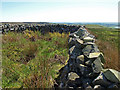
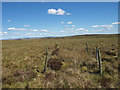
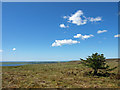
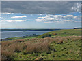
The above images may not be of the site on this page, they are loaded from Geograph.
Please Submit an Image of this site or go out and take one for us!
Click here to see more info for this site
Nearby sites
Key: Red: member's photo, Blue: 3rd party photo, Yellow: other image, Green: no photo - please go there and take one, Grey: site destroyed
Download sites to:
KML (Google Earth)
GPX (GPS waypoints)
CSV (Garmin/Navman)
CSV (Excel)
To unlock full downloads you need to sign up as a Contributory Member. Otherwise downloads are limited to 50 sites.
Turn off the page maps and other distractions
Nearby sites listing. In the following links * = Image available
250m NNE 21° White Cairn, Beoch Hill* Cairn (NX09436677)
1.4km NW 314° Drummuckloch Hill Cairn* Cairn (NX08366756)
1.5km NW 315° Drummuckloch Hill Standing Stone* Standing Stone (Menhir) (NX08346762)
2.4km SE 143° Balker Moor N* Cairn (NX10726455)
2.5km SSE 164° Teroy Fort* Broch or Nuraghe (NX0992364108)
2.5km SE 143° Balker Moor S* Cairn (NX10766444)
2.9km NE 52° Drumacissock South Cairn* Cairn (NX11676818)
2.9km NE 51° Drumacissock North Cairn* Cairn (NX11706827)
3.3km NW 315° Cairn Hill (Cairnryan)* Cairn (NX07116896)
3.9km NE 50° Diddles Hill Cairn* Cairn (NX12446896)
4.3km E 86° Cairnerzean Fell Summit* Cairn (NX13606668)
4.3km E 95° Cairnerzean Fell South* Cairn (NX13616595)
4.5km ESE 108° Auld Wife's Grave* Chambered Cairn (NX13536498)
4.5km E 89° Cairnerzean Fell N* Cairn (NX13836642)
4.5km NNE 18° Brockloch Fell* Cairn (NX10947075)
4.5km E 92° Cairnerzean Fell Central* Cairn (NX13866620)
5.1km E 88° Lingdowey Burn N* Cairn (NX14416649)
5.3km N 9° Claywarnies Cairn* Cairn (NX10347171)
5.3km E 90° Lingdowey Burn S* Cairn (NX14616635)
5.4km NNE 18° Drumanwherran S Cairn Cemetery* Cairn (NX11207160)
5.4km NW 323° Taxing Stone* Standing Stones (NX06237096)
5.4km NNW 345° Long Tom (Cairnryan)* Standing Stone (Menhir) (NX08167183)
5.5km E 83° Lingdowey Burn E* Cairn (NX14806698)
5.7km ENE 78° Cairnerzean Farm SW* Cairn (NX14986747)
5.7km ENE 78° Cairnerzean Farm NE* Cairn (NX14996748)
View more nearby sites and additional images


 We would like to know more about this location. Please feel free to add a brief description and any relevant information in your own language.
 Wir möchten mehr über diese Stätte erfahren. Bitte zögern Sie nicht, eine kurze Beschreibung und relevante Informationen in Deutsch hinzuzufügen.
 Nous aimerions en savoir encore un peu sur les lieux. S'il vous plaît n'hesitez pas à ajouter une courte description et tous les renseignements pertinents dans votre propre langue.
 Quisieramos informarnos un poco más de las lugares. No dude en añadir una breve descripción y otros datos relevantes en su propio idioma.