<< Our Photo Pages >> Garleffin - Stone Row / Alignment in Scotland in South Ayrshire
Submitted by vicky on Wednesday, 03 March 2004 Page Views: 11109
Neolithic and Bronze AgeSite Name: Garleffin Alternative Name: The Grey Stanes O' GarleffanCountry: Scotland County: South Ayrshire Type: Stone Row / Alignment
Nearest Town: Ballantrae Nearest Village: Garleffin
Map Ref: NX08738172 Landranger Map Number: 76
Latitude: 55.092925N Longitude: 4.998915W
Condition:
| 5 | Perfect |
| 4 | Almost Perfect |
| 3 | Reasonable but with some damage |
| 2 | Ruined but still recognisable as an ancient site |
| 1 | Pretty much destroyed, possibly visible as crop marks |
| 0 | No data. |
| -1 | Completely destroyed |
| 5 | Superb |
| 4 | Good |
| 3 | Ordinary |
| 2 | Not Good |
| 1 | Awful |
| 0 | No data. |
| 5 | Can be driven to, probably with disabled access |
| 4 | Short walk on a footpath |
| 3 | Requiring a bit more of a walk |
| 2 | A long walk |
| 1 | In the middle of nowhere, a nightmare to find |
| 0 | No data. |
| 5 | co-ordinates taken by GPS or official recorded co-ordinates |
| 4 | co-ordinates scaled from a detailed map |
| 3 | co-ordinates scaled from a bad map |
| 2 | co-ordinates of the nearest village |
| 1 | co-ordinates of the nearest town |
| 0 | no data |
Internal Links:
External Links:
I have visited· I would like to visit
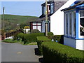
markj99 visited on 15th Sep 2012 - their rating: Cond: 1 Amb: 3 Access: 5 Canmore ID 60935 relates the sadly familiar tale of a megalithic site destroyed by modern farming. Only 2 of the original stones remain in the garden of a bungalow called Druidslea, probably named after the stones. The standing stone in the front garden is allegedly in its original position but the second standing stone was moved to the back garden in 1991. Garleffin stones are like caged tigers in a zoo: they shouldn't be subjected to such indignity.
")
"Only stones designated E and F by the OS, remain in their original position, lying within the garden of a private house." - Canmore site no. 60935.
You may be viewing yesterday's version of this page. To see the most up to date information please register for a free account.
")
Do not use the above information on other web sites or publications without permission of the contributor.
davidmorgan has found this location on Google Street View:
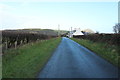
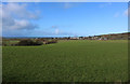
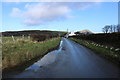
Nearby Images from Geograph Britain and Ireland:
©2016(licence)
©2018(licence)
©2018(licence)
©2008(licence)
©2018(licence)
The above images may not be of the site on this page, they are loaded from Geograph.
Please Submit an Image of this site or go out and take one for us!
Click here to see more info for this site
Nearby sites
Key: Red: member's photo, Blue: 3rd party photo, Yellow: other image, Green: no photo - please go there and take one, Grey: site destroyed
Download sites to:
KML (Google Earth)
GPX (GPS waypoints)
CSV (Garmin/Navman)
CSV (Excel)
To unlock full downloads you need to sign up as a Contributory Member. Otherwise downloads are limited to 50 sites.
Turn off the page maps and other distractions
Nearby sites listing. In the following links * = Image available
4.0km NE 38° Knockdolian* Cairn (NX1132784805)
4.5km S 180° Carlock Hill Cairn (NX0857377233)
5.7km SSW 196° Drumduff Cairn (NX0689176291)
6.9km SSW 197° Penderry Hill Cairn (NX0644175163)
7.4km S 176° Millmoan Hill* Cairn (NX08897432)
7.8km SSW 202° Finnarts Hill* Standing Stones (NX05537455)
8.0km SSE 156° Drummanmoan Loan* Cairn (NX11667427)
8.2km SSW 202° Finnarts Hill Enclosure* Causewayed Enclosure (NX0531174211)
8.5km SSW 203° Finnarts Hill Cairn* Cairn (NX0513274052)
8.6km SSE 168° Friar's Kirk NW* Cairn (NX10197322)
8.8km SSE 167° Friar's Kirk SE* Cairn (NX10407308)
9.1km E 84° Arecleoch Standing Stone* Standing Stone (Menhir) (NX178822)
9.4km SSW 191° Haggstone Moor Standing Stone* Standing Stone (Menhir) (NX0648572626)
9.4km ESE 109° Arecleoch Chambered Cairn Chambered Cairn (NX175783)
9.6km SSW 195° Haggstone Moor Cairn* Cairn (NX0577672521)
9.8km SSE 164° Drumanwherran N* Cairn (NX10967212)
9.9km ESE 102° Cave Cairn (Chirmorrie)* Chambered Cairn (NX18317924)
9.9km S 181° Long Tom (Cairnryan)* Standing Stone (Menhir) (NX08167183)
10.0km SSE 152° Laganabeastie West* Cairn (NX13007271)
10.0km SSE 152° Laganbeastie East* Cairn (NX13057271)
10.0km SSW 194° Gallop Hole* Cairn (NX0583872157)
10.1km SSW 193° Haggstone Moor Circle Stone Circle (NX060720)
10.1km SSE 168° Claywarnies Cairn* Cairn (NX10347171)
10.4km SSE 164° Drumanwherran S Cairn Cemetery* Cairn (NX11207160)
10.7km SSE 152° Grey Hill (Shennas)* Cairn (NX13307198)
View more nearby sites and additional images


 We would like to know more about this location. Please feel free to add a brief description and any relevant information in your own language.
 Wir möchten mehr über diese Stätte erfahren. Bitte zögern Sie nicht, eine kurze Beschreibung und relevante Informationen in Deutsch hinzuzufügen.
 Nous aimerions en savoir encore un peu sur les lieux. S'il vous plaît n'hesitez pas à ajouter une courte description et tous les renseignements pertinents dans votre propre langue.
 Quisieramos informarnos un poco más de las lugares. No dude en añadir una breve descripción y otros datos relevantes en su propio idioma.