 with our Megalithic Portal iPhone app")


<< Text Pages >> Merkland Cist - Cist in Scotland in Isle of Arran
Submitted by Andy B on Sunday, 14 August 2016 Page Views: 1514
Neolithic and Bronze AgeSite Name: Merkland CistCountry: Scotland County: Isle of Arran Type: Cist
Nearest Town: Brodick
Map Ref: NS02693896
Latitude: 55.604138N Longitude: 5.133748W
Condition:
| 5 | Perfect |
| 4 | Almost Perfect |
| 3 | Reasonable but with some damage |
| 2 | Ruined but still recognisable as an ancient site |
| 1 | Pretty much destroyed, possibly visible as crop marks |
| 0 | No data. |
| -1 | Completely destroyed |
| 5 | Superb |
| 4 | Good |
| 3 | Ordinary |
| 2 | Not Good |
| 1 | Awful |
| 0 | No data. |
| 5 | Can be driven to, probably with disabled access |
| 4 | Short walk on a footpath |
| 3 | Requiring a bit more of a walk |
| 2 | A long walk |
| 1 | In the middle of nowhere, a nightmare to find |
| 0 | No data. |
| 5 | co-ordinates taken by GPS or official recorded co-ordinates |
| 4 | co-ordinates scaled from a detailed map |
| 3 | co-ordinates scaled from a bad map |
| 2 | co-ordinates of the nearest village |
| 1 | co-ordinates of the nearest town |
| 0 | no data |
Be the first person to rate this site - see the 'Contribute!' box in the right hand menu.
Internal Links:
External Links:
Cist in Isle of Arran
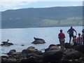
Canmore: A poorly-preserved cist situated on a small eminence near a stream. Formed by four slabs it is 1.0m long by 0.5m and approximately 0.4m deep; another slab standing in the cist appears to be the displaced cover stone. Source
You may be viewing yesterday's version of this page. To see the most up to date information please register for a free account.
Do not use the above information on other web sites or publications without permission of the contributor.
Nearby Images from Geograph Britain and Ireland:

©2006(licence)
©2005(licence)

©2008(licence)

©2018(licence)

©2012(licence)
The above images may not be of the site on this page, they are loaded from Geograph.
Please Submit an Image of this site or go out and take one for us!
Click here to see more info for this site
Nearby sites
Key: Red: member's photo, Blue: 3rd party photo, Yellow: other image, Green: no photo - please go there and take one, Grey: site destroyed
Download sites to:
KML (Google Earth)
GPX (GPS waypoints)
CSV (Garmin/Navman)
CSV (Excel)
To unlock full downloads you need to sign up as a Contributory Member. Otherwise downloads are limited to 50 sites.
Turn off the page maps and other distractions
Nearby sites listing. In the following links * = Image available
1.6km SW 226° Replica Bronze Age Round House at Brodick Castle Modern Stone Circle etc (NS015379)
2.6km SW 231° Glen Shiel* Stone Row / Alignment (NS0061337447)
2.9km SSW 213° Stronach Standing Stone* Standing Stone (Menhir) (NS0100236608)
3.3km SW 231° Glen Shirag Stone Circle (NS000370)
3.5km SW 220° Stronach Ridge Rock Art* Rock Art (NS00303636)
3.6km SSW 192° Mayish* Standing Stone (Menhir) (NS01813551)
3.6km SSW 210° Auchrannie, Glen Cloy* Souterrain (Fogou, Earth House) (NS007359)
4.6km NNW 341° Corrie possible Four-Poster Stone Circle (NS01404334)
4.7km SW 229° Glen Shurig (Kilbride) Stone Circle (NR9936)
4.8km SSW 204° Glenrickard* Chambered Cairn (NS00513466)
5.6km S 186° Lamlash* Stone Circle (NS0188233419)
5.8km S 177° Dunan Mor* Chambered Cairn (NS027332)
5.9km NNW 348° Sannox Chambered Cairn Chambered Cairn (NS017448)
6.0km S 177° Dunan Beag* Chambered Cairn (NS0270932974)
6.2km NNW 342° South Sannox* Stone Circle (NS0106044907)
6.2km S 175° North Blairmore* Standing Stone (Menhir) (NS0293432791)
6.6km NNW 347° Sannox Cist* Cist (NS015455)
6.7km NNW 348° Sannox Bay Standing Stone* Standing Stone (Menhir) (NS01644558)
6.9km NNW 347° Mid Sannox Standing Stone* Standing Stone (Menhir) (NS0143345782)
7.7km NNW 348° North Sannox Chambered Cairn* Chambered Cairn (NS01424659)
7.9km NNW 346° North Sannox Farm* Chambered Cairn (NS01114676)
8.5km NNW 339° Allt Carn Bhain Chambered Cairn (NR99994707)
9.3km WSW 244° Moinechoill* Chambered Cairn (NR941353)
9.4km WSW 244° Monyquil* Standing Stones (NR9405735284)
9.6km NNW 332° Allt Lon Na Cuilc Marker Stone (NR98524766)
View more nearby sites and additional images


 We would like to know more about this location. Please feel free to add a brief description and any relevant information in your own language.
 Wir möchten mehr über diese Stätte erfahren. Bitte zögern Sie nicht, eine kurze Beschreibung und relevante Informationen in Deutsch hinzuzufügen.
 Nous aimerions en savoir encore un peu sur les lieux. S'il vous plaît n'hesitez pas à ajouter une courte description et tous les renseignements pertinents dans votre propre langue.
 Quisieramos informarnos un poco más de las lugares. No dude en añadir una breve descripción y otros datos relevantes en su propio idioma.