<< Text Pages >> Mynydd Melyn Settlement 1 - Ancient Village or Settlement in Wales in Pembrokeshire
Submitted by vicky on Sunday, 29 September 2002 Page Views: 3923
Multi-periodSite Name: Mynydd Melyn Settlement 1Country: Wales
NOTE: This site is 0.5 km away from the location you searched for.
County: Pembrokeshire Type: Ancient Village or Settlement
Nearest Town: Fishguard Nearest Village: Pontfaen
Map Ref: SN027362 Landranger Map Number: 145
Latitude: 51.989116N Longitude: 4.874895W
Condition:
| 5 | Perfect |
| 4 | Almost Perfect |
| 3 | Reasonable but with some damage |
| 2 | Ruined but still recognisable as an ancient site |
| 1 | Pretty much destroyed, possibly visible as crop marks |
| 0 | No data. |
| -1 | Completely destroyed |
| 5 | Superb |
| 4 | Good |
| 3 | Ordinary |
| 2 | Not Good |
| 1 | Awful |
| 0 | No data. |
| 5 | Can be driven to, probably with disabled access |
| 4 | Short walk on a footpath |
| 3 | Requiring a bit more of a walk |
| 2 | A long walk |
| 1 | In the middle of nowhere, a nightmare to find |
| 0 | No data. |
| 5 | co-ordinates taken by GPS or official recorded co-ordinates |
| 4 | co-ordinates scaled from a detailed map |
| 3 | co-ordinates scaled from a bad map |
| 2 | co-ordinates of the nearest village |
| 1 | co-ordinates of the nearest town |
| 0 | no data |
Internal Links:
External Links:
I have visited· I would like to visit
bishop_pam visited on 13th Feb 2020 - their rating: Cond: 3 Amb: 3 Access: 3
Have you visited this site? Please add a comment below.
You may be viewing yesterday's version of this page. To see the most up to date information please register for a free account.
Do not use the above information on other web sites or publications without permission of the contributor.
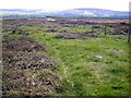
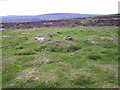
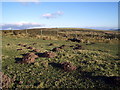
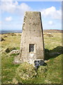
Nearby Images from Geograph Britain and Ireland:
©2007(licence)
©2006(licence)
©2007(licence)
©2010(licence)
©2010(licence)
The above images may not be of the site on this page, they are loaded from Geograph.
Please Submit an Image of this site or go out and take one for us!
Click here to see more info for this site
Nearby sites
Key: Red: member's photo, Blue: 3rd party photo, Yellow: other image, Green: no photo - please go there and take one, Grey: site destroyed
Download sites to:
KML (Google Earth)
GPX (GPS waypoints)
CSV (Garmin/Navman)
CSV (Excel)
To unlock full downloads you need to sign up as a Contributory Member. Otherwise downloads are limited to 50 sites.
Turn off the page maps and other distractions
Nearby sites listing. In the following links * = Image available
282m NE 43° Mynydd Melyn Stone* Standing Stone (Menhir) (SN029364)
282m NE 43° Mynydd Melyn Cairn Cairn (SN029364)
1.1km NE 39° Mynydd Melyn Settlement 2 Ancient Village or Settlement (SN034370)
1.1km WNW 290° Glyn Gath Barrow* Round Barrow(s) (SN017366)
1.1km WNW 290° Glyn Gath Hut Circle* Ancient Village or Settlement (SN017366)
1.2km ENE 73° Bedd Morris* Standing Stone (Menhir) (SN0381836502)
1.5km ENE 76° Mynydd Caregog Ancient Village or Settlement (SN042365)
1.7km WNW 298° Carn Enoch* Ancient Village or Settlement (SN01263705)
2.0km E 85° Gochel Sythi Standing Stone (Menhir) (SN047363)
2.1km WSW 251° Trellwyn-fach* Standing Stone (Menhir) (SN0072235599)
2.1km S 170° Allt Penrhiw Ancient Village or Settlement (SN030341)
2.1km WNW 285° Mynydd Dinas Rocking Stone* Natural Stone / Erratic / Other Natural Feature (SN00653685)
2.2km S 191° Pontfaen Church Early Christian Sculptured Stone (SN022341)
2.2km SE 144° Castell Pengegin Hillfort (SN039344)
2.2km SSE 167° Allt Pengegin isaf Ancient Village or Settlement (SN031340)
2.3km SW 221° Llanychllwydog Church* Early Christian Sculptured Stone (SN011345)
2.5km ENE 57° Waun Fawr Ancient Village or Settlement (SN049375)
2.6km WSW 252° Tre-llwyn Fawr* Standing Stone (Menhir) (SN002355)
2.6km W 259° Trellwyn-fach Stone Pair* Standing Stones (SN001358)
2.6km ENE 77° Carn Ingli Kerb Cairn Cairn (SN053367)
2.7km SSW 212° The Pillar Stones* Early Christian Sculptured Stone (SN012340)
2.7km NE 49° Carn Ffoi* Hillfort (SN048379)
2.8km ENE 67° Carn Ingli Mountain IA Settlement Ancient Village or Settlement (SN053372)
2.8km ENE 73° Carn Llwyd* Ancient Village or Settlement (SN054369)
2.8km W 262° Parc y Meirw* Stone Row / Alignment (SM99883591)
View more nearby sites and additional images


 We would like to know more about this location. Please feel free to add a brief description and any relevant information in your own language.
 Wir möchten mehr über diese Stätte erfahren. Bitte zögern Sie nicht, eine kurze Beschreibung und relevante Informationen in Deutsch hinzuzufügen.
 Nous aimerions en savoir encore un peu sur les lieux. S'il vous plaît n'hesitez pas à ajouter une courte description et tous les renseignements pertinents dans votre propre langue.
 Quisieramos informarnos un poco más de las lugares. No dude en añadir una breve descripción y otros datos relevantes en su propio idioma.