<< Our Photo Pages >> Stronach Standing Stone - Standing Stone (Menhir) in Scotland in Isle of Arran
Submitted by vicky on Monday, 04 November 2002 Page Views: 10540
Neolithic and Bronze AgeSite Name: Stronach Standing StoneCountry: Scotland County: Isle of Arran Type: Standing Stone (Menhir)
Nearest Town: Brodick
Map Ref: NS0100236608 Landranger Map Number: 69
Latitude: 55.582349N Longitude: 5.158801W
Condition:
| 5 | Perfect |
| 4 | Almost Perfect |
| 3 | Reasonable but with some damage |
| 2 | Ruined but still recognisable as an ancient site |
| 1 | Pretty much destroyed, possibly visible as crop marks |
| 0 | No data. |
| -1 | Completely destroyed |
| 5 | Superb |
| 4 | Good |
| 3 | Ordinary |
| 2 | Not Good |
| 1 | Awful |
| 0 | No data. |
| 5 | Can be driven to, probably with disabled access |
| 4 | Short walk on a footpath |
| 3 | Requiring a bit more of a walk |
| 2 | A long walk |
| 1 | In the middle of nowhere, a nightmare to find |
| 0 | No data. |
| 5 | co-ordinates taken by GPS or official recorded co-ordinates |
| 4 | co-ordinates scaled from a detailed map |
| 3 | co-ordinates scaled from a bad map |
| 2 | co-ordinates of the nearest village |
| 1 | co-ordinates of the nearest town |
| 0 | no data |
Internal Links:
External Links:
I have visited· I would like to visit
Chappers60 visited on 24th Oct 2024 - their rating: Cond: 4 Amb: 2 Access: 5 Large, impressive stone but location at the very edge of main road detracts.
bishop_pam visited on 1st May 2023 - their rating: Cond: 5 Amb: 4 Access: 5
SandyG visited on 23rd Aug 2017 - their rating: Cond: 5 Amb: 1 There is plenty of parking nearby.
Andy B visited on 26th Aug 2016 - their rating: Cond: 4 Amb: 3 Access: 5
coldrum visited - their rating: Cond: 4 Amb: 3 Access: 5
durandal visited - their rating: Cond: 4 Amb: 3 Access: 5
Average ratings for this site from all visit loggers: Condition: 4.33 Ambience: 2.67 Access: 5
")
A 2.4 metre tall standing stone.
Canmore site no. 40154
You may be viewing yesterday's version of this page. To see the most up to date information please register for a free account.
")
")
")
Do not use the above information on other web sites or publications without permission of the contributor.
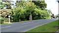
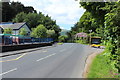
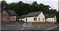
Nearby Images from Geograph Britain and Ireland:
©2020(licence)
©2016(licence)
©2012(licence)
©2015(licence)
©2016(licence)
The above images may not be of the site on this page, they are loaded from Geograph.
Please Submit an Image of this site or go out and take one for us!
Click here to see more info for this site
Nearby sites
Key: Red: member's photo, Blue: 3rd party photo, Yellow: other image, Green: no photo - please go there and take one, Grey: site destroyed
Download sites to:
KML (Google Earth)
GPX (GPS waypoints)
CSV (Garmin/Navman)
CSV (Excel)
To unlock full downloads you need to sign up as a Contributory Member. Otherwise downloads are limited to 50 sites.
Turn off the page maps and other distractions
Nearby sites listing. In the following links * = Image available
742m WSW 248° Stronach Ridge Rock Art* Rock Art (NS00303636)
768m SSW 200° Auchrannie, Glen Cloy* Souterrain (Fogou, Earth House) (NS007359)
923m NNW 333° Glen Shiel* Stone Row / Alignment (NS0061337447)
1.1km WNW 289° Glen Shirag Stone Circle (NS000370)
1.4km SE 141° Mayish* Standing Stone (Menhir) (NS01813551)
1.4km NNE 18° Replica Bronze Age Round House at Brodick Castle Modern Stone Circle etc (NS015379)
2.0km SSW 192° Glenrickard* Chambered Cairn (NS00513466)
2.1km WSW 250° Glen Shurig (Kilbride) Stone Circle (NR9936)
2.9km NNE 33° Merkland Cist Cist (NS02693896)
3.3km SSE 162° Lamlash* Stone Circle (NS0188233419)
3.8km SSE 151° Dunan Mor* Chambered Cairn (NS027332)
4.0km SSE 152° Dunan Beag* Chambered Cairn (NS0270932974)
4.3km SSE 151° North Blairmore* Standing Stone (Menhir) (NS0293432791)
6.7km N 1° Corrie possible Four-Poster Stone Circle (NS01404334)
7.0km WSW 257° Moinechoill* Chambered Cairn (NR941353)
7.0km WSW 257° Monyquil* Standing Stones (NR9405735284)
7.7km S 172° Monamore* Chambered Cairn (NS0175228890)
8.2km N 2° Sannox Chambered Cairn Chambered Cairn (NS017448)
8.3km N 358° South Sannox* Stone Circle (NS0106044907)
8.9km N 1° Sannox Cist* Cist (NS015455)
9.0km N 1° Sannox Bay Standing Stone* Standing Stone (Menhir) (NS01644558)
9.2km N 0° Mid Sannox Standing Stone* Standing Stone (Menhir) (NS0143345782)
9.2km SW 224° Clauchan Glen Standing Stone (Menhir) (NR94283029)
9.6km WSW 240° Shiskine* Stone Circle (NR92443225)
9.9km SW 234° Ballymichael Standing Stones* Standing Stones (NR92723119)
View more nearby sites and additional images


 We would like to know more about this location. Please feel free to add a brief description and any relevant information in your own language.
 Wir möchten mehr über diese Stätte erfahren. Bitte zögern Sie nicht, eine kurze Beschreibung und relevante Informationen in Deutsch hinzuzufügen.
 Nous aimerions en savoir encore un peu sur les lieux. S'il vous plaît n'hesitez pas à ajouter une courte description et tous les renseignements pertinents dans votre propre langue.
 Quisieramos informarnos un poco más de las lugares. No dude en añadir una breve descripción y otros datos relevantes en su propio idioma.