


<< Our Photo Pages >> St Breock Downs Barrow - Round Barrow(s) in England in Cornwall
Submitted by markj99 on Monday, 01 February 2021 Page Views: 696
Neolithic and Bronze AgeSite Name: St Breock Downs BarrowCountry: England
NOTE: This site is 1.6 km away from the location you searched for.
County: Cornwall Type: Round Barrow(s)
Nearest Town: Wadebridge Nearest Village: Burlawn
Map Ref: SW97606821
Latitude: 50.478673N Longitude: 4.854089W
Condition:
| 5 | Perfect |
| 4 | Almost Perfect |
| 3 | Reasonable but with some damage |
| 2 | Ruined but still recognisable as an ancient site |
| 1 | Pretty much destroyed, possibly visible as crop marks |
| 0 | No data. |
| -1 | Completely destroyed |
| 5 | Superb |
| 4 | Good |
| 3 | Ordinary |
| 2 | Not Good |
| 1 | Awful |
| 0 | No data. |
| 5 | Can be driven to, probably with disabled access |
| 4 | Short walk on a footpath |
| 3 | Requiring a bit more of a walk |
| 2 | A long walk |
| 1 | In the middle of nowhere, a nightmare to find |
| 0 | No data. |
| 5 | co-ordinates taken by GPS or official recorded co-ordinates |
| 4 | co-ordinates scaled from a detailed map |
| 3 | co-ordinates scaled from a bad map |
| 2 | co-ordinates of the nearest village |
| 1 | co-ordinates of the nearest town |
| 0 | no data |
Internal Links:
External Links:
I have visited· I would like to visit
lucasn visited on 30th Nov 2021 - their rating: Cond: 4 Amb: 4 Access: 4
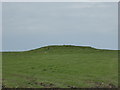
markj99 visited on 13th Oct 2013 - their rating: Cond: 3 Amb: 4 Access: 3 St Breock Downs Barrow, located c.2.5 miles S of Wadebridge, is in a group of sites dominated by Men Gurta. They are accessed via a network of narrow lanes. It is worthwhile to visit all the sites in the cluster. St Breock Downs Barrow is visible N of the road approaching Men Gurta from E.
Average ratings for this site from all visit loggers: Condition: 3.5 Ambience: 4 Access: 3.5
")
A recently constructed wind farm provides a dramatic backdrop to St Breock Downs Barrow. In addition , St Breock Downs Menhir, a smaller version of Men Gurta can be found c. 330 yards WSW of the barrow on St Breock Downs, see the nearby sites list below.
You may be viewing yesterday's version of this page. To see the most up to date information please register for a free account.
")
")
")
Do not use the above information on other web sites or publications without permission of the contributor.
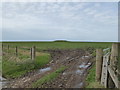
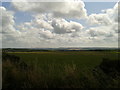
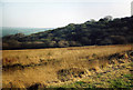
Nearby Images from Geograph Britain and Ireland:
©2014(licence)
©2014(licence)
©2014(licence)

©2012(licence)
©2005(licence)
The above images may not be of the site on this page, they are loaded from Geograph.
Please Submit an Image of this site or go out and take one for us!
Click here to see more info for this site
Nearby sites
Key: Red: member's photo, Blue: 3rd party photo, Yellow: other image, Green: no photo - please go there and take one, Grey: site destroyed
Download sites to:
KML (Google Earth)
GPX (GPS waypoints)
CSV (Garmin/Navman)
CSV (Excel)
To unlock full downloads you need to sign up as a Contributory Member. Otherwise downloads are limited to 50 sites.
Turn off the page maps and other distractions
Nearby sites listing. In the following links * = Image available
290m W 279° St Breock Downs Menhir* Standing Stone (Menhir) (SW9731468264)
327m NW 315° St Breock Downs North* Barrow Cemetery (SW9737668449)
819m W 270° St Breock Beacon Kistvaen* Burial Chamber or Dolmen (SW9677968243)
823m W 275° Men Gurta* Standing Stone (Menhir) (SW96786831)
1.7km NW 322° Pawton Quoit* Burial Chamber or Dolmen (SW96586960)
1.7km WNW 285° Pawton Springs* Barrow Cemetery (SW9593468737)
1.9km W 273° Pawton Gate Round Barrow(s) (SW95716837)
2.0km W 265° Rosenannon Downs* Barrow Cemetery (SW95556810)
2.4km SW 226° St Mary's Well (Rosenannon)* Holy Well or Sacred Spring (SW958666)
2.5km W 265° Rosenannon Downs W* Barrow Cemetery (SW95126811)
3.7km W 268° The Fiddler* Standing Stone (Menhir) (SW9393368211)
3.9km NNW 342° Whitecross (Wadebridge)* Ancient Cross (SW965720)
4.0km WSW 258° Nine Maidens Stone Row* Stone Row / Alignment (SW93636754)
4.6km SSW 206° St. Wenna's well* Holy Well or Sacred Spring (SW954642)
4.6km S 177° Demelza Castle* Ancient Village or Settlement (SW977636)
4.7km W 267° Trelow Downs Stone Row / Alignment (SW92906817)
5.7km S 183° Belowda Beacon tumuli* Barrow Cemetery (SW97136254)
6.0km WNW 296° Trenance Rounds* Ancient Village or Settlement (SW923710)
6.4km ENE 73° Prior's Cross* Ancient Cross (SX038698)
6.5km NNE 31° Three Hole Cross* Ancient Cross (SX01177367)
6.6km S 170° St Gundred's Well* Holy Well or Sacred Spring (SW985617)
6.6km SSW 205° Castle an Dinas (St Columb)* Hillfort (SW94556236)
6.6km ENE 72° Pencarrow Rounds* Hillfort (SX03987001)
6.9km NE 36° Killibury Camp* Hillfort (SX01857365)
6.9km ENE 65° Pencarrow Cross* Ancient Cross (SX040709)
View more nearby sites and additional images


 We would like to know more about this location. Please feel free to add a brief description and any relevant information in your own language.
 Wir möchten mehr über diese Stätte erfahren. Bitte zögern Sie nicht, eine kurze Beschreibung und relevante Informationen in Deutsch hinzuzufügen.
 Nous aimerions en savoir encore un peu sur les lieux. S'il vous plaît n'hesitez pas à ajouter une courte description et tous les renseignements pertinents dans votre propre langue.
 Quisieramos informarnos un poco más de las lugares. No dude en añadir una breve descripción y otros datos relevantes en su propio idioma.