Featured: Explore Scotland (and everywhere else) with our Megalithic Portal iPhone app

Explore Scotland (and everywhere else) with our Megalithic Portal iPhone app

Random Image


St. Ann's Well

Prehistoric Cumbria

Prehistoric Cumbria

Who's Online

There are currently, 375 guests and 2 members online.

You are a guest. To join in, please register for free by clicking here

Sponsors

<< Our Photo Pages >> Garn Turne - Chambered Tomb in Wales in Pembrokeshire

Submitted by vicky on Thursday, 01 October 2020  Page Views: 15188

Neolithic and Bronze AgeSite Name: Garn Turne Alternative Name: Carn Turne, Garn Tarne
Country: Wales County: Pembrokeshire Type: Chambered Tomb
Nearest Town: Fishguard  Nearest Village: St Dogwells
Map Ref: SM97922725  Landranger Map Number: 157
Latitude: 51.907036N  Longitude: 4.93915W
Condition:
5Perfect
4Almost Perfect
3Reasonable but with some damage
2Ruined but still recognisable as an ancient site
1Pretty much destroyed, possibly visible as crop marks
0No data.
-1Completely destroyed
3 Ambience:
5Superb
4Good
3Ordinary
2Not Good
1Awful
0No data.
3 Access:
5Can be driven to, probably with disabled access
4Short walk on a footpath
3Requiring a bit more of a walk
2A long walk
1In the middle of nowhere, a nightmare to find
0No data.
4 Accuracy:
5co-ordinates taken by GPS or official recorded co-ordinates
4co-ordinates scaled from a detailed map
3co-ordinates scaled from a bad map
2co-ordinates of the nearest village
1co-ordinates of the nearest town
0no data
4

Internal Links:
External Links:

I have visited· I would like to visit

Andy B SumDoood would like to visit

SeeHafstone7 visited on 10th Mar 2022 - their rating: Cond: 3 Amb: 4 Access: 4 There is now easy access to this from the passing place/2 or 3 car space right by the tomb. The farmer has made a narrow way through the thick hedge and barbed wire, with a simple metal gate. Please ensure you secure the gate with the bailer twine as you enter and leave.

TheCaptain couldn't find on 5th Oct 2015 Despite there being a few places to park nearby, I could find no way into the relevant field to have a look at this interesting sounding site, which is not clearly marked on the maps.

Anne T saw from a distance on 23rd Aug 2014 - their rating: Access: 1 Burial chamber at Garn Turne Rocks, Pembrokeshire: (couldn't find anywhere to access this site): The final sites we wanted to see before hitting the motorway home to Northumberland were the burial chambers at Garn Turne. Having successfully located the field and the footpath nearest to the largest burial chamber, we parked in an extended passing place near the footpath. We met a couple of local ladies with their families picking blackberries in the hedgerows and chatted briefly, telling them where we were going; they didn’t seem to think there would be a problem with access. Walking to 50 metres or so up the footpath to a gate in the field, we could see no access into the Garn Turne Enclosure. My husband hopped across the gate whilst I took photographs of the very curious cows in the adjacent field who’d come to see what we were up to! From this footpath, the chamber appeared to be inaccessible – there seemed to be no gates whatsoever. When we looked at the Portal later in the day, there were lots of other photographs of this site, and we are left wondering how they accessed it. Other web sites mention squeezing through hedges, and I don’t like to do this without permission from the farmer. I had to be content with a photograph from a distance. By way of compensation, we went to see Ogham and Latin inscribed stone at St. Dogwell’s Church (just marked as ‘Stone’ on the map, next to Sealyham Bridge). However, there was a second chamber on the map, at approximate grid reference SM 98269 26566 (the UK Grid Finder’s images are shrouded in cloud, so can’t get a precise fix). We found the very overgrown footpath that took us closest to the chamber, only to be met by a very aggressive combine harvester driver, who forced us to reverse at least a quarter of a mile, pull over for him, then block our way. At this point we gave up and decided to head for home, only to catch up with said combine harvester and had to follow him at about 15 miles an hour for the next four or five miles (he refused to let us by at any available passing place).

Penbron sem have visited here

Average ratings for this site from all visit loggers: Access: 2.5
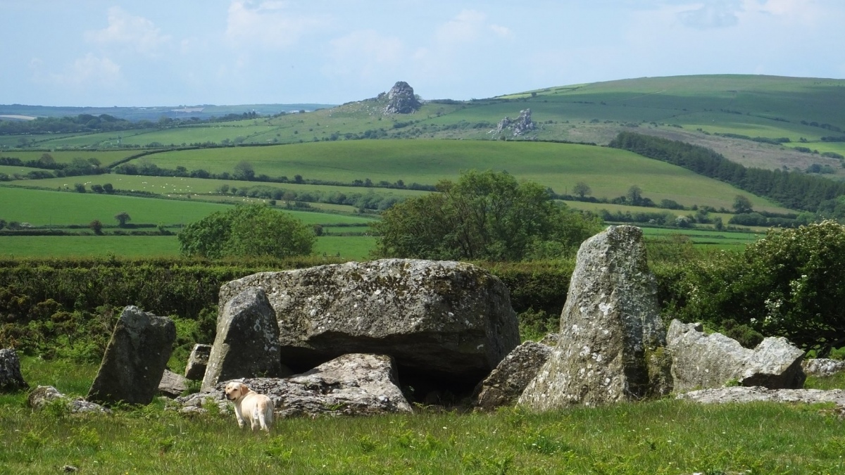
Garn Turne
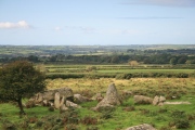
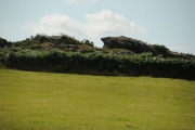
Garn Turne submitted by Penbron : Garn Turne with Maiden Castle yonder in distance (Vote or comment on this photo)
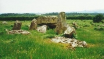
An impressive long cairn (11km south of Fishguard on a public footpath) with, reputedly, one of the largest capstones in Britain weighing more than 60 tonnes. To add to this a v-shaped forecourt similar to Pentre Ifan remains. The forecourt faces a large outcrop to the east.
You may be viewing yesterday's version of this page. To see the most up to date information please register for a free account.


Garn Turne
Garn Turne submitted by enkidu41 : SM 9793 2725 The tomb consists of a massive capstone of 16’3” x 13’6” and weighing more than 60 tons resting on a series of dislodged uprights. There is V-shaped forecourt. (2 comments - Vote or comment on this photo)

Garn Turne
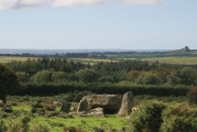
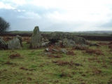
Garn Turne submitted by steveco : Garn Turn Burial Chamber SM979272. (Vote or comment on this photo)

Garn turne 1
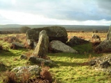
Garn turne 1 submitted by PaulM : GARN TURNE LONG CAIRN NGR: SM97932725 (Landranger map 157/Outdoor Leisure North Pembrokeshire map (No 35)) An impressive long cairn (11km south of Fishguard on a public footpath) with, reputedly, one of the largest capstones in Britain weighing more than 60 tonnes. To add to this a v-shaped forecourt (similar to Pentre Ifan) remains. The forecourt faces a large outcrop to the east. (Vote or comment on this photo)

Garn Turne
Garn Turne submitted by enkidu41 : SM 9793 2725 The tomb consists of a massive capstone of 16’3” x 13’6” and weighing more than 60 tons resting on a series of dislodged uprights. There is V-shaped forecourt. (1 comment - Vote or comment on this photo)

Garn Turne 2
Garn Turne 2 submitted by PaulM : GARN TURNE STANDING STONE NGR: SM97932724 (Landranger map 157/Outdoor Leisure North Pembrokeshire map (No 35)) Located to the south of the burial chamber. Part of the long cairn 'complex'. (Vote or comment on this photo)

Garn Turne
Garn Turne submitted by PERKYPUFFIN : The stones are arranged like an animal coral. I firmly believe that it was a ritual site where domesticated animals, cattle, goats or sheep were taken for slaughter and/or to increase their fertility. George Nash found a double edged flint knife here in 2011. The so called capstone I have estimated to be no more than 48 tons. Nevertheless massive and if a capstone more than 3 times the weight o... (2 comments)

Garn Turne
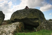
Garn Turne submitted by Postman : Nine year old daughter looks on slightly unimpressed.

Garn Turne
Garn Turne submitted by Bladup : Garn Turne chambered cairn.

Garn Turne
Garn Turne submitted by Bladup

Garn Turne
Garn Turne submitted by geraldaf : Ley Hunters at GarnTurne Must admit I did not give the ground condition any attention at the time. Seems like excavations had taken place before we arrived. Any news of this?

Garn Turne
Garn Turne submitted by enkidu41 : SM 9793 2725 The tomb consists of a massive capstone of 16’3” x 13’6” and weighing more than 60 tons resting on a series of dislodged uprights. There is V-shaped forecourt.

Garn Turne
Garn Turne submitted by enkidu41

Garn Turne
Garn Turne submitted by enkidu41

Garn Turne
Garn Turne submitted by enkidu41

Garn Turne cap
Garn Turne cap submitted by PaulM : GARN TURNE LONG CAIRN NGR: SM97932725 (Landranger map 157/Outdoor Leisure North Pembrokeshire map (No 35)) Reputedly, one of the largest capstones in Britain weighing more than 60 tonnes.

Garn Turne
Garn Turne submitted by Postman : A very impressive site.

Garn Turne
Garn Turne submitted by Postman : From on a nearby rock.

Garn Turne
Garn Turne submitted by Postman : From another nearby rock.

Garn Turne
Garn Turne submitted by Postman : Mid September 2008

Garn Turne
Garn Turne submitted by Postman : Good skies, good stones, good day.

Garn Turne
Garn Turne submitted by Postman : Another rock outcrop looks over it's dolmen

Garn Turne
Garn Turne submitted by Anne T : This is the closest we managed to get to the burial chamber at Garn Turne Rocks - from the footpath leading up to Ffynone. By way of compensation, we ended up seeing the Ogham and Latin inscribed stone at St. Dogwell's church. (3 comments)

Garn Turne
Garn Turne submitted by sem : Garn Turn looking roughly North towards the rock outcrop that gives the site it's name.

Garn Turne
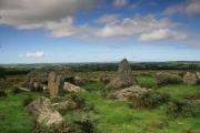
Garn Turne submitted by PaulM : A wide angle view of Garn Turne. (1 comment)

These are just the first 25 photos of Garn Turne. If you log in with a free user account you will be able to see our entire collection.

Do not use the above information on other web sites or publications without permission of the contributor.
Click here to see more info for this site

Nearby sites

Click here to view sites on an interactive OS map

Key: Red: member's photo, Blue: 3rd party photo, Yellow: other image, Green: no photo - please go there and take one, Grey: site destroyed

Download sites to:
KML (Google Earth)
GPX (GPS waypoints)
CSV (Garmin/Navman)
CSV (Excel)

To unlock full downloads you need to sign up as a Contributory Member. Otherwise downloads are limited to 50 sites.


Turn off the page maps and other distractions

Nearby sites listing. In the following links * = Image available
 728m SSE 153° Parc Y Llyn* Burial Chamber or Dolmen (SM98232659)
 941m NNE 20° The Altar* Chambered Tomb (SM98282812)
 1.3km NW 304° Hogtivis Stone* Early Christian Sculptured Stone (SM969280)
 2.7km W 276° Lower Broadmoor* Standing Stone (Menhir) (SM95212765)
 4.2km E 88° Henne Barrow Round Barrow(s) (SN021272)
 4.3km NE 42° Puncheston Stone* Standing Stone (Menhir) (SN009303)
 4.4km S 181° Spittal Church Early Christian Sculptured Stone (SM977229)
 4.5km NE 34° Parc Lan Cairn Cairn (SN006309)
 4.7km W 273° St Lawrence Camp Promontory Fort / Cliff Castle (SM93212771)
 4.7km WNW 295° Letterston III Stone Circle (SM937294)
 4.8km ENE 65° Carn Fuwch Ancient Village or Settlement (SN024291)
 5.0km NNE 29° Fagwyr Fran* Multiple Stone Rows / Avenue (SN005315)
 5.4km ENE 62° Mynydd Castlebythe Cairn (SN028296)
 5.6km WNW 283° Ty-newydd-grug* Standing Stone (Menhir) (SM9247228708)
 5.8km W 278° BrynGwyn Stone Standing Stone (Menhir) (SM9223728297)
 5.9km NNE 28° Mynydd Cilciffeth Cairn (SN009324)
 6.2km WSW 250° Barnards Hill Tumulus Round Barrow(s) (SM91962536)
 6.3km ENE 78° Tufton Castle Ancient Village or Settlement (SN04172834)
 6.5km E 86° Castell Hendre Ancient Village or Settlement (SN04472740)
 6.8km NNW 327° Llanstinan Bridge* Ancient Trackway (SM944331)
 6.9km ENE 78° Tavern Farm Ancient Village or Settlement (SN04792842)
 7.2km NE 54° Mynydd Morvil Barrow Cemetery (SN039313)
 7.3km ESE 110° Parc-y-marl Misc. Earthwork (SN047245)
 7.3km NE 49° Morvil church* Early Christian Sculptured Stone (SN037318)
 7.4km N 8° Llanychaer Church* Early Christian Sculptured Stone (SM992345)
View more nearby sites and additional images

<< Molteberghellene

Evjestien >>

Please add your thoughts on this site

Seahenge

Seahenge

Sponsors

Auto-Translation (Google)

Translate from English into:

"Garn Turne" | Login/Create an Account | 6 News and Comments
  
Go back to top of page    Comments are owned by the poster. We aren't responsible for their content.
How to build a dolmen - Exploring Neolithic construction at Garn Turne by Andy B on Monday, 07 May 2018
(User Info | Send a Message)
How to build a dolmen, January 6, 2014

Well known on the Continent and scattered along the coasts of Wales, Cornwall, and Ireland, dolmens are an immediately recognisable form of chambered tomb. They represent remarkable achievements for their Neolithic builders, crowned with stones weighing as much as 160 tonnes. Vicki Cummings and Colin Richards investigate how these distinctive monuments were constructed — and what happened when a project did not go to plan.

More at
https://www.archaeology.co.uk/articles/features/how-to-build-a-dolmen.htm
[ Reply to This ]

Re: Garn Turne by TheCaptain on Tuesday, 06 October 2015
(User Info | Send a Message)
I spent a fair while looking for this yesterday but being unable to find a way into the field / area. Liking to visit these things without reading details first, I have to say I wasn't even sure where to find it, but realised at the end, but could find no way in. But by then in the horizontal drizzle and ankle deep mud, decided to move on.
[ Reply to This ]

Rock art at Garn Turne by George Nash by Andy B on Monday, 09 December 2013
(User Info | Send a Message)
The paper discusses the recent (2006) discovery of a cup-and-ring petroglyph located on the capstone of a megalithic monument in south-west Wales. Cup-and-rings are found in abundance across the Neolithic and Bronze Age Atlantic zone of western Europe, usually carved on rock-outcroppings. In Wales there is increasing evidence that these images along with single and multiple cupules are being used to statement megalithic monuments. The cup-and-ring, located on an enormous capstone of Garn Turne is the first to be found on a Neolithic chambered monument in Wales. It provides possible evidence for stratigraphic use of the monument and is one of an increasing number of monuments that hitherto were considered to be absent of art

http://www.academia.edu/1079811/Rock_art_at_Garn_Turne_Pembrokeshire

Also Visual and Acoustic Mapping at Garn Turne by the Landscape Perception project

Tests on the Garn Turne dolmen elicited no resonant responses at all. However, the natural outcrop held a surprise for us:

http://www.landscape-perception.com/related_locations/garn_turne/
[ Reply to This ]

A summary of excavations at Garn Turne, Pembrokeshire by Andy B on Monday, 09 December 2013
(User Info | Send a Message)
Vicki Cummings writes: In the summers of 2011 and 2012 we opened a large trench at the site of Garn Turne in Pembrokeshire. These seasons of excavation at Garn Turne have revealed multiple phases of activity at this site, including the remains of at least two dolmen monuments. Prior to excavation there appeared to be a natural outcrop in the middle of the forecourt. This is very unusual and not paralleled at other dolmen sites in Britain or Ireland. Excavations revealed that this stone is not an outcrop but a quarried stone (named the Floss Stone).

It was found to be sitting on the edge of a pit, probably its source, which had evidence of intense burning in one area. A radiocarbon date on short-lived charcoal from this burning event produced a date of 3702-3639 BC. This stone was partly set on a rammed-stone platform which was cut by the digging of a large pit (which we think is the pit for the main capstone at the site) so we can suggest that the quarrying and moving of this stone predates the main dolmen (Garn Turne Major).

Also pre-dating Garn Turne Major is the remains of a smaller dolmen (Garn Turne Minor) situated directly to the north-west of the main site. Prior to excavation only the capstone of Garn Turne Minor was visible above ground. In our trenches, however, we found a number of collapsed orthostats alongside the large prostrate capstone. This monument once stood in a large pit, much like Arthur’s Stone on the Gower. At a later date, and once the monument had collapsed, the dolmen was surrounded by a platform of stones and soil so that the pit and collapsed uprights were no longer visible. We were only able to explore this dolmen in one small area because after the construction of this platform, a series of smaller standing stones were added around the collapsed capstone. Perhaps these were commemorating the dolmen or its collapse.

The main monument at Garn Turne (Garn Turne Major) was constructed after both the quarrying of the Floss Stone and the construction of Garn Turne Minor. A large pit in the forecourt was almost certainly the original location of the 80 tonne capstone for Garn Turne Major. Two radiocarbon dates from burnt hazel placed at the bottom of this pit are 3787-3656 BC and 3761-3643 BC. The capstone was quarried from the ground, flaked into shape using massive hammerstones, and the pit from where it was dug partly backfilled. The massive capstone was then elevated onto its supporting uprights, before collapsing, presumably due to the sheer weight of the capstone.

At a later date, a forecourt of sorts was constructed, partly in the remains of the massive quarry pit. Dates from this layer of the pit came back in the late Neolithic/early Bronze Age (2464-2210 BC, and 2618-2470 BC), and we tentatively speculate that these may date the construction of the façade. Another radiocarbon date from higher up in the pit is from the Iron Age (800-547 BC), which along with some iron slag found at the site, suggests that this site saw considerable activity at different points in prehistory. We also identified a series of standing stones in the immediate vicinity of Garn Turne, demonstrating that this entire landscape had seen broader monumental construction.

More at
http://presaddfed.wordpress.com/2013/08/29/a-summary-of-excavations-at-garn-turne-pembrokeshire/
[ Reply to This ]

Garn Turne Street View by SteveDut on Sunday, 30 May 2010
(User Info | Send a Message)

View Larger Map
[ Reply to This ]

Re: Garn Turne by coldrum on Wednesday, 14 January 2009
(User Info | Send a Message)
RCAHMW site record:

http://www.coflein.gov.uk/en/site/305207/details/CARN+TURNE%3BGARN+TURNE%3BOLD+COLDSTONE/
[ Reply to This ]

Your Name: Anonymous [ Register Now ]
Subject:


Add your comment or contribution to this page. Spam or offensive posts are deleted immediately, don't even bother

<<< What is five plus one as a number? (Please type the answer to this question in the little box on the left)
You can also embed videos and other things. For Youtube please copy and paste the 'embed code'.
For Google Street View please include Street View in the text.
Create a web link like this: <a href="https://www.megalithic.co.uk">This is a link</a>  

Allowed HTML is:
<p> <b> <i> <a> <img> <em> <br> <strong> <blockquote> <tt> <li> <ol> <ul> <object> <param> <embed> <iframe>

We would like to know more about this location. Please feel free to add a brief description and any relevant information in your own language.
Wir möchten mehr über diese Stätte erfahren. Bitte zögern Sie nicht, eine kurze Beschreibung und relevante Informationen in Deutsch hinzuzufügen.
Nous aimerions en savoir encore un peu sur les lieux. S'il vous plaît n'hesitez pas à ajouter une courte description et tous les renseignements pertinents dans votre propre langue.
Quisieramos informarnos un poco más de las lugares. No dude en añadir una breve descripción y otros datos relevantes en su propio idioma.