<< Our Photo Pages >> Sidhean Riabhach - Cist in Scotland in Argyll
Submitted by caradoc68 on Tuesday, 31 January 2012 Page Views: 2923
Neolithic and Bronze AgeSite Name: Sidhean Riabhach Alternative Name: SlaterichCountry: Scotland
NOTE: This site is 1.9 km away from the location you searched for.
County: Argyll Type: Cist
Nearest Town: oban Nearest Village: Kerrera
Map Ref: NM82092959
Latitude: 56.408118N Longitude: 5.533615W
Condition:
| 5 | Perfect |
| 4 | Almost Perfect |
| 3 | Reasonable but with some damage |
| 2 | Ruined but still recognisable as an ancient site |
| 1 | Pretty much destroyed, possibly visible as crop marks |
| 0 | No data. |
| -1 | Completely destroyed |
| 5 | Superb |
| 4 | Good |
| 3 | Ordinary |
| 2 | Not Good |
| 1 | Awful |
| 0 | No data. |
| 5 | Can be driven to, probably with disabled access |
| 4 | Short walk on a footpath |
| 3 | Requiring a bit more of a walk |
| 2 | A long walk |
| 1 | In the middle of nowhere, a nightmare to find |
| 0 | No data. |
| 5 | co-ordinates taken by GPS or official recorded co-ordinates |
| 4 | co-ordinates scaled from a detailed map |
| 3 | co-ordinates scaled from a bad map |
| 2 | co-ordinates of the nearest village |
| 1 | co-ordinates of the nearest town |
| 0 | no data |
Internal Links:
External Links:
")
On the south side of a natural pinnacle near Sithean Riabhach, and about 470 metres NNE of Slaterich, there are the remains of two cists situated alongside one another and only about 1 metre apart. The west cist measured about 1 metre in length and 0.61 metres in breadth and in depth. Part of this cist still protrudes above the turf. A slab lying nearby, and measuring 0.9 by 0.66 metres, may be the dislodged capstone. This cist contained a beaker. The east cist originally measured 1.35 metres in length, 0.38 metres in breadth and 0.66 metres in depth. Part of this cist also can be seen protruding above the turf. A large slab, 1.72 metres in length, part of which may be seen to one side of the cist may have been the original capstone. This cist contained a food vessel and some quartzite pebbles. The finds from both cists are now in the National Museum of Antiquities of Scotland.
You may be viewing yesterday's version of this page. To see the most up to date information please register for a free account.
Do not use the above information on other web sites or publications without permission of the contributor.
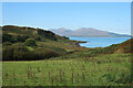
Nearby Images from Geograph Britain and Ireland:
©2022(licence)
©2022(licence)
©2017(licence)
©2017(licence)
©2022(licence)
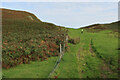
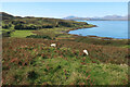
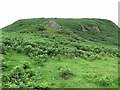
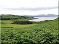
The above images may not be of the site on this page, they are loaded from Geograph.
Please Submit an Image of this site or go out and take one for us!
Click here to see more info for this site
Nearby sites
Key: Red: member's photo, Blue: 3rd party photo, Yellow: other image, Green: no photo - please go there and take one, Grey: site destroyed
Download sites to:
KML (Google Earth)
GPX (GPS waypoints)
CSV (Garmin/Navman)
CSV (Excel)
To unlock full downloads you need to sign up as a Contributory Member. Otherwise downloads are limited to 50 sites.
Turn off the page maps and other distractions
Nearby sites listing. In the following links * = Image available
432m N 350° Slatrach Cairn Cairn (NM82043002)
3.4km SSE 163° Dun Ormidale* Stone Fort or Dun (NM82902630)
3.4km ENE 63° Oban cup marked stone* Rock Art (NM85243097)
3.6km SE 133° Glenshellach* Rock Art (NM8459027055)
3.6km S 174° Dun Gallanach* Stone Fort or Dun (NM823260)
3.6km NE 56° Dunollie Stone Fort or Dun (NM85223148)
3.9km ENE 75° Macarthur Cave, Oban* Cave or Rock Shelter (NM85923043)
4.2km ESE 120° Ariogan Cairn* Cairn (NM85602731)
5.2km ENE 68° Pennyfuir Cairn Cairn (NM86993128)
5.9km SSE 153° Dunan Molach Stone Fort or Dun (NM84522416)
6.4km ESE 108° Killiechonich* Rock Art (NM88082736)
6.5km ESE 112° Dalinaneun Farm Cairn 3 Cairn (NM880268)
6.5km ESE 112° Serpent Mound - Loch Nell* Artificial Mound (NM880268)
6.5km ESE 113° Dalineun* Chambered Tomb (NM8799326710)
6.8km ESE 116° Moleigh* Cairn (NM88082631)
6.9km NW 320° Eilean Musdile (Lismore) Standing Stone (Menhir) (NM779351)
6.9km ESE 112° Barnacarry* Crannog (NM88362662)
6.9km ESE 117° Possible cairn at Kilmore* Cairn (NM88092609)
7.0km ESE 118° Cleigh* Misc. Earthwork (NM88112602)
7.0km ESE 118° Dalinaneun Farm Cairn 2* Cairn (NM881260)
7.0km NNW 333° Dun Chruban* Stone Fort or Dun (NM79243598)
7.1km NE 49° Dunstaffnage Round Houses* Ancient Village or Settlement (NM877340)
7.2km NNW 340° An Dun 2 (Lismore)* Stone Fort or Dun (NM79983651)
7.3km ESE 123° Cnoc Buidhe* Cairn (NM88032532)
7.4km E 96° Skull Shaped Stone - Loch Nell* Natural Stone / Erratic / Other Natural Feature (NM8939628383)
View more nearby sites and additional images


 We would like to know more about this location. Please feel free to add a brief description and any relevant information in your own language.
 Wir möchten mehr über diese Stätte erfahren. Bitte zögern Sie nicht, eine kurze Beschreibung und relevante Informationen in Deutsch hinzuzufügen.
 Nous aimerions en savoir encore un peu sur les lieux. S'il vous plaît n'hesitez pas à ajouter une courte description et tous les renseignements pertinents dans votre propre langue.
 Quisieramos informarnos un poco más de las lugares. No dude en añadir una breve descripción y otros datos relevantes en su propio idioma.