


<< Text Pages >> Low Ugadale - Chambered Cairn in Scotland in Argyll
Submitted by SolarMegalith on Tuesday, 18 December 2012 Page Views: 2305
Neolithic and Bronze AgeSite Name: Low UgadaleCountry: Scotland
NOTE: This site is 1.6 km away from the location you searched for.
County: Argyll Type: Chambered Cairn
Map Ref: NR779294
Latitude: 55.507723N Longitude: 5.518809W
Condition:
| 5 | Perfect |
| 4 | Almost Perfect |
| 3 | Reasonable but with some damage |
| 2 | Ruined but still recognisable as an ancient site |
| 1 | Pretty much destroyed, possibly visible as crop marks |
| 0 | No data. |
| -1 | Completely destroyed |
| 5 | Superb |
| 4 | Good |
| 3 | Ordinary |
| 2 | Not Good |
| 1 | Awful |
| 0 | No data. |
| 5 | Can be driven to, probably with disabled access |
| 4 | Short walk on a footpath |
| 3 | Requiring a bit more of a walk |
| 2 | A long walk |
| 1 | In the middle of nowhere, a nightmare to find |
| 0 | No data. |
| 5 | co-ordinates taken by GPS or official recorded co-ordinates |
| 4 | co-ordinates scaled from a detailed map |
| 3 | co-ordinates scaled from a bad map |
| 2 | co-ordinates of the nearest village |
| 1 | co-ordinates of the nearest town |
| 0 | no data |
Internal Links:
External Links:
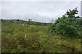
Chambered Cairn in Argyll
Remains of a horned long cairn.
Read More at Canmore.
You may be viewing yesterday's version of this page. To see the most up to date information please register for a free account.
Do not use the above information on other web sites or publications without permission of the contributor.
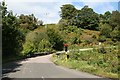
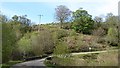
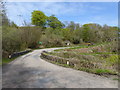
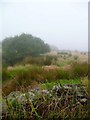
Nearby Images from Geograph Britain and Ireland:
©2007(licence)
©2012(licence)
©2018(licence)
©2013(licence)
©2014(licence)
The above images may not be of the site on this page, they are loaded from Geograph.
Please Submit an Image of this site or go out and take one for us!
Click here to see more info for this site
Nearby sites
Key: Red: member's photo, Blue: 3rd party photo, Yellow: other image, Green: no photo - please go there and take one, Grey: site destroyed
Download sites to:
KML (Google Earth)
GPX (GPS waypoints)
CSV (Garmin/Navman)
CSV (Excel)
To unlock full downloads you need to sign up as a Contributory Member. Otherwise downloads are limited to 50 sites.
Turn off the page maps and other distractions
Nearby sites listing. In the following links * = Image available
2.6km SSW 208° Ardnacross 1 Chambered Cairn (NR766272)
2.6km N 6° Holy Well (Saddell Abbey)* Holy Well or Sacred Spring (NR783320)
3.5km SSW 196° Ardnacross 2 Chambered Cairn (NR768261)
3.7km SSW 197° The Priest's Grave (Ardnacross)* Cist (NR76662592)
4.0km SSW 200° Peninver Bridge Standing Stone* Standing Stone (Menhir) (NR76352570)
4.2km SW 231° Gort na H'ulaidhe Chambered Cairn (NR745269)
4.3km SW 215° Kilkeddan Farm cist burial Cist (NR75252600)
4.3km SSW 201° Glenlussa Lodge* Standing Stone (Menhir) (NR76152543)
6.4km SSW 211° Greenland Chambered Cairn (NR743241)
7.1km NW 320° Beinn an Tuirc Standing Stone (Menhir) (NR73563507)
7.2km NW 324° Ballynacloghy Portal tomb* Portal Tomb (D52348198)
7.3km NNW 336° Beinn an Tuirc Stone Circle (NR753362)
7.3km NNE 15° Dippen Bay* Carving (NR801364)
7.3km WSW 248° Skeroblin Stone* Standing Stone (Menhir) (NR70932701)
7.6km WSW 251° Skeroblin Row Stone Row / Alignment (NR706273)
7.9km NNE 24° Carradale Point Hillfort* Hillfort (NR81513649)
8.8km W 262° Tangy Loch Cairn (NR691286)
9.2km WSW 244° High Park Stone* Standing Stone (Menhir) (NR69442573)
9.8km SSW 211° Campbeltown* Standing Stone (Menhir) (NR7239321234)
9.9km SW 235° Craigs NE (Kintyre) Recumbent Standing Stone (Menhir) (NR6949924121)
10.4km SW 233° Craigs East (Kintyre)* Standing Stone (Menhir) (NR6932623544)
10.5km SW 234° Craigs (Kintyre)* Standing Stone (Menhir) (NR6903123633)
10.6km E 79° Kings Cave* Cave or Rock Shelter (NR88443092)
10.7km E 88° Drumidoon* Stone Circle (NR886292)
10.7km E 87° Drumadoon Hillfort* Hillfort
View more nearby sites and additional images


 We would like to know more about this location. Please feel free to add a brief description and any relevant information in your own language.
 Wir möchten mehr über diese Stätte erfahren. Bitte zögern Sie nicht, eine kurze Beschreibung und relevante Informationen in Deutsch hinzuzufügen.
 Nous aimerions en savoir encore un peu sur les lieux. S'il vous plaît n'hesitez pas à ajouter une courte description et tous les renseignements pertinents dans votre propre langue.
 Quisieramos informarnos un poco más de las lugares. No dude en añadir una breve descripción y otros datos relevantes en su propio idioma.