 with our Megalithic Portal iPhone app")


<< Our Photo Pages >> Penhalvean Cross - Ancient Cross in England in Cornwall
Submitted by Bladup on Tuesday, 19 March 2024 Page Views: 65
Early Medieval (Dark Age)Site Name: Penhalvean CrossCountry: England
NOTE: This site is 0.7 km away from the location you searched for.
County: Cornwall Type: Ancient Cross
Map Ref: SW71003799
Latitude: 50.197536N Longitude: 5.210051W
Condition:
| 5 | Perfect |
| 4 | Almost Perfect |
| 3 | Reasonable but with some damage |
| 2 | Ruined but still recognisable as an ancient site |
| 1 | Pretty much destroyed, possibly visible as crop marks |
| 0 | No data. |
| -1 | Completely destroyed |
| 5 | Superb |
| 4 | Good |
| 3 | Ordinary |
| 2 | Not Good |
| 1 | Awful |
| 0 | No data. |
| 5 | Can be driven to, probably with disabled access |
| 4 | Short walk on a footpath |
| 3 | Requiring a bit more of a walk |
| 2 | A long walk |
| 1 | In the middle of nowhere, a nightmare to find |
| 0 | No data. |
| 5 | co-ordinates taken by GPS or official recorded co-ordinates |
| 4 | co-ordinates scaled from a detailed map |
| 3 | co-ordinates scaled from a bad map |
| 2 | co-ordinates of the nearest village |
| 1 | co-ordinates of the nearest town |
| 0 | no data |
Internal Links:
External Links:
")
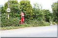
The head of a medieval cross, found in 1955 by the then owner beneath a demolished outhouse and now mounted on a hedge junction by the drive. The monument measures 0.37m in diameter and 0.165m in thickness.
You may be viewing yesterday's version of this page. To see the most up to date information please register for a free account.
")
Do not use the above information on other web sites or publications without permission of the contributor.
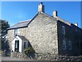
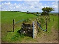
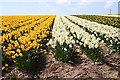
Nearby Images from Geograph Britain and Ireland:
©2010(licence)
©2015(licence)
©2019(licence)
©2006(licence)
©2006(licence)
The above images may not be of the site on this page, they are loaded from Geograph.
Please Submit an Image of this site or go out and take one for us!
Click here to see more info for this site
Nearby sites
Key: Red: member's photo, Blue: 3rd party photo, Yellow: other image, Green: no photo - please go there and take one, Grey: site destroyed
Download sites to:
KML (Google Earth)
GPX (GPS waypoints)
CSV (Garmin/Navman)
CSV (Excel)
To unlock full downloads you need to sign up as a Contributory Member. Otherwise downloads are limited to 50 sites.
Turn off the page maps and other distractions
Nearby sites listing. In the following links * = Image available
1.8km WNW 284° Gregwartha Tumuli* Barrow Cemetery (SW693385)
1.8km E 87° Trewithen Round Ancient Village or Settlement (SW72833802)
1.9km S 175° Colvennor Standing Stone* Modern Stone Circle etc (SW71073610)
2.0km SW 226° Carnmenellis Outcrop* Rock Outcrop (SW69533669)
2.0km SW 223° Carnmenellis Tor cairn* Rock Outcrop (SW69553657)
2.1km ENE 66° Trebowland Round* Ancient Village or Settlement (SW72923874)
2.1km SW 220° Carnmenellis cairn* Cairn (SW69563644)
2.2km ESE 109° Stithians Vicarage Garden Cross* Ancient Cross (SW73083716)
2.3km ESE 110° St Stithians Churchyard Cross* Ancient Cross (SW73123713)
2.3km SW 222° Carnmenellis Giant's Cave* Natural Stone / Erratic / Other Natural Feature (SW69403634)
2.3km NW 308° Carnkie tumuli* Barrow Cemetery (SW692395)
2.4km SSW 196° Carnmenellis Crosses* Ancient Cross (SW70233567)
2.7km SE 132° Tretheague Ancient Cross* Ancient Cross (SW729361)
2.7km N 8° Figgy Dowdy's Well* Holy Well or Sacred Spring (SW7146740637)
2.7km E 92° Seaureaugh standing Stone* Standing Stone (Menhir) (SW73723776)
2.7km SSE 162° Stithians Cupmarked Stones* Rock Art (SW71713536)
2.8km S 179° Mt Wise Farm* Standing Stone (Menhir) (SW7092535175)
3.0km WSW 239° Wendron South* Stone Circle (SW68313654)
3.1km WSW 240° Wendron North* Stone Circle (SW68293656)
3.3km SW 218° Calvadnack* Ancient Village or Settlement (SW689355)
3.3km W 264° Vincent's Well Holy Well or Sacred Spring (SW677378)
3.5km NW 317° Menhir Carn Brea (Redruth)* Standing Stone (Menhir) (SW687407)
3.6km ESE 119° Trevales Farm Wayside Cross* Ancient Cross (SW74073614)
3.7km NW 315° Carn Brea Enclosure* Ancient Village or Settlement (SW685407)
3.7km NW 317° Carn Brea Well* Holy Well or Sacred Spring (SW68584085)
View more nearby sites and additional images


 We would like to know more about this location. Please feel free to add a brief description and any relevant information in your own language.
 Wir möchten mehr über diese Stätte erfahren. Bitte zögern Sie nicht, eine kurze Beschreibung und relevante Informationen in Deutsch hinzuzufügen.
 Nous aimerions en savoir encore un peu sur les lieux. S'il vous plaît n'hesitez pas à ajouter une courte description et tous les renseignements pertinents dans votre propre langue.
 Quisieramos informarnos un poco más de las lugares. No dude en añadir una breve descripción y otros datos relevantes en su propio idioma.