<< Other Photo Pages >> Upper Tote - Cairn in Scotland in Isle of Skye
Submitted by davidmorgan on Thursday, 16 December 2021 Page Views: 2165
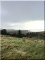
Neolithic and Bronze AgeSite Name: Upper Tote Alternative Name: Tot nan DruidheanCountry: Scotland County: Isle of Skye Type: Cairn
Nearest Town: Portree
Map Ref: NG51865898
Latitude: 57.552600N Longitude: 6.149477W
Condition:
| 5 | Perfect |
| 4 | Almost Perfect |
| 3 | Reasonable but with some damage |
| 2 | Ruined but still recognisable as an ancient site |
| 1 | Pretty much destroyed, possibly visible as crop marks |
| 0 | No data. |
| -1 | Completely destroyed |
| 5 | Superb |
| 4 | Good |
| 3 | Ordinary |
| 2 | Not Good |
| 1 | Awful |
| 0 | No data. |
| 5 | Can be driven to, probably with disabled access |
| 4 | Short walk on a footpath |
| 3 | Requiring a bit more of a walk |
| 2 | A long walk |
| 1 | In the middle of nowhere, a nightmare to find |
| 0 | No data. |
| 5 | co-ordinates taken by GPS or official recorded co-ordinates |
| 4 | co-ordinates scaled from a detailed map |
| 3 | co-ordinates scaled from a bad map |
| 2 | co-ordinates of the nearest village |
| 1 | co-ordinates of the nearest town |
| 0 | no data |
Internal Links:
External Links:
")
Ref: Highland Historic Environment Record - MHG5269.
Note: A Skye crofter who destroyed a Bronze Age cairn has been fined £18,000. More details in the comments on our page.
You may be viewing yesterday's version of this page. To see the most up to date information please register for a free account.
")
")
")
Do not use the above information on other web sites or publications without permission of the contributor.
Nearby Images from Geograph Britain and Ireland:
©2013(licence)
©2020(licence)
©2017(licence)
©2006(licence)
©2020(licence)
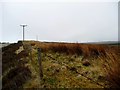
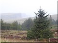
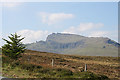
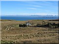
The above images may not be of the site on this page, they are loaded from Geograph.
Please Submit an Image of this site or go out and take one for us!
Click here to see more info for this site
Nearby sites
Key: Red: member's photo, Blue: 3rd party photo, Yellow: other image, Green: no photo - please go there and take one, Grey: site destroyed
Download sites to:
KML (Google Earth)
GPX (GPS waypoints)
CSV (Garmin/Navman)
CSV (Excel)
To unlock full downloads you need to sign up as a Contributory Member. Otherwise downloads are limited to 50 sites.
Turn off the page maps and other distractions
Nearby sites listing. In the following links * = Image available
1.2km SSE 151° Rigg Promontory Fort* Promontory Fort / Cliff Castle (NG52375790)
2.1km WNW 295° Dun Taivson Stone Fort or Dun (NG56)
4.0km NNW 342° Dun Connavern* Stone Fort or Dun (NG50856284)
5.3km SSW 197° Old Man of Storr* Rock Outcrop (NG5003853990)
5.3km N 351° Dun Dearg* Stone Fort or Dun (NG51376430)
5.5km NNW 340° Dun Raisaburgh* Broch or Nuraghe (NG50326427)
5.6km NNW 346° Raisaburgh Cairn* Cairn (NG508645)
6.4km NNW 344° Dun Grianan* Broch or Nuraghe (NG505652)
8.2km NNW 336° Dun Smail* Stone Fort or Dun (NG489667)
8.9km NNW 341° Cadha Riach* Chambered Tomb (NG49556757)
9.7km NNW 338° Carn Ban (Skye)* Cairn (NG487682)
10.0km NNW 341° An Corran* Ancient Mine, Quarry or other Industry (NG49106860)
10.9km NW 325° Dun Beag (Brogaig)* Hillfort (NG46076827)
11.2km NW 312° Cleat Hillfort Artificial Mound (NG440670)
11.2km WSW 237° Dun Eyre* Stone Fort or Dun (NG420535)
11.7km WSW 244° Dun Adhamh* Stone Fort or Dun (NG410546)
11.7km NNW 329° Dun Vallerain* Hillfort (NG46476943)
11.9km NNW 333° Loch Sheanta* Holy Well or Sacred Spring (NG471699)
12.2km SW 235° Eyre Alignment* Stone Row / Alignment (NG4143252510)
12.4km SW 225° Kensalyre Stone* Standing Stone (Menhir) (NG426507)
12.5km SW 224° Kensaleyre S Cairn* Cairn (NG42605059)
12.5km SW 229° Carn Liath (Kensaleyre)* Chambered Cairn (NG420513)
12.5km SW 225° Kensaleyre N Cairn* Cairn (NG42555064)
12.7km SSW 204° Dun Borve (Skye)* Broch or Nuraghe (NG45914772)
12.8km SSW 208° Borve Stone Row* Stone Row / Alignment (NG452480)
View more nearby sites and additional images


 We would like to know more about this location. Please feel free to add a brief description and any relevant information in your own language.
 Wir möchten mehr über diese Stätte erfahren. Bitte zögern Sie nicht, eine kurze Beschreibung und relevante Informationen in Deutsch hinzuzufügen.
 Nous aimerions en savoir encore un peu sur les lieux. S'il vous plaît n'hesitez pas à ajouter une courte description et tous les renseignements pertinents dans votre propre langue.
 Quisieramos informarnos un poco más de las lugares. No dude en añadir una breve descripción y otros datos relevantes en su propio idioma.