


<< Other Photo Pages >> An Corran - Ancient Mine, Quarry or other Industry in Scotland in Isle of Skye
Submitted by Andy B on Wednesday, 24 October 2007 Page Views: 10447
Multi-periodSite Name: An CorranCountry: Scotland
NOTE: This site is 0.2 km away from the location you searched for.
County: Isle of Skye Type: Ancient Mine, Quarry or other Industry
Map Ref: NG49106860
Latitude: 57.637255N Longitude: 6.205424W
Condition:
| 5 | Perfect |
| 4 | Almost Perfect |
| 3 | Reasonable but with some damage |
| 2 | Ruined but still recognisable as an ancient site |
| 1 | Pretty much destroyed, possibly visible as crop marks |
| 0 | No data. |
| -1 | Completely destroyed |
| 5 | Superb |
| 4 | Good |
| 3 | Ordinary |
| 2 | Not Good |
| 1 | Awful |
| 0 | No data. |
| 5 | Can be driven to, probably with disabled access |
| 4 | Short walk on a footpath |
| 3 | Requiring a bit more of a walk |
| 2 | A long walk |
| 1 | In the middle of nowhere, a nightmare to find |
| 0 | No data. |
| 5 | co-ordinates taken by GPS or official recorded co-ordinates |
| 4 | co-ordinates scaled from a detailed map |
| 3 | co-ordinates scaled from a bad map |
| 2 | co-ordinates of the nearest village |
| 1 | co-ordinates of the nearest town |
| 0 | no data |
Internal Links:
External Links:
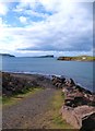
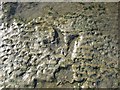
Shell Midden and lithics quarry in Isle of Skye. An Corran (at the southern end of Staffin Bay) is perhaps the oldest human site on Skye, being Mesolithic, before the development of agriculture or long term settlement. It has an apparent link to other early sites around the Inner Sound.
It is at the site of a former rock overhang above the Staffin beach, the overhang was destroyed by the roads department, without adequate field investigation or dating. Research by indicated hearths, flints, animal and human bone, arrowheads, a midden (ancient rubbish heap).
Source: Amanda Detweiler's Research Project (archive link) on Megalithic and Mesolithic Sites, Oxford College of Emory University
See also: History Scotland Magazine: Scotlands First Settlers (archive link).
A project to investigate the earliest settlement of west-coast Scotland, K Hardy & Caroline Wickham-Jones
You may be viewing yesterday's version of this page. To see the most up to date information please register for a free account.
Do not use the above information on other web sites or publications without permission of the contributor.
Andy B has found this location on Google Street View:
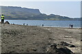
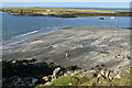
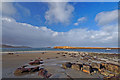
Nearby Images from Geograph Britain and Ireland:
©2012(licence)
©2023(licence)
©2023(licence)
©2010(licence)
©2011(licence)
The above images may not be of the site on this page, they are loaded from Geograph.
Please Submit an Image of this site or go out and take one for us!
Click here to see more info for this site
Nearby sites
Key: Red: member's photo, Blue: 3rd party photo, Yellow: other image, Green: no photo - please go there and take one, Grey: site destroyed
Download sites to:
KML (Google Earth)
GPX (GPS waypoints)
CSV (Garmin/Navman)
CSV (Excel)
To unlock full downloads you need to sign up as a Contributory Member. Otherwise downloads are limited to 50 sites.
Turn off the page maps and other distractions
Nearby sites listing. In the following links * = Image available
564m SW 221° Carn Ban (Skye)* Cairn (NG487682)
1.1km SSE 153° Cadha Riach* Chambered Tomb (NG49556757)
1.9km S 182° Dun Smail* Stone Fort or Dun (NG489667)
2.4km WNW 300° Loch Sheanta* Holy Well or Sacred Spring (NG471699)
2.7km WNW 284° Dun Vallerain* Hillfort (NG46476943)
3.0km W 260° Dun Beag (Brogaig)* Hillfort (NG46076827)
3.6km SSE 153° Dun Grianan* Broch or Nuraghe (NG5054965323)
4.2km NW 317° Tobar Kiltavie, Flodigarry* Holy Well or Sacred Spring (NG46457185)
4.3km NW 318° Dun Flodigarry* Broch or Nuraghe (NG46397196)
4.4km SSE 154° Raisaburgh Cairn* Cairn (NG508645)
4.5km NW 318° Druim Nan Slochd Dun* Hillfort (NG463721)
4.5km SSE 161° Dun Raisaburgh* Broch or Nuraghe (NG50326427)
4.9km SSE 149° Dun Dearg* Stone Fort or Dun (NG51376430)
5.3km WSW 249° Cleat Hillfort Artificial Mound (NG440670)
6.0km SSE 160° Dun Connavern* Stone Fort or Dun (NG50856284)
8.6km S 170° Dun Taivson Stone Fort or Dun (NG56)
10.0km SSE 160° Upper Tote* Cairn (NG51865898)
10.1km W 272° Kilvaxter souterrain* Souterrain (Fogou, Earth House) (NG3900569619)
10.1km WNW 285° Osmigarry* Standing Stone (Menhir) (NG3943571814)
11.2km SSE 159° Rigg Promontory Fort* Promontory Fort / Cliff Castle (NG52375790)
11.3km SW 236° Uig.* Standing Stone (Menhir) (NG394628)
11.9km W 267° Carn Liath (Skye)* Chambered Cairn (NG372688)
12.2km W 281° Dun Bornaskitaig* Broch or Nuraghe (NG37267161)
12.4km WSW 248° Dun Skudiburgh* Stone Fort or Dun (NG373647)
13.2km W 273° Dun Liath (Bornesketaig)* Stone Fort or Dun (NG359700)
View more nearby sites and additional images


 We would like to know more about this location. Please feel free to add a brief description and any relevant information in your own language.
 Wir möchten mehr über diese Stätte erfahren. Bitte zögern Sie nicht, eine kurze Beschreibung und relevante Informationen in Deutsch hinzuzufügen.
 Nous aimerions en savoir encore un peu sur les lieux. S'il vous plaît n'hesitez pas à ajouter une courte description et tous les renseignements pertinents dans votre propre langue.
 Quisieramos informarnos un poco más de las lugares. No dude en añadir una breve descripción y otros datos relevantes en su propio idioma.