


<< Text Pages >> St Senara - Holy Well or Sacred Spring in England in Cornwall
Submitted by Thorgrim on Monday, 29 March 2004 Page Views: 10394
Springs and Holy WellsSite Name: St Senara Alternative Name: Higher Kerrow WellCountry: England County: Cornwall Type: Holy Well or Sacred Spring
Nearest Town: Penzance Nearest Village: Zennor
Map Ref: SW4631136232 Landranger Map Number: 203
Latitude: 50.171690N Longitude: 5.554144W
Condition:
| 5 | Perfect |
| 4 | Almost Perfect |
| 3 | Reasonable but with some damage |
| 2 | Ruined but still recognisable as an ancient site |
| 1 | Pretty much destroyed, possibly visible as crop marks |
| 0 | No data. |
| -1 | Completely destroyed |
| 5 | Superb |
| 4 | Good |
| 3 | Ordinary |
| 2 | Not Good |
| 1 | Awful |
| 0 | No data. |
| 5 | Can be driven to, probably with disabled access |
| 4 | Short walk on a footpath |
| 3 | Requiring a bit more of a walk |
| 2 | A long walk |
| 1 | In the middle of nowhere, a nightmare to find |
| 0 | No data. |
| 5 | co-ordinates taken by GPS or official recorded co-ordinates |
| 4 | co-ordinates scaled from a detailed map |
| 3 | co-ordinates scaled from a bad map |
| 2 | co-ordinates of the nearest village |
| 1 | co-ordinates of the nearest town |
| 0 | no data |
Internal Links:
External Links:
Holy Well / Spring in Cornwall
Have you visited this site? Please add a comment below.
You may be viewing yesterday's version of this page. To see the most up to date information please register for a free account.
Do not use the above information on other web sites or publications without permission of the contributor.
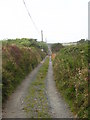
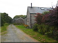
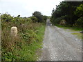
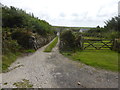
Nearby Images from Geograph Britain and Ireland:
©2010(licence)

©2009(licence)
©2010(licence)
©2015(licence)
©2015(licence)
The above images may not be of the site on this page, they are loaded from Geograph.
Please Submit an Image of this site or go out and take one for us!
Click here to see more info for this site
Nearby sites
Key: Red: member's photo, Blue: 3rd party photo, Yellow: other image, Green: no photo - please go there and take one, Grey: site destroyed
Download sites to:
KML (Google Earth)
GPX (GPS waypoints)
CSV (Garmin/Navman)
CSV (Excel)
To unlock full downloads you need to sign up as a Contributory Member. Otherwise downloads are limited to 50 sites.
Turn off the page maps and other distractions
Nearby sites listing. In the following links * = Image available
347m NW 318° Huel Creek barrow* Round Barrow(s) (SW46093650)
487m S 186° Try Round* Ancient Village or Settlement (SW46243575)
699m E 98° Conquer downs* Barrow Cemetery (SW470361)
703m SSW 191° Trye Settlement* Ancient Village or Settlement (SW46143555)
741m SE 146° Carnaquidden Downs* Ancient Village or Settlement (SW467356)
790m N 11° Trewey Common* Ancient Village or Settlement (SW465370)
868m ENE 62° Lady Downs* Barrow Cemetery (SW471366)
889m E 83° Lady Downs standing stone* Standing Stone (Menhir) (SW47203630)
1.0km WSW 258° Tolcreeg Barrow* Chambered Cairn (SW45293606)
1.2km NE 46° Noon Veor cist* Cist (SW472370)
1.2km SE 133° Carnaquidden Kerb Cairn* Ring Cairn (SW47163535)
1.3km SSW 193° Try Menhir (Cornwall)* Standing Stone (Menhir) (SW4596434975)
1.4km SW 230° Mulfra Quoit* Portal Tomb (SW4518035360)
1.4km NE 52° Embla Tumulus* Round Barrow(s) (SW47483707)
1.5km NNE 21° Foage Cairn* Cairn (SW469376)
1.5km N 10° Foage Iron Age/Romano British Courtyard House 1 Ancient Village or Settlement (SW46643770)
1.5km NNW 338° Trewey Hill* Cairn (SW45823767)
1.5km SE 140° Chysauster* Ancient Village or Settlement (SW47243502)
1.5km NW 313° Kerrowe Menhir* Standing Stone (Menhir) (SW45233732)
1.5km WSW 243° Mulfra Hill Tumuli* Barrow Cemetery (SW449356)
1.6km SSW 212° Mulfra Settlement* Ancient Village or Settlement (SW454349)
1.6km NW 324° Kerrowe Farm Tumulus* Round Barrow(s) (SW454376)
1.7km SE 145° Chysauster Fogou* Souterrain (Fogou, Earth House) (SW47203483)
1.7km N 7° Zennor settlement* Ancient Village or Settlement (SW46583787)
1.7km NNE 18° Zennor tumuli* Barrow Cemetery (SW469378)
View more nearby sites and additional images


 We would like to know more about this location. Please feel free to add a brief description and any relevant information in your own language.
 Wir möchten mehr über diese Stätte erfahren. Bitte zögern Sie nicht, eine kurze Beschreibung und relevante Informationen in Deutsch hinzuzufügen.
 Nous aimerions en savoir encore un peu sur les lieux. S'il vous plaît n'hesitez pas à ajouter une courte description et tous les renseignements pertinents dans votre propre langue.
 Quisieramos informarnos un poco más de las lugares. No dude en añadir una breve descripción y otros datos relevantes en su propio idioma.