<< Our Photo Pages >> Dun nan Gall - Broch or Nuraghe in Scotland in Isle of Mull
Submitted by DrewParsons on Friday, 17 October 2008 Page Views: 7941
Iron Age and Later PrehistorySite Name: Dun nan GallCountry: Scotland
NOTE: This site is 1.5 km away from the location you searched for.
County: Isle of Mull Type: Broch or Nuraghe
Nearest Town: Tobermory Nearest Village: Ballygown
Map Ref: NM43344331
Latitude: 56.511597N Longitude: 6.173448W
Condition:
| 5 | Perfect |
| 4 | Almost Perfect |
| 3 | Reasonable but with some damage |
| 2 | Ruined but still recognisable as an ancient site |
| 1 | Pretty much destroyed, possibly visible as crop marks |
| 0 | No data. |
| -1 | Completely destroyed |
| 5 | Superb |
| 4 | Good |
| 3 | Ordinary |
| 2 | Not Good |
| 1 | Awful |
| 0 | No data. |
| 5 | Can be driven to, probably with disabled access |
| 4 | Short walk on a footpath |
| 3 | Requiring a bit more of a walk |
| 2 | A long walk |
| 1 | In the middle of nowhere, a nightmare to find |
| 0 | No data. |
| 5 | co-ordinates taken by GPS or official recorded co-ordinates |
| 4 | co-ordinates scaled from a detailed map |
| 3 | co-ordinates scaled from a bad map |
| 2 | co-ordinates of the nearest village |
| 1 | co-ordinates of the nearest town |
| 0 | no data |
Internal Links:
External Links:
I have visited· I would like to visit
DrewParsons has visited here
")
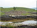
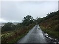
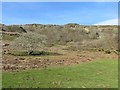
A ruined broch located on the shores of Loch Tuath, Mull. It is 11 metres in diameter and comprises a mound of stones rising perhaps 1.5 metres. The RCAHMS archeology notes give the grid reference incorrectly with the almost identical Eastings and Northings reversed. The site is 200 metres from the road accessed by climbing across a fixed gate opposite the southernmost house in Ballygown.
You may be viewing yesterday's version of this page. To see the most up to date information please register for a free account.
")
Do not use the above information on other web sites or publications without permission of the contributor.
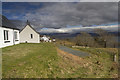
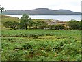
Nearby Images from Geograph Britain and Ireland:
©2017(licence)
©2011(licence)
©2006(licence)
©2022(licence)
©2015(licence)
The above images may not be of the site on this page, they are loaded from Geograph.
Please Submit an Image of this site or go out and take one for us!
Click here to see more info for this site
Nearby sites
Key: Red: member's photo, Blue: 3rd party photo, Yellow: other image, Green: no photo - please go there and take one, Grey: site destroyed
Download sites to:
KML (Google Earth)
GPX (GPS waypoints)
CSV (Garmin/Navman)
CSV (Excel)
To unlock full downloads you need to sign up as a Contributory Member. Otherwise downloads are limited to 50 sites.
Turn off the page maps and other distractions
Nearby sites listing. In the following links * = Image available
771m E 101° Dun Choinichean Stone Fort or Dun (NM44094312)
4.1km S 187° Ulva Standing Stone Standing Stone (Menhir) (NM42563926)
4.3km WNW 301° Tobar Ninian* Holy Well or Sacred Spring (NM3976545784)
4.4km WNW 295° Torr Damh* Cairn (NM39434544)
4.7km WNW 296° Tostarie* Standing Stone (Menhir) (NM3918145614)
4.8km SSE 160° Meall Min Rock Art (NM447387)
5.0km WNW 289° Dun Ban, Tostarie Stone Fort or Dun (NM38694524)
5.3km SSW 212° Cragaig* Standing Stones (NM40283901)
5.9km WNW 286° Dun Aisgain Stone Fort or Dun (NM37744524)
6.7km N 353° Torr A'chlachain, Mull Hillfort (NM42945000)
6.8km N 4° Torr Aint* Hillfort (NM44265005)
7.1km WSW 240° Tigh An Duine Stone Fort or Dun (NM36944013)
7.6km ENE 63° Tenga (Mull)* Stone Circle (NM50394631)
7.7km N 357° Aintuim Cairn Round Cairn (NM43445103)
7.8km S 173° Inch Kenneth Stone Standing Stone (Menhir) (NM4385835492)
8.3km N 0° Dervaig SSE* Stone Row / Alignment (NM4385951655)
8.5km N 1° Priest's Well (Dervaig)* Holy Well or Sacred Spring (NM440518)
8.6km N 0° Dervaig D Stone Row / Alignment (NM43935189)
8.6km N 0° Dervaig 3* Standing Stones (NM43935189)
8.6km N 353° Torr A'mhanaich Hillfort (NM42855192)
8.7km N 0° Dervaig centre* Stone Row / Alignment (NM43905203)
8.9km ENE 62° Ledmore Crannog (NM51514696)
9.1km NNW 341° Dun Auladh Round Cairn (NM40815212)
9.7km E 96° Kellan Wood Stone Fort or Dun (NM52914163)
9.7km NW 307° Creag A' Chaisteal Rock Art (NM35874957)
View more nearby sites and additional images


 We would like to know more about this location. Please feel free to add a brief description and any relevant information in your own language.
 Wir möchten mehr über diese Stätte erfahren. Bitte zögern Sie nicht, eine kurze Beschreibung und relevante Informationen in Deutsch hinzuzufügen.
 Nous aimerions en savoir encore un peu sur les lieux. S'il vous plaît n'hesitez pas à ajouter une courte description et tous les renseignements pertinents dans votre propre langue.
 Quisieramos informarnos un poco más de las lugares. No dude en añadir una breve descripción y otros datos relevantes en su propio idioma.