

<< Text Pages >> Treen Circle - Stone Circle in England in Cornwall
Submitted by Anonymous on Monday, 07 October 2002 Page Views: 6538
Neolithic and Bronze AgeSite Name: Treen CircleCountry: England County: Cornwall Type: Stone Circle
Map Ref: SW397222 Landranger Map Number: 203
Latitude: 50.042880N Longitude: 5.636969W
Condition:
| 5 | Perfect |
| 4 | Almost Perfect |
| 3 | Reasonable but with some damage |
| 2 | Ruined but still recognisable as an ancient site |
| 1 | Pretty much destroyed, possibly visible as crop marks |
| 0 | No data. |
| -1 | Completely destroyed |
| 5 | Superb |
| 4 | Good |
| 3 | Ordinary |
| 2 | Not Good |
| 1 | Awful |
| 0 | No data. |
| 5 | Can be driven to, probably with disabled access |
| 4 | Short walk on a footpath |
| 3 | Requiring a bit more of a walk |
| 2 | A long walk |
| 1 | In the middle of nowhere, a nightmare to find |
| 0 | No data. |
| 5 | co-ordinates taken by GPS or official recorded co-ordinates |
| 4 | co-ordinates scaled from a detailed map |
| 3 | co-ordinates scaled from a bad map |
| 2 | co-ordinates of the nearest village |
| 1 | co-ordinates of the nearest town |
| 0 | no data |
Internal Links:
External Links:
I have visited· I would like to visit
lucasn visited on 23rd Sep 2018 - their rating: Cond: -1 Amb: 4 Access: 3
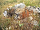
Formerly marked as 'extant' this circle has been destroyed, more information please.
Burl suggests it may be an Iron Age enclosure.
You may be viewing yesterday's version of this page. To see the most up to date information please register for a free account.
Do not use the above information on other web sites or publications without permission of the contributor.
Nearby Images from Geograph Britain and Ireland:

©2012(licence)

©2009(licence)

©2015(licence)

©2006(licence)

©2015(licence)
The above images may not be of the site on this page, they are loaded from Geograph.
Please Submit an Image of this site or go out and take one for us!
Click here to see more info for this site
Nearby sites
Key: Red: member's photo, Blue: 3rd party photo, Yellow: other image, Green: no photo - please go there and take one, Grey: site destroyed
Download sites to:
KML (Google Earth)
GPX (GPS waypoints)
CSV (Garmin/Navman)
CSV (Excel)
To unlock full downloads you need to sign up as a Contributory Member. Otherwise downloads are limited to 50 sites.
Turn off the page maps and other distractions
Nearby sites listing. In the following links * = Image available
85m ESE 108° Treryn Dinas* Promontory Fort / Cliff Castle (SW39782217)
230m S 175° The Logan Rock (Treen)* Natural Stone / Erratic / Other Natural Feature (SW39712197)
241m NNE 32° Treen standing stone* Modern Stone Circle etc (SW3983722399)
795m NW 304° Treen Farm stone* Standing Stone (Menhir) (SW3906322679)
1.5km W 272° Rospletha cross* Ancient Cross (SW38202233)
1.6km WSW 258° St Levan's Well* Holy Well or Sacred Spring (SW38082193)
1.7km W 267° St Levan's Stone* Natural Stone / Erratic / Other Natural Feature (SW38042220)
1.7km W 267° Churchyard Cross St Levan* Ancient Cross (SW38032220)
1.9km W 272° Lower Roskestal Cross* Early Christian Sculptured Stone (SW37792235)
2.1km NNE 29° Treverven Standing Stone* Standing Stone (Menhir) (SW4082323992)
2.2km ENE 66° Trevedran Standing Stone* Modern Stone Circle etc (SW41732297)
2.4km NNE 22° Treverven Markstone* Marker Stone (SW407244)
2.9km N 355° Alsia Mill Cross* Early Christian Sculptured Stone (SW396251)
2.9km N 349° Alsia Well* Holy Well or Sacred Spring (SW393251)
3.0km NW 313° Trebehor Cross* Early Christian Sculptured Stone (SW3763824319)
3.0km NE 45° Boskenna Crosses* Early Christian Sculptured Stone (SW419242)
3.3km NNE 13° Pendrea Cross* Ancient Cross (SW40592533)
3.4km WNW 288° Higher Bosistow Menhir* Standing Stone (Menhir) (SW36532338)
3.5km NE 42° Chyoone Cross* Ancient Cross (SW42192469)
3.5km ENE 58° Boscawen-Ros West* Standing Stone (Menhir) (SW4277423932)
3.5km NE 52° Boskenna Cross* Ancient Cross (SW42592426)
3.6km ENE 58° Boscawen-Ros East* Standing Stone (Menhir) (SW42822394)
3.7km NNE 16° St Buryan (Village)* Ancient Cross (SW4090025674)
3.7km NE 53° Boscawen Ros Holed Stone* Holed Stone (SW4274524272)
3.7km NNE 16° St Buryan (Churchyard)* Ancient Cross (SW40922570)
View more nearby sites and additional images


 We would like to know more about this location. Please feel free to add a brief description and any relevant information in your own language.
 Wir möchten mehr über diese Stätte erfahren. Bitte zögern Sie nicht, eine kurze Beschreibung und relevante Informationen in Deutsch hinzuzufügen.
 Nous aimerions en savoir encore un peu sur les lieux. S'il vous plaît n'hesitez pas à ajouter une courte description et tous les renseignements pertinents dans votre propre langue.
 Quisieramos informarnos un poco más de las lugares. No dude en añadir una breve descripción y otros datos relevantes en su propio idioma.