<< Other Photo Pages >> Dun Santavaig - Stone Fort or Dun in Scotland in Isle of Skye
Submitted by Andy B on Thursday, 15 April 2010 Page Views: 4589
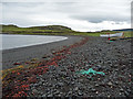
Multi-periodSite Name: Dun SantavaigCountry: Scotland County: Isle of Skye Type: Stone Fort or Dun
Map Ref: NG382572
Latitude: 57.528960N Longitude: 6.375158W
Condition:
| 5 | Perfect |
| 4 | Almost Perfect |
| 3 | Reasonable but with some damage |
| 2 | Ruined but still recognisable as an ancient site |
| 1 | Pretty much destroyed, possibly visible as crop marks |
| 0 | No data. |
| -1 | Completely destroyed |
| 5 | Superb |
| 4 | Good |
| 3 | Ordinary |
| 2 | Not Good |
| 1 | Awful |
| 0 | No data. |
| 5 | Can be driven to, probably with disabled access |
| 4 | Short walk on a footpath |
| 3 | Requiring a bit more of a walk |
| 2 | A long walk |
| 1 | In the middle of nowhere, a nightmare to find |
| 0 | No data. |
| 5 | co-ordinates taken by GPS or official recorded co-ordinates |
| 4 | co-ordinates scaled from a detailed map |
| 3 | co-ordinates scaled from a bad map |
| 2 | co-ordinates of the nearest village |
| 1 | co-ordinates of the nearest town |
| 0 | no data |
Internal Links:
External Links:
I have visited· I would like to visit
Andy B has visited here
")
You may be viewing yesterday's version of this page. To see the most up to date information please register for a free account.
")
Do not use the above information on other web sites or publications without permission of the contributor.
Nearby Images from Geograph Britain and Ireland:
©2006(licence)
©2008(licence)
©2008(licence)
©2020(licence)
©2008(licence)
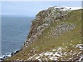
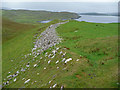
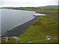
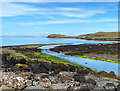
The above images may not be of the site on this page, they are loaded from Geograph.
Please Submit an Image of this site or go out and take one for us!
Click here to see more info for this site
Nearby sites
Key: Red: member's photo, Blue: 3rd party photo, Yellow: other image, Green: no photo - please go there and take one, Grey: site destroyed
Download sites to:
KML (Google Earth)
GPX (GPS waypoints)
CSV (Garmin/Navman)
CSV (Excel)
To unlock full downloads you need to sign up as a Contributory Member. Otherwise downloads are limited to 50 sites.
Turn off the page maps and other distractions
Nearby sites listing. In the following links * = Image available
1.7km SE 144° Unnamed dun at Kingsburgh* Stone Fort or Dun (NG391558)
2.0km NNW 342° Dun Maraig* Stone Fort or Dun (NG377591)
2.5km N 9° Snizort Stone Setting* Stone Circle (NG38755962)
3.5km WSW 243° Dun na h-Airde* Stone Fort or Dun (NG350558)
3.5km S 191° Creagan Soillier* Stone Fort or Dun (NG37315378)
3.8km SE 129° Dun Adhamh* Stone Fort or Dun (NG410546)
4.7km S 186° Dun Suladale* Broch or Nuraghe (NG374526)
4.7km SW 217° Dun Flashader* Broch or Nuraghe (NG351536)
5.3km SE 131° Dun Eyre* Stone Fort or Dun (NG420535)
5.7km SE 142° Eyre Alignment* Stone Row / Alignment (NG4143252510)
5.7km N 8° Uig.* Standing Stone (Menhir) (NG394628)
6.1km SSE 148° Standing stones below Dun Cruinn* Standing Stones (NG411518)
6.1km SSE 148° Dun Cruinn* Stone Fort or Dun (NG411518)
6.9km SSW 201° Dun Edinbane* Broch or Nuraghe (NG35355092)
7.0km SE 144° Carn Liath (Kensaleyre)* Chambered Cairn (NG420513)
7.5km N 349° Dun Skudiburgh* Stone Fort or Dun (NG373647)
7.8km SE 142° Kensalyre Stone* Standing Stone (Menhir) (NG426507)
7.9km SE 143° Kensaleyre N Cairn* Cairn (NG42555064)
7.9km SE 143° Kensaleyre S Cairn* Cairn (NG42605059)
9.0km SSE 151° Tote, Skye* Class I Pictish Symbol Stone (NG421491)
9.4km SSE 154° St Columba's Chapel (Skeabost) Early Christian Sculptured Stone (NG41824850)
9.5km SSE 157° Dun Sgalair* Stone Fort or Dun (NG41354826)
11.4km NNE 27° Cleat Hillfort Artificial Mound (NG440670)
11.5km SE 139° Borve Stone Row* Stone Row / Alignment (NG452480)
11.6km N 351° Carn Liath (Skye)* Chambered Cairn (NG372688)
View more nearby sites and additional images


 We would like to know more about this location. Please feel free to add a brief description and any relevant information in your own language.
 Wir möchten mehr über diese Stätte erfahren. Bitte zögern Sie nicht, eine kurze Beschreibung und relevante Informationen in Deutsch hinzuzufügen.
 Nous aimerions en savoir encore un peu sur les lieux. S'il vous plaît n'hesitez pas à ajouter une courte description et tous les renseignements pertinents dans votre propre langue.
 Quisieramos informarnos un poco más de las lugares. No dude en añadir una breve descripción y otros datos relevantes en su propio idioma.