<< Text Pages >> Neriby (Bridgend) - Standing Stone (Menhir) in Scotland in Isle of Islay
Submitted by Anne T on Wednesday, 06 December 2017 Page Views: 1438
Neolithic and Bronze AgeSite Name: Neriby (Bridgend)Country: Scotland County: Isle of Islay Type: Standing Stone (Menhir)
Nearest Town: Bridgend Nearest Village: Neriby
Map Ref: NR35956053
Latitude: 55.765823N Longitude: 6.211178W
Condition:
| 5 | Perfect |
| 4 | Almost Perfect |
| 3 | Reasonable but with some damage |
| 2 | Ruined but still recognisable as an ancient site |
| 1 | Pretty much destroyed, possibly visible as crop marks |
| 0 | No data. |
| -1 | Completely destroyed |
| 5 | Superb |
| 4 | Good |
| 3 | Ordinary |
| 2 | Not Good |
| 1 | Awful |
| 0 | No data. |
| 5 | Can be driven to, probably with disabled access |
| 4 | Short walk on a footpath |
| 3 | Requiring a bit more of a walk |
| 2 | A long walk |
| 1 | In the middle of nowhere, a nightmare to find |
| 0 | No data. |
| 5 | co-ordinates taken by GPS or official recorded co-ordinates |
| 4 | co-ordinates scaled from a detailed map |
| 3 | co-ordinates scaled from a bad map |
| 2 | co-ordinates of the nearest village |
| 1 | co-ordinates of the nearest town |
| 0 | no data |
Be the first person to rate this site - see the 'Contribute!' box in the right hand menu.
Internal Links:
External Links:
Standing Stone (Menhir) in Islay
The site of this now long-gone standing stone is recorded as Canmore ID 377722, which says: "There is no trace of the standing stone that was situated about 270m NW of Neriby farmhouse. It is recorded (Ordnance Survey Name Book 1878) that in 1878 it measured about 2m in height and 0.5m in breadth."
The Northern Antiquarian (TNA) also features a page for this site - see their entry for Neriby, Bridgend, Islay. TNA adds: "Anyone journeying this way might wanna scour the ground to see if the fella’s remains can be seen lying around anywhere – though the fact that an old quarry was dug hereabouts doesn’t bode well for a successful hunt. There are, however, remains of an old tumulus a bit further up the way…"
Note: Has anyone visited this site? Do you know if anything remains of this standing stone, last recorded in 1878?
You may be viewing yesterday's version of this page. To see the most up to date information please register for a free account.
Do not use the above information on other web sites or publications without permission of the contributor.
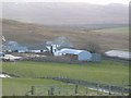
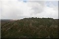
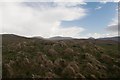
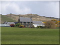
Nearby Images from Geograph Britain and Ireland:
©2010(licence)
©2014(licence)
©2014(licence)
©2010(licence)
©2017(licence)
The above images may not be of the site on this page, they are loaded from Geograph.
Please Submit an Image of this site or go out and take one for us!
Click here to see more info for this site
Nearby sites
Key: Red: member's photo, Blue: 3rd party photo, Yellow: other image, Green: no photo - please go there and take one, Grey: site destroyed
Download sites to:
KML (Google Earth)
GPX (GPS waypoints)
CSV (Garmin/Navman)
CSV (Excel)
To unlock full downloads you need to sign up as a Contributory Member. Otherwise downloads are limited to 50 sites.
Turn off the page maps and other distractions
Nearby sites listing. In the following links * = Image available
860m NNW 347° Gortanilivorrie Standing Stone (Menhir) (NR35816138)
4.4km NW 324° Knockdon Standing Stone (Menhir) (NR33616424)
5.7km NE 47° Mullach Dubh* Standing Stone (Menhir) (NR40366412)
5.7km WNW 297° Tayandock* Standing Stone (Menhir) (NR31016341)
5.8km NE 39° Knocklearoch* Standing Stones (NR3989164860)
7.1km N 360° Baile Tarbhach Standing Stone (Menhir) (NR36366762)
7.1km WNW 290° Uiskentuie* Standing Stone (Menhir) (NR29386336)
7.4km NNW 348° Beinn Cham Standing Stones (NR349679)
8.4km NE 34° Scanistle Standing Stone (Menhir) (NR41086724)
8.7km NNE 19° Finlaggan* Standing Stone (Menhir) (NR3927668559)
9.3km N 349° Clach an Tiompain Standing Stone (Menhir) (NR34756977)
9.8km WNW 289° Foreland House Standing Stone (Menhir) (NR269643)
10.7km W 271° Gartacharra* Standing Stone (Menhir) (NR252613)
11.3km ENE 64° Camas An Staca* Standing Stone (Menhir) (NR46416479)
11.5km WSW 252° Port Charlotte* Chambered Cairn (NR2482957613)
11.5km WNW 299° Glacan Daraich Ancient Village or Settlement (NR262667)
11.7km W 265° Cnoc Thornasaig Standing Stone (Menhir) (NR242603)
12.1km ESE 116° Ardtalla Standing Stone (Menhir) (NR46575456)
12.8km ESE 123° Trudernish* Standing Stone (Menhir) (NR46295290)
12.9km SSW 195° Kintra (Islay) Standing Stone (Menhir) (NR319483)
13.1km S 190° Carragh Bhan* Standing Stone (Menhir) (NR32834781)
13.2km NW 322° St Nem's Churchyard (Kilnave)* Ancient Cross (NR285715)
13.4km SSW 197° Dun A'chail* Stone Fort or Dun (NR31274796)
13.5km W 266° Cnoc Nan Guaillean Standing Stone* Standing Stone (Menhir) (NR22406042)
13.8km SE 131° Kildalton Cross* Ancient Cross (NR4580250830)
View more nearby sites and additional images


 We would like to know more about this location. Please feel free to add a brief description and any relevant information in your own language.
 Wir möchten mehr über diese Stätte erfahren. Bitte zögern Sie nicht, eine kurze Beschreibung und relevante Informationen in Deutsch hinzuzufügen.
 Nous aimerions en savoir encore un peu sur les lieux. S'il vous plaît n'hesitez pas à ajouter une courte description et tous les renseignements pertinents dans votre propre langue.
 Quisieramos informarnos un poco más de las lugares. No dude en añadir una breve descripción y otros datos relevantes en su propio idioma.