

<< Our Photo Pages >> Tom Thumb Rock - Rock Outcrop in England in Cornwall
Submitted by markj99 on Friday, 05 March 2021 Page Views: 1113
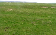
Natural PlacesSite Name: Tom Thumb RockCountry: England County: Cornwall Type: Rock Outcrop
Nearest Town: Penzance Nearest Village: St Just
Map Ref: SW36843061
Latitude: 50.117102N Longitude: 5.682614W
Condition:
| 5 | Perfect |
| 4 | Almost Perfect |
| 3 | Reasonable but with some damage |
| 2 | Ruined but still recognisable as an ancient site |
| 1 | Pretty much destroyed, possibly visible as crop marks |
| 0 | No data. |
| -1 | Completely destroyed |
| 5 | Superb |
| 4 | Good |
| 3 | Ordinary |
| 2 | Not Good |
| 1 | Awful |
| 0 | No data. |
| 5 | Can be driven to, probably with disabled access |
| 4 | Short walk on a footpath |
| 3 | Requiring a bit more of a walk |
| 2 | A long walk |
| 1 | In the middle of nowhere, a nightmare to find |
| 0 | No data. |
| 5 | co-ordinates taken by GPS or official recorded co-ordinates |
| 4 | co-ordinates scaled from a detailed map |
| 3 | co-ordinates scaled from a bad map |
| 2 | co-ordinates of the nearest village |
| 1 | co-ordinates of the nearest town |
| 0 | no data |
Internal Links:
External Links:
")
There is a dark oral folklore tale focused on Tom Thumb Rock. On the Celtic festival of Samhain the first stranger into town would be treated like a king for the day until the sun was about to set. The stranger was led to Tom Thumb Rock and placed on top to have their throat cut. This sacrifice was thought to ensure fertility for the next year.
The local name Tom Thumb Rock has only been marked on maps since the seventies and its derivation is unknown.
You may be viewing yesterday's version of this page. To see the most up to date information please register for a free account.
")
")
")
")
")
")
")
")
")
")
")
")
")
")
")
")
")
")
Do not use the above information on other web sites or publications without permission of the contributor.
Click here to see more info for this site
Nearby sites
Key: Red: member's photo, Blue: 3rd party photo, Yellow: other image, Green: no photo - please go there and take one, Grey: site destroyed
Download sites to:
KML (Google Earth)
GPX (GPS waypoints)
CSV (Garmin/Navman)
CSV (Excel)
To unlock full downloads you need to sign up as a Contributory Member. Otherwise downloads are limited to 50 sites.
Turn off the page maps and other distractions
Nearby sites listing. In the following links * = Image available
926m NNE 13° The Selus Stone* Early Christian Sculptured Stone (SW371315)
1.0km E 91° Bosworlas Lehau* Rock Outcrop (SW37873055)
1.2km WSW 250° Gribba (Letcha) kerb cairn* Cairn (SW35703025)
1.2km NNE 21° Venton East* Holy Well or Sacred Spring (SW3732931708)
1.3km SW 230° Carn Polpry Ring cairns* Ring Cairn (SW35792983)
1.4km SW 226° Boscregan Cairns* Cairn (SW358297)
1.5km WNW 293° Carn Gluze* Chambered Cairn (SW35523125)
1.5km SE 128° Lower Numphra Tumulus* Round Barrow(s) (SW3796529644)
1.5km SSW 192° Nanquidno Cross* Early Christian Sculptured Stone (SW3644629140)
1.9km SSW 199° Nanjulian courtyard house settlement* Ancient Village or Settlement (SW36152888)
1.9km S 178° Nanquidno Downs Tumulus and Hut Circles* Round Barrow(s) (SW368287)
1.9km NE 35° Tregeseal Barrow* Chambered Tomb (SW38043214)
2.1km NW 305° Cape Cornwall* Ancient Cross (SW352319)
2.1km NE 46° Lower Bostraze Misc. Earthwork (SW38473201)
2.2km NE 46° Carn Vres* Round Barrow(s) (SW38523209)
2.2km NW 323° Kenidjack Cairn Circle* Ring Cairn (SW35593247)
2.3km NNE 19° Higher Botallack Enclosure* Ancient Village or Settlement (SW377327)
2.4km NNE 31° Truthwall Barrow* Round Barrow(s) (SW38183257)
2.4km NNE 28° No Go By Hill Field System* Misc. Earthwork (SW38083265)
2.4km NW 323° Kenidjack Cliff Castle* Promontory Fort / Cliff Castle (SW355326)
2.5km NE 41° Tregeseal W Stone Circle (SW38553239)
2.5km NNE 26° Camyorth Field System Misc. Earthwork (SW38023278)
2.5km NE 42° Tregeseal C* Stone Circle (SW38613238)
2.5km NE 43° Tregeseal East* Stone Circle (SW38663237)
2.6km NE 36° Truthwall Commom Ancient Village or Settlement (SW38483267)
View more nearby sites and additional images


 We would like to know more about this location. Please feel free to add a brief description and any relevant information in your own language.
 Wir möchten mehr über diese Stätte erfahren. Bitte zögern Sie nicht, eine kurze Beschreibung und relevante Informationen in Deutsch hinzuzufügen.
 Nous aimerions en savoir encore un peu sur les lieux. S'il vous plaît n'hesitez pas à ajouter une courte description et tous les renseignements pertinents dans votre propre langue.
 Quisieramos informarnos un poco más de las lugares. No dude en añadir una breve descripción y otros datos relevantes en su propio idioma.