 with our Megalithic Portal iPhone app")


<< Text Pages >> Temple of Anaitis (Waternish) - Stone Circle in Scotland in Isle of Skye
Submitted by Anne T on Wednesday, 10 January 2018 Page Views: 3174
Neolithic and Bronze AgeSite Name: Temple of Anaitis (Waternish) Alternative Name: Annait; Temple of AnnaitCountry: Scotland County: Isle of Skye Type: Stone Circle
Nearest Village: Waternish
Map Ref: NG27255273
Latitude: 57.482473N Longitude: 6.55244W
Condition:
| 5 | Perfect |
| 4 | Almost Perfect |
| 3 | Reasonable but with some damage |
| 2 | Ruined but still recognisable as an ancient site |
| 1 | Pretty much destroyed, possibly visible as crop marks |
| 0 | No data. |
| -1 | Completely destroyed |
| 5 | Superb |
| 4 | Good |
| 3 | Ordinary |
| 2 | Not Good |
| 1 | Awful |
| 0 | No data. |
| 5 | Can be driven to, probably with disabled access |
| 4 | Short walk on a footpath |
| 3 | Requiring a bit more of a walk |
| 2 | A long walk |
| 1 | In the middle of nowhere, a nightmare to find |
| 0 | No data. |
| 5 | co-ordinates taken by GPS or official recorded co-ordinates |
| 4 | co-ordinates scaled from a detailed map |
| 3 | co-ordinates scaled from a bad map |
| 2 | co-ordinates of the nearest village |
| 1 | co-ordinates of the nearest town |
| 0 | no data |
Internal Links:
External Links:
Stone Circle in Isle of Skye
A mound is seemingly all that remains of this stone circle, and is featured on The Northern Antiquarian (TNA) - see their entry for the Temple of Anaitis, Lusta, Waternish, Skye.
The TNA page gives directions for finding this site, together with an image of the 1880 OS map showing the location of the circle and a number of descriptions from 19th and 20th century historical reference material, adding: "This is a curious place, full of archaeological potential if the folklore and history records are owt to go by, yet little of any substance remains to substantiate what may have been an important stone circle or other heathen site in earlier times."
You may be viewing yesterday's version of this page. To see the most up to date information please register for a free account.
Do not use the above information on other web sites or publications without permission of the contributor.
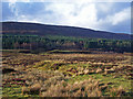
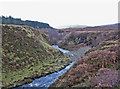
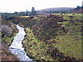
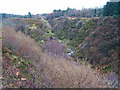
Nearby Images from Geograph Britain and Ireland:
©2008(licence)
©2008(licence)
©2008(licence)

©2008(licence)
©2008(licence)
The above images may not be of the site on this page, they are loaded from Geograph.
Please Submit an Image of this site or go out and take one for us!
Click here to see more info for this site
Nearby sites
Key: Red: member's photo, Blue: 3rd party photo, Yellow: other image, Green: no photo - please go there and take one, Grey: site destroyed
Download sites to:
KML (Google Earth)
GPX (GPS waypoints)
CSV (Garmin/Navman)
CSV (Excel)
To unlock full downloads you need to sign up as a Contributory Member. Otherwise downloads are limited to 50 sites.
Turn off the page maps and other distractions
Nearby sites listing. In the following links * = Image available
3.6km WNW 285° Claigan* Souterrain (Fogou, Earth House) (NG238539)
4.4km SSW 211° Dun Osdale Pictish Symbol Stone* Class I Pictish Symbol Stone (NG24734911)
4.7km SW 236° Dun Fiadhairt* Broch or Nuraghe (NG232504)
6.0km SSW 212° Dun Totaig* Stone Fort or Dun (NG237479)
6.7km NNW 342° Dun Hallin* Stone Fort or Dun (NG256592)
7.0km SSW 202° Dun Osdale Broch* Broch or Nuraghe (NG24124641)
7.7km W 264° Clach Ard* Standing Stone (Menhir) (NG195525)
7.9km E 80° Dun Flashader* Broch or Nuraghe (NG351536)
8.2km S 187° Dun Cnoc a'Sga* Stone Fort or Dun (NG257447)
8.3km E 99° Dun Edinbane* Broch or Nuraghe (NG35355092)
8.3km ENE 65° Dun na h-Airde* Stone Fort or Dun (NG350558)
9.1km SSE 160° Vatten* Cairn (NG2983843987)
9.7km NNW 327° Heaven Stone* Standing Stone (Menhir) (NG22486122)
9.7km SSW 207° Healabhal Mhor chambered cairn* Chambered Cairn (NG222444)
10.1km E 80° Creagan Soillier* Stone Fort or Dun (NG37315378)
10.1km E 87° Dun Suladale* Broch or Nuraghe (NG374526)
10.7km SSE 162° Dun Feorlig* Broch or Nuraghe (NG299423)
10.8km SSE 157° Dun Abhuinn Bhaile Mheadhonaich* Stone Fort or Dun (NG309425)
11.5km NNW 338° Dun Borrafiach* Broch or Nuraghe (NG23556368)
11.8km ENE 64° Dun Santavaig* Stone Fort or Dun (NG382572)
12.0km S 172° Dun Neill* Stone Fort or Dun (NG28114073)
12.2km ENE 72° Unnamed dun at Kingsburgh* Stone Fort or Dun (NG391558)
12.2km NE 55° Dun Maraig* Stone Fort or Dun (NG377591)
12.6km NNW 340° Dun Gearymore* Broch or Nuraghe (NG23676489)
12.7km SE 139° Dun Arkaig* Broch or Nuraghe (NG350426)
View more nearby sites and additional images


 We would like to know more about this location. Please feel free to add a brief description and any relevant information in your own language.
 Wir möchten mehr über diese Stätte erfahren. Bitte zögern Sie nicht, eine kurze Beschreibung und relevante Informationen in Deutsch hinzuzufügen.
 Nous aimerions en savoir encore un peu sur les lieux. S'il vous plaît n'hesitez pas à ajouter une courte description et tous les renseignements pertinents dans votre propre langue.
 Quisieramos informarnos un poco más de las lugares. No dude en añadir una breve descripción y otros datos relevantes en su propio idioma.