 with our Megalithic Portal iPhone app")


<< Our Photo Pages >> Mount Todden Cairn - Chambered Cairn in England in Isles of Scilly
Submitted by Bladup on Wednesday, 15 June 2022 Page Views: 534
Neolithic and Bronze AgeSite Name: Mount Todden CairnCountry: England County: Isles of Scilly Type: Chambered Cairn
Map Ref: SV9286011490
Latitude: 49.924509N Longitude: 6.280847W
Condition:
| 5 | Perfect |
| 4 | Almost Perfect |
| 3 | Reasonable but with some damage |
| 2 | Ruined but still recognisable as an ancient site |
| 1 | Pretty much destroyed, possibly visible as crop marks |
| 0 | No data. |
| -1 | Completely destroyed |
| 5 | Superb |
| 4 | Good |
| 3 | Ordinary |
| 2 | Not Good |
| 1 | Awful |
| 0 | No data. |
| 5 | Can be driven to, probably with disabled access |
| 4 | Short walk on a footpath |
| 3 | Requiring a bit more of a walk |
| 2 | A long walk |
| 1 | In the middle of nowhere, a nightmare to find |
| 0 | No data. |
| 5 | co-ordinates taken by GPS or official recorded co-ordinates |
| 4 | co-ordinates scaled from a detailed map |
| 3 | co-ordinates scaled from a bad map |
| 2 | co-ordinates of the nearest village |
| 1 | co-ordinates of the nearest town |
| 0 | no data |
Internal Links:
External Links:
")
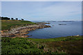
On the crest of a hill at approximately 38.0m OD is an earth and stone semi-circular cairn 12.0m a cross and 0.7m high, Built against an outcrop (like a lot of Scilly sites) with no visible ditch. The scrub and bracken covered mound comprises several boulders; the largest being a natural outcrop - 9.0m x 0.4m. On the East side the tops of two parallel stones suggest a possible cist or chamber. This site corporates an elongated 9m rock outcrop on the West side, and the three stones on the East side suggest a chamber orientated north east/south west, At the moment the site is totally overgrown.
This site is scheduled as Historic England List ID 1010164, Kerbed platform cairn 80m north east of Mount Todden Farm, St Mary's.
You may be viewing yesterday's version of this page. To see the most up to date information please register for a free account.
")
")
Do not use the above information on other web sites or publications without permission of the contributor.
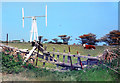
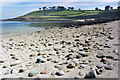
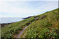
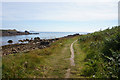
Nearby Images from Geograph Britain and Ireland:
©2020(licence)
©2020(licence)
©2018(licence)
©2018(licence)
©2018(licence)
The above images may not be of the site on this page, they are loaded from Geograph.
Please Submit an Image of this site or go out and take one for us!
Click here to see more info for this site
Nearby sites
Key: Red: member's photo, Blue: 3rd party photo, Yellow: other image, Green: no photo - please go there and take one, Grey: site destroyed
Download sites to:
KML (Google Earth)
GPX (GPS waypoints)
CSV (Garmin/Navman)
CSV (Excel)
To unlock full downloads you need to sign up as a Contributory Member. Otherwise downloads are limited to 50 sites.
Turn off the page maps and other distractions
Nearby sites listing. In the following links * = Image available
126m ENE 57° Mount Todden* Modern Stone Circle etc (SV9297011553)
376m SE 137° Normandy Down* Chambered Cairn (SV931112)
433m NNE 16° Toll's Island* Misc. Earthwork (SV930119)
566m N 349° Toll's Hill (1)* Ancient Village or Settlement (SV9278812052)
662m NNW 334° Toll's Hill (2) Misc. Earthwork (SV926121)
791m S 181° Porth Hellick Down* Burial Chamber or Dolmen (SV928107)
882m W 280° Maypole Chambered Tomb (SV920117)
966m SW 215° Higher Moor Cairns* Barrow Cemetery (SV92261073)
983m NW 322° Helvear Hill* Chambered Cairn (SV923123)
1.0km NW 318° Helvear Farm Cairn (SV922123)
1.1km W 266° Holy Vale Longstone* Standing Stone (Menhir) (SV91771147)
1.1km SSW 195° Salakee Down 1* Chambered Tomb (SV925104)
1.2km WSW 242° Rocky Hill* Ancient Cross (SV918110)
1.3km W 278° Town Lane (St Mary's) Cist (SV91571175)
1.3km NNW 326° Innisidgen Upper* Burial Chamber or Dolmen (SV92181265)
1.4km SSW 200° Salakee Down 2 Chambered Tomb (SV92321025)
1.4km NW 325° Innisidgen Hill Misc. Earthwork (SV921127)
1.4km NW 325° Innisidgen Lower* Burial Chamber or Dolmen (SV92111272)
1.5km SSW 193° Giant's Castle* Hillfort (SV92461008)
1.5km NW 318° Helvear Down* Cairn (SV9193312655)
1.5km SSW 204° Salakee Down 3 Chambered Tomb (SV92171016)
1.5km SSW 200° Salakee Down 6 (2 cairns)* Chambered Tomb (SV92271009)
1.6km SSW 198° Salakee Down 4* Chambered Tomb (SV92281003)
1.6km SSW 200° Salakee Down 5* Chambered Tomb (SV92241002)
1.7km NW 318° Little Porth Ancient Village or Settlement (SV918128)
View more nearby sites and additional images


 We would like to know more about this location. Please feel free to add a brief description and any relevant information in your own language.
 Wir möchten mehr über diese Stätte erfahren. Bitte zögern Sie nicht, eine kurze Beschreibung und relevante Informationen in Deutsch hinzuzufügen.
 Nous aimerions en savoir encore un peu sur les lieux. S'il vous plaît n'hesitez pas à ajouter une courte description et tous les renseignements pertinents dans votre propre langue.
 Quisieramos informarnos un poco más de las lugares. No dude en añadir una breve descripción y otros datos relevantes en su propio idioma.