


<< Our Photo Pages >> Glantane East Stone Circle - Stone Circle in Ireland (Republic of) in Co. Cork
Submitted by Johnny on Sunday, 13 October 2002 Page Views: 9594
Neolithic and Bronze AgeSite Name: Glantane East Stone CircleCountry: Ireland (Republic of) County: Co. Cork Type: Stone Circle
Map Ref: W2829784056
Discovery Map Number: D79
Latitude: 52.004426N Longitude: 9.044853W
Condition:
| 5 | Perfect |
| 4 | Almost Perfect |
| 3 | Reasonable but with some damage |
| 2 | Ruined but still recognisable as an ancient site |
| 1 | Pretty much destroyed, possibly visible as crop marks |
| 0 | No data. |
| -1 | Completely destroyed |
| 5 | Superb |
| 4 | Good |
| 3 | Ordinary |
| 2 | Not Good |
| 1 | Awful |
| 0 | No data. |
| 5 | Can be driven to, probably with disabled access |
| 4 | Short walk on a footpath |
| 3 | Requiring a bit more of a walk |
| 2 | A long walk |
| 1 | In the middle of nowhere, a nightmare to find |
| 0 | No data. |
| 5 | co-ordinates taken by GPS or official recorded co-ordinates |
| 4 | co-ordinates scaled from a detailed map |
| 3 | co-ordinates scaled from a bad map |
| 2 | co-ordinates of the nearest village |
| 1 | co-ordinates of the nearest town |
| 0 | no data |
Internal Links:
External Links:
I have visited· I would like to visit
frogcottage42 has visited here
")
This partially destroyed stone circle is still an imposing presence standing in moorland on the east side of the River Keel valley. Only six erect stones survive of perhaps eleven to thirteen which would have formed a circle 4.5m in diameter. The stones vary in height from 0.5m to 1.0m and are surrounded by a 2.5m wide fosse and low bank, a rare feature shared by the fine circle at Reenascreena (cf). Two tall pillar-like stones lay along the outer face of the fosse and 8m to the SE of the circle. According to the Office of Public Works, these stones were erected in 1994 opposite each other at the edge of the fosse. It would appear, therefore, that one of them has subsequently fallen again.
You may be viewing yesterday's version of this page. To see the most up to date information please register for a free account.
")
")
")
")
Do not use the above information on other web sites or publications without permission of the contributor.
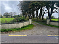
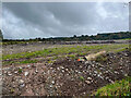
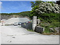
Nearby Images from Geograph Britain and Ireland:
©2023(licence)
©2023(licence)
©2016(licence)
The above images may not be of the site on this page, they are loaded from Geograph.
Please Submit an Image of this site or go out and take one for us!
Click here to see more info for this site
Nearby sites
Click here to view sites on an interactive map of the areaKey: Red: member's photo, Blue: 3rd party photo, Yellow: other image, Green: no photo - please go there and take one, Grey: site destroyed
Download sites to:
KML (Google Earth)
GPX (GPS waypoints)
CSV (Garmin/Navman)
CSV (Excel)
To unlock full downloads you need to sign up as a Contributory Member. Otherwise downloads are limited to 50 sites.
![]()
Turn off the page maps and other distractions
Nearby sites listing. In the following links * = Image available
256m NE 43° Glantane East NE* Stone Row / Alignment (W2847684240)
692m SSW 206° Glantane SW Stone Circle* Stone Circle (W27988344)
1.1km SSW 202° Glantane East Southwest Stone Row* Stone Row / Alignment (W2787183068)
1.1km E 82° Knocknakilla* Stone Circle (W294842)
1.1km NNE 28° Knocknakilla Standing Stone* Standing Stone (Menhir) (W28858504)
1.2km SSE 151° Carriganimmy (south west) wedge tomb* Wedge Tomb
1.2km SSW 209° Glantane East Wedge Tomb* Wedge Tomb (W277830)
1.2km ESE 113° Carraig an Ime (north east) wedge tomb* Wedge Tomb
1.3km NE 37° Knocknakilla Modern Dolmen* Modern Stone Circle etc (W29108508)
1.6km WNW 298° Caherdowney Ringfort (cashel)* Stone Fort or Dun
1.7km SE 144° Carriganimmy circle* Stone Circle
1.9km E 96° Carriganimmy hut site* Ancient Village or Settlement
1.9km WNW 290° Caherdowney west ringfort (cashel)* Stone Fort or Dun
2.4km ESE 122° Carriganimmy row* Stone Row / Alignment (W30328275)
2.5km ENE 61° Cloghboola Beg Stone Row / Alignment (W30538526)
2.5km ENE 61° Cloghboola Beg* Stone Circle (W3054185260)
2.7km N 358° Knocknakilla NW Stone Row / Alignment
2.7km WSW 256° Caherdowney Wedge Tomb* Wedge Tomb
2.8km WNW 294° Ballyvouskill cairn* Cairn
2.9km NNW 345° Cloghboola More circle Stone Circle (W27588691)
3.0km WNW 287° Ballyvouskill circle* Stone Circle (W25418496)
3.3km N 349° Cloghboola More row Stone Row / Alignment
3.3km NNE 23° Lackdotia stone Standing Stone (Menhir)
3.4km S 174° Carrigonirtane stone circle* Stone Circle
3.4km SSE 147° Knockraheen NW Stone Row* Stone Row / Alignment (W30098118)
View more nearby sites and additional images


 We would like to know more about this location. Please feel free to add a brief description and any relevant information in your own language.
 Wir möchten mehr über diese Stätte erfahren. Bitte zögern Sie nicht, eine kurze Beschreibung und relevante Informationen in Deutsch hinzuzufügen.
 Nous aimerions en savoir encore un peu sur les lieux. S'il vous plaît n'hesitez pas à ajouter une courte description et tous les renseignements pertinents dans votre propre langue.
 Quisieramos informarnos un poco más de las lugares. No dude en añadir una breve descripción y otros datos relevantes en su propio idioma.