

<< Our Photo Pages >> St Gundred's Well - Holy Well or Sacred Spring in England in Cornwall
Submitted by theendlessbreeze on Monday, 29 March 2004 Page Views: 12722
Springs and Holy WellsSite Name: St Gundred's WellCountry: England County: Cornwall Type: Holy Well or Sacred Spring
Nearest Town: St Austell Nearest Village: Roche
Map Ref: SW985617 Landranger Map Number: 200
Latitude: 50.420511N Longitude: 4.837918W
Condition:
| 5 | Perfect |
| 4 | Almost Perfect |
| 3 | Reasonable but with some damage |
| 2 | Ruined but still recognisable as an ancient site |
| 1 | Pretty much destroyed, possibly visible as crop marks |
| 0 | No data. |
| -1 | Completely destroyed |
| 5 | Superb |
| 4 | Good |
| 3 | Ordinary |
| 2 | Not Good |
| 1 | Awful |
| 0 | No data. |
| 5 | Can be driven to, probably with disabled access |
| 4 | Short walk on a footpath |
| 3 | Requiring a bit more of a walk |
| 2 | A long walk |
| 1 | In the middle of nowhere, a nightmare to find |
| 0 | No data. |
| 5 | co-ordinates taken by GPS or official recorded co-ordinates |
| 4 | co-ordinates scaled from a detailed map |
| 3 | co-ordinates scaled from a bad map |
| 2 | co-ordinates of the nearest village |
| 1 | co-ordinates of the nearest town |
| 0 | no data |
Internal Links:
External Links:
I have visited· I would like to visit
SolarMegalith would like to visit
cazzyjane has visited here
")
From Roche, drive right onto the A30 and a little further on the left is Demelza Road. Take this road, then on right you will find a path. Drive down this path until you come to the end to 'Higher Holywell Farm'. Here you will find a cottage; behind it is a gate, take the steps down. You will find the well in a stone surround on the left hand side.
St Gundred's Well was visited in the past by young women who threw bent pins into the well to foretell the future.
You may be viewing yesterday's version of this page. To see the most up to date information please register for a free account.
")
")
")
")
")
")
Do not use the above information on other web sites or publications without permission of the contributor.
Nearby sites
Download sites to:
KML (Google Earth)
GPX (GPS waypoints)
CSV (Garmin/Navman)
CSV (Excel)
To unlock full downloads you need to sign up as a Contributory Member. Otherwise downloads are limited to 50 sites.
Nearby sites listing. In the following links * = Image available
1.6km S 172° Menevegar Menhir* Standing Stone (Menhir) (SW98676011)
1.6km WNW 299° Belowda Beacon tumuli* Barrow Cemetery (SW97136254)
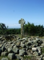
1.9km S 169° Roche Cross* Ancient Cross (SW98795978)
2.1km NNW 335° Demelza Castle* Ancient Village or Settlement (SW977636)
2.2km SSE 162° Roche Rock* Rock Outcrop (SW99105962)
4.0km NW 307° St. Wenna's well* Holy Well or Sacred Spring (SW954642)
4.0km W 277° Castle an Dinas (St Columb)* Hillfort (SW94556236)
4.3km WSW 254° Deep Tye Farm Henge (SW943607)
4.3km SSE 162° Hensbarrow* Round Barrow(s) (SW99685754)
4.4km ENE 76° Castilly Tumulus* Round Barrow(s) (SX02846258)
4.7km ENE 75° Castilly Henge* Henge (SX03116274)
4.7km SW 223° St Dennis Churchyard Cross* Ancient Cross (SW95155835)
4.8km SW 223° St Dennis Hill Fort* Hillfort (SW951583)
5.4km S 178° Cocksbarrow Timber Circle (SW985563)
5.6km NNW 329° St Mary's Well (Rosenannon)* Holy Well or Sacred Spring (SW958666)
5.9km ENE 63° The Annicu Stone* Sculptured Stone (SX039642)
6.1km WSW 257° St Columba Holy Well* Holy Well or Sacred Spring (SW925606)
6.1km SSE 146° Caerloggas Barrow III Timber Circle (SX017565)
6.1km SSE 146° Caerloggas Barrow I Timber Circle (SX017565)
6.1km SE 146° Caerloggas Down longstone* Modern Stone Circle etc (SX0174756485)
6.1km W 270° Devil's Quoit (St Columb Major)* Burial Chamber or Dolmen (SW9234161952)
6.2km SSE 148° Caerloggas Down Circle* Modern Stone Circle etc (SX01635635)
6.3km ENE 73° Reperry Cross* Ancient Cross (SX0463963316)
6.6km N 350° St Breock Downs Barrow* Round Barrow(s) (SW97606821)
6.7km NNW 348° St Breock Downs Menhir* Standing Stone (Menhir) (SW9731468264)


 We would like to know more about this location. Please feel free to add a brief description and any relevant information in your own language.
 Wir möchten mehr über diese Stätte erfahren. Bitte zögern Sie nicht, eine kurze Beschreibung und relevante Informationen in Deutsch hinzuzufügen.
 Nous aimerions en savoir encore un peu sur les lieux. S'il vous plaît n'hesitez pas à ajouter une courte description et tous les renseignements pertinents dans votre propre langue.
 Quisieramos informarnos un poco más de las lugares. No dude en añadir una breve descripción y otros datos relevantes en su propio idioma.