

<< Text Pages >> Cantamento de la Pepina - Castro or Chafurdão in Spain in Extremadura
Submitted by TheCaptain on Wednesday, 08 September 2010 Page Views: 1602
Iron Age and Later PrehistorySite Name: Cantamento de la PepinaCountry: Spain Region: Extremadura Type: Castro or Chafurdão
Nearest Town: Badajoz Nearest Village: Fregenal de la Sierra
Latitude: 38.150000N Longitude: 6.65W
Condition:
| 5 | Perfect |
| 4 | Almost Perfect |
| 3 | Reasonable but with some damage |
| 2 | Ruined but still recognisable as an ancient site |
| 1 | Pretty much destroyed, possibly visible as crop marks |
| 0 | No data. |
| -1 | Completely destroyed |
| 5 | Superb |
| 4 | Good |
| 3 | Ordinary |
| 2 | Not Good |
| 1 | Awful |
| 0 | No data. |
| 5 | Can be driven to, probably with disabled access |
| 4 | Short walk on a footpath |
| 3 | Requiring a bit more of a walk |
| 2 | A long walk |
| 1 | In the middle of nowhere, a nightmare to find |
| 0 | No data. |
| 5 | co-ordinates taken by GPS or official recorded co-ordinates |
| 4 | co-ordinates scaled from a detailed map |
| 3 | co-ordinates scaled from a bad map |
| 2 | co-ordinates of the nearest village |
| 1 | co-ordinates of the nearest town |
| 0 | no data |
Be the first person to rate this site - see the 'Contribute!' box in the right hand menu.
Internal Links:
External Links:
Castro in Extremadura
Cantamento de la Pepina is a Castro in the community of Fregenal de la Sierra, Province of Badajoz, region of Extremadura
You may be viewing yesterday's version of this page. To see the most up to date information please register for a free account.
Do not use the above information on other web sites or publications without permission of the contributor.
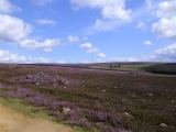
Nearby Images from Flickr

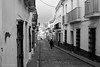
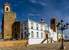
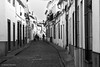
The above images may not be of the site on this page, but were taken nearby. They are loaded from Flickr so please click on them for image credits.
Click here to see more info for this site
Nearby sites
Click here to view sites on an interactive map of the areaKey: Red: member's photo, Blue: 3rd party photo, Yellow: other image, Green: no photo - please go there and take one, Grey: site destroyed
Download sites to:
KML (Google Earth)
GPX (GPS waypoints)
CSV (Garmin/Navman)
CSV (Excel)
To unlock full downloads you need to sign up as a Contributory Member. Otherwise downloads are limited to 50 sites.
Turn off the page maps and other distractions
Nearby sites listing. In the following links * = Image available
0m E 90° El Castrejon Burial Chamber or Dolmen
87m W 270° Las Arquetas Burial Chamber or Dolmen
3.5km WSW 237° La Sepultura Burial Chamber or Dolmen
15.9km NNW 330° La Bazana Burial Chamber or Dolmen
19.5km E 82° Palanca del Moro Standing Stone (Menhir)
19.8km NE 49° Menhir de la Fuente de Abajo* Standing Stone (Menhir)
20.6km ENE 71° Menhir del Rábano* Standing Stone (Menhir)
21.0km NNW 331° Valuengo Burial Chamber or Dolmen
21.0km NNW 345° Granja del Toriñuelo* Burial Chamber or Dolmen
21.0km NNW 331° Boliscos 1 Burial Chamber or Dolmen
21.1km NNW 331° La Parrena Burial Chamber or Dolmen
21.1km NNW 331° Dehesa Boyal Burial Chamber or Dolmen
21.1km NNW 332° Boliscos 3 Burial Chamber or Dolmen
21.2km NNW 331° Boliscos 2 Burial Chamber or Dolmen
21.2km NNW 331° Pinela Burial Chamber or Dolmen
26.5km NNE 21° Cortijo del Bonal Burial Chamber or Dolmen
26.7km WNW 299° Oliva de la Frontera Burial Chamber or Dolmen
27.4km NW 314° La Pizarrilla 1 Burial Chamber or Dolmen
27.4km NW 314° La Pizarrilla 2 Burial Chamber or Dolmen
29.8km NE 47° Los Encinares Burial Chamber or Dolmen
31.6km W 275° Eira da Cortiça 2* Burial Chamber or Dolmen
31.7km W 275° Eira da Cortiça 1* Burial Chamber or Dolmen
32.8km SW 229° Llanos de la Belleza Dolmen Burial Chamber or Dolmen
34.3km ESE 102° Dehesa del Hospital Burial Chamber or Dolmen
36.0km W 277° Dolmen de Piedras Pinchás Burial Chamber or Dolmen
View more nearby sites and additional images


 We would like to know more about this location. Please feel free to add a brief description and any relevant information in your own language.
 Wir möchten mehr über diese Stätte erfahren. Bitte zögern Sie nicht, eine kurze Beschreibung und relevante Informationen in Deutsch hinzuzufügen.
 Nous aimerions en savoir encore un peu sur les lieux. S'il vous plaît n'hesitez pas à ajouter une courte description et tous les renseignements pertinents dans votre propre langue.
 Quisieramos informarnos un poco más de las lugares. No dude en añadir una breve descripción y otros datos relevantes en su propio idioma.