

<< Our Photo Pages >> Nysted Jættestue 2 - Passage Grave in Denmark in Møn + Lolland-Falster
Submitted by Fortidsminder on Saturday, 19 June 2010 Page Views: 1527
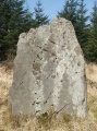
Neolithic and Bronze AgeSite Name: Nysted Jættestue 2Country: Denmark County: Møn + Lolland-Falster Type: Passage Grave
Nearest Town: Maribo Nearest Village: Nysted
Latitude: 54.661933N Longitude: 11.758732E
Condition:
| 5 | Perfect |
| 4 | Almost Perfect |
| 3 | Reasonable but with some damage |
| 2 | Ruined but still recognisable as an ancient site |
| 1 | Pretty much destroyed, possibly visible as crop marks |
| 0 | No data. |
| -1 | Completely destroyed |
| 5 | Superb |
| 4 | Good |
| 3 | Ordinary |
| 2 | Not Good |
| 1 | Awful |
| 0 | No data. |
| 5 | Can be driven to, probably with disabled access |
| 4 | Short walk on a footpath |
| 3 | Requiring a bit more of a walk |
| 2 | A long walk |
| 1 | In the middle of nowhere, a nightmare to find |
| 0 | No data. |
| 5 | co-ordinates taken by GPS or official recorded co-ordinates |
| 4 | co-ordinates scaled from a detailed map |
| 3 | co-ordinates scaled from a bad map |
| 2 | co-ordinates of the nearest village |
| 1 | co-ordinates of the nearest town |
| 0 | no data |
Be the first person to rate this site - see the 'Contribute!' box in the right hand menu.
Internal Links:
External Links:
I have visited· I would like to visit
Tonnox visited on 15th Sep 2020 - their rating: Cond: 3 Amb: 4 Access: 2
")
More information at www.kulturarv.dk: Danish Sites and Monuments Record: 070613-1
"Fortidsmindedata Copyright Kulturarvsstyrelsen"
You may be viewing yesterday's version of this page. To see the most up to date information please register for a free account.
")
")
")
")
")
")
")
")
")
")
")
")
")
")
")
")
Do not use the above information on other web sites or publications without permission of the contributor.
Click here to see more info for this site
Nearby sites
Click here to view sites on an interactive map of the areaKey: Red: member's photo, Blue: 3rd party photo, Yellow: other image, Green: no photo - please go there and take one, Grey: site destroyed
Download sites to:
KML (Google Earth)
GPX (GPS waypoints)
CSV (Garmin/Navman)
CSV (Excel)
To unlock full downloads you need to sign up as a Contributory Member. Otherwise downloads are limited to 50 sites.
Turn off the page maps and other distractions
Nearby sites listing. In the following links * = Image available
754m SSW 192° Nysted Jættestue 1* Passage Grave
3.2km SE 128° Vantore Tågense Dyssekammer* Burial Chamber or Dolmen
3.4km W 276° Ålholm Hestehave Runddysse Burial Chamber or Dolmen
3.4km W 273° Ålholm Hestehave Sofiehøj Burial Chamber or Dolmen
3.8km NNW 330° Kettinge Troelshøj (modern)* Misc. Earthwork
3.8km NW 318° Kettinge Jættestue* Passage Grave
3.8km NNE 21° Eskemosegård Råhøj Runddysse* Burial Chamber or Dolmen
4.1km E 81° Roden Skov Langdysse* Long Barrow
4.3km N 354° Landbogård Langdysse* Long Barrow
4.5km E 80° Roden Skov Runddysse* Burial Chamber or Dolmen
4.5km NNE 14° Frejlev Solstenen* Rock Art
4.5km NNE 23° Frejlev Skalkekors* Ancient Cross
4.6km N 9° Frejlev Dyssekammer* Burial Chamber or Dolmen
4.9km NNE 23° Frejlev Langdysse Long Barrow
5.1km NE 44° Frejlev Lille Guldhøj Jættestue* Passage Grave
5.2km E 84° Stegens Odde Langdysse Long Barrow
5.2km NE 42° Frejlev Store Guldhøj Jættestue* Passage Grave
5.3km NW 316° Lågerup Langdysse* Long Barrow
5.4km NNE 31° Frejlev St. Vittingshøj Jættestue* Passage Grave
5.4km NE 50° Frejlev Skov Runddysse 5* Burial Chamber or Dolmen
5.6km NNE 32° Frejlev Skov Runddysse 1* Burial Chamber or Dolmen
5.7km NE 35° Frejlev Skov Runddysse 3* Burial Chamber or Dolmen
5.8km NE 51° Frejlev Skov Bautasten* Standing Stone (Menhir)
5.9km NE 51° Frejlev Skov Skåltegnssten Rock Art
5.9km NE 51° Frejlev Skov Runddysse 6* Round Barrow(s)
View more nearby sites and additional images


 We would like to know more about this location. Please feel free to add a brief description and any relevant information in your own language.
 Wir möchten mehr über diese Stätte erfahren. Bitte zögern Sie nicht, eine kurze Beschreibung und relevante Informationen in Deutsch hinzuzufügen.
 Nous aimerions en savoir encore un peu sur les lieux. S'il vous plaît n'hesitez pas à ajouter une courte description et tous les renseignements pertinents dans votre propre langue.
 Quisieramos informarnos un poco más de las lugares. No dude en añadir una breve descripción y otros datos relevantes en su propio idioma.