

<< Our Photo Pages >> Ruds Vedby Runddysse 3 - Burial Chamber or Dolmen in Denmark in Sjælland
Submitted by Fortidsminder on Thursday, 10 June 2010 Page Views: 1068
Neolithic and Bronze AgeSite Name: Ruds Vedby Runddysse 3 Alternative Name: Vedbygård Rudskovs MarkCountry: Denmark County: Sjælland Type: Burial Chamber or Dolmen
Nearest Town: Holbæk Nearest Village: Ruds Vedby
Latitude: 55.538886N Longitude: 11.411460E
Condition:
| 5 | Perfect |
| 4 | Almost Perfect |
| 3 | Reasonable but with some damage |
| 2 | Ruined but still recognisable as an ancient site |
| 1 | Pretty much destroyed, possibly visible as crop marks |
| 0 | No data. |
| -1 | Completely destroyed |
| 5 | Superb |
| 4 | Good |
| 3 | Ordinary |
| 2 | Not Good |
| 1 | Awful |
| 0 | No data. |
| 5 | Can be driven to, probably with disabled access |
| 4 | Short walk on a footpath |
| 3 | Requiring a bit more of a walk |
| 2 | A long walk |
| 1 | In the middle of nowhere, a nightmare to find |
| 0 | No data. |
| 5 | co-ordinates taken by GPS or official recorded co-ordinates |
| 4 | co-ordinates scaled from a detailed map |
| 3 | co-ordinates scaled from a bad map |
| 2 | co-ordinates of the nearest village |
| 1 | co-ordinates of the nearest town |
| 0 | no data |
Be the first person to rate this site - see the 'Contribute!' box in the right hand menu.
Internal Links:
External Links:
")
More information at www.kulturarv.dk: Danish Sites and Monuments Record: 030211-11
"Fortidsmindedata Copyright Kulturarvsstyrelsen"
You may be viewing yesterday's version of this page. To see the most up to date information please register for a free account.
")
")
Do not use the above information on other web sites or publications without permission of the contributor.
Nearby Images from Flickr
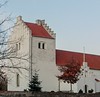
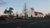
The above images may not be of the site on this page, but were taken nearby. They are loaded from Flickr so please click on them for image credits.
Click here to see more info for this site
Nearby sites
Click here to view sites on an interactive map of the areaKey: Red: member's photo, Blue: 3rd party photo, Yellow: other image, Green: no photo - please go there and take one, Grey: site destroyed
Download sites to:
KML (Google Earth)
GPX (GPS waypoints)
CSV (Garmin/Navman)
CSV (Excel)
To unlock full downloads you need to sign up as a Contributory Member. Otherwise downloads are limited to 50 sites.
Turn off the page maps and other distractions
Nearby sites listing. In the following links * = Image available
311m W 280° Ruds Vedby Jættestue* Passage Grave
381m W 279° Ruds Vedby Langdysse 5* Long Barrow
388m WSW 251° Ruds Vedby Langdysse 1* Long Barrow
574m E 99° Ruds Vedby Conradineslyst Langdysse 2* Long Barrow
687m SE 144° Ruds Vedby Runddysse 2* Burial Chamber or Dolmen
923m S 175° Ruds Vedby Runddysse 1* Burial Chamber or Dolmen
1.2km W 269° Ruds Vedby Langdysse 4* Long Barrow
1.3km SW 224° Enemærket Skov* Burial Chamber or Dolmen
1.4km ESE 104° Ruds Vedby Langdysse 3* Long Barrow
1.5km SSE 163° Kragevig Runddysse 2 Burial Chamber or Dolmen
1.6km NNW 328° Reerslev Langdysse 1* Long Barrow
1.7km SE 139° Sobjerg Runddysse 1 Burial Chamber or Dolmen
1.8km ENE 75° Ruds Vedby Conradineslyst Runddysse* Burial Chamber or Dolmen
1.8km NNW 327° Reerslev Megalitgrav 3* Burial Chamber or Dolmen
1.9km NW 326° Reerslev Megalitgrav 2* Burial Chamber or Dolmen
1.9km ESE 108° Skellebjerg Langdysse* Long Barrow
1.9km NNW 336° Reerslev Rævsbjerg Megalitgrav* Burial Chamber or Dolmen
2.0km NNW 347° Reerslev Runddysse 3* Burial Chamber or Dolmen
2.0km WSW 245° Ruds Vedby Langdysse 2* Long Barrow
2.0km E 84° Ruds Vedby Conradineslyst Langdysse 1* Long Barrow
2.0km SSE 149° Sobjerg Runddysse 2 Burial Chamber or Dolmen
2.1km ESE 105° Skellebjerg Jættestue* Passage Grave
2.2km N 6° Risbjerg Langdysse 2* Long Barrow
2.2km N 7° Risbjerg Runddysse* Burial Chamber or Dolmen
2.3km N 9° Risbjerg Langdysse 1* Long Barrow
View more nearby sites and additional images


 We would like to know more about this location. Please feel free to add a brief description and any relevant information in your own language.
 Wir möchten mehr über diese Stätte erfahren. Bitte zögern Sie nicht, eine kurze Beschreibung und relevante Informationen in Deutsch hinzuzufügen.
 Nous aimerions en savoir encore un peu sur les lieux. S'il vous plaît n'hesitez pas à ajouter une courte description et tous les renseignements pertinents dans votre propre langue.
 Quisieramos informarnos un poco más de las lugares. No dude en añadir una breve descripción y otros datos relevantes en su propio idioma.