

<< Our Photo Pages >> Raklev Underdyssen - Long Barrow in Denmark in Sjælland
Submitted by Fortidsminder on Thursday, 10 June 2010 Page Views: 2121
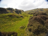
Neolithic and Bronze AgeSite Name: Raklev UnderdyssenCountry: Denmark County: Sjælland Type: Long Barrow
Nearest Town: Holbæk Nearest Village: Raklev
Latitude: 55.697851N Longitude: 11.068325E
Condition:
| 5 | Perfect |
| 4 | Almost Perfect |
| 3 | Reasonable but with some damage |
| 2 | Ruined but still recognisable as an ancient site |
| 1 | Pretty much destroyed, possibly visible as crop marks |
| 0 | No data. |
| -1 | Completely destroyed |
| 5 | Superb |
| 4 | Good |
| 3 | Ordinary |
| 2 | Not Good |
| 1 | Awful |
| 0 | No data. |
| 5 | Can be driven to, probably with disabled access |
| 4 | Short walk on a footpath |
| 3 | Requiring a bit more of a walk |
| 2 | A long walk |
| 1 | In the middle of nowhere, a nightmare to find |
| 0 | No data. |
| 5 | co-ordinates taken by GPS or official recorded co-ordinates |
| 4 | co-ordinates scaled from a detailed map |
| 3 | co-ordinates scaled from a bad map |
| 2 | co-ordinates of the nearest village |
| 1 | co-ordinates of the nearest town |
| 0 | no data |
Be the first person to rate this site - see the 'Contribute!' box in the right hand menu.
Internal Links:
External Links:
I have visited· I would like to visit
Tonnox visited on 24th Jul 2020 - their rating: Cond: 4 Amb: 5 Access: 4
")
More information at www.kulturarv.dk: Danish Sites and Monuments Record: 030103-1
"Fortidsmindedata Copyright Kulturarvsstyrelsen"
You may be viewing yesterday's version of this page. To see the most up to date information please register for a free account.
")
")
")
")
")
")
")
")
")
")
")
")
")
")
")
")
")
")
")
")
")
")
")
")
These are just the first 25 photos of Raklev Underdyssen. If you log in with a free user account you will be able to see our entire collection.
Do not use the above information on other web sites or publications without permission of the contributor.
Click here to see more info for this site
Nearby sites
Click here to view sites on an interactive map of the areaKey: Red: member's photo, Blue: 3rd party photo, Yellow: other image, Green: no photo - please go there and take one, Grey: site destroyed
Download sites to:
KML (Google Earth)
GPX (GPS waypoints)
CSV (Garmin/Navman)
CSV (Excel)
To unlock full downloads you need to sign up as a Contributory Member. Otherwise downloads are limited to 50 sites.
Turn off the page maps and other distractions
Nearby sites listing. In the following links * = Image available
397m W 279° Raklev Langdysse* Long Barrow
483m ESE 113° Raklev Vriedysse* Burial Chamber or Dolmen
1.2km WNW 291° Raklev Troldedyssen* Long Barrow
1.4km SSE 148° Ulfshøj Rundhøj* Round Barrow(s)
1.6km N 6° Ellede Langdysse* Long Barrow
2.0km SSE 159° Kalundborg Museum* Museum
2.0km WNW 294° Nyrup Jættestue* Passage Grave
2.2km WNW 293° Nyrup Megalitgrav* Burial Chamber or Dolmen
2.6km WNW 290° Slaaenhøj Jættestue* Passage Grave
2.7km NW 324° Kallerup Svannæsdysse* Burial Chamber or Dolmen
3.3km NNW 331° Kallerup Jættestue* Passage Grave
3.5km E 94° Kåstrup Runddysse* Burial Chamber or Dolmen
3.9km ESE 121° Kåstrup Samsingerbanke Langdysse* Long Barrow
4.1km ESE 120° Kaastrup Langdysse* Long Barrow
4.3km ESE 121° Kåstrup Holme Vråhøi Runddysse* Burial Chamber or Dolmen
4.5km WNW 303° Nostrup Runddysse* Burial Chamber or Dolmen
4.6km WNW 302° Ørehøj (Nostrup)* Round Barrow(s)
4.6km NW 305° Nostrup Megalitgrav* Burial Chamber or Dolmen
4.7km SSW 211° Asnæs Gravhøje* Barrow Cemetery
4.8km WNW 303° Kongstrup Langdysse* Long Barrow
4.8km S 184° Lerchenborg* Burial Chamber or Dolmen
4.9km NW 305° Kongstrup Kong Haralds Dysse* Burial Chamber or Dolmen
5.3km SSE 154° Kalundborg Vandreblok* Natural Stone / Erratic / Other Natural Feature
5.5km NW 308° Kongstrup Jættestue* Passage Grave
5.7km SSW 204° Asnæs Forskov Langdysse* Long Barrow
View more nearby sites and additional images


 We would like to know more about this location. Please feel free to add a brief description and any relevant information in your own language.
 Wir möchten mehr über diese Stätte erfahren. Bitte zögern Sie nicht, eine kurze Beschreibung und relevante Informationen in Deutsch hinzuzufügen.
 Nous aimerions en savoir encore un peu sur les lieux. S'il vous plaît n'hesitez pas à ajouter une courte description et tous les renseignements pertinents dans votre propre langue.
 Quisieramos informarnos un poco más de las lugares. No dude en añadir una breve descripción y otros datos relevantes en su propio idioma.