

<< Our Photo Pages >> Kongedyssen Langdysse - Long Barrow in Denmark in Hovedstaden
Submitted by praeceptor on Thursday, 10 June 2010 Page Views: 4678
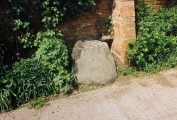
Neolithic and Bronze AgeSite Name: Kongedyssen Langdysse Alternative Name: Dæmpegrd., Tokkekøb Hegn, DæmpegårdsdyssenCountry: Denmark County: Hovedstaden Type: Long Barrow
Nearest Town: København Nearest Village: Blovstrød
Latitude: 55.895107N Longitude: 12.382392E
Condition:
| 5 | Perfect |
| 4 | Almost Perfect |
| 3 | Reasonable but with some damage |
| 2 | Ruined but still recognisable as an ancient site |
| 1 | Pretty much destroyed, possibly visible as crop marks |
| 0 | No data. |
| -1 | Completely destroyed |
| 5 | Superb |
| 4 | Good |
| 3 | Ordinary |
| 2 | Not Good |
| 1 | Awful |
| 0 | No data. |
| 5 | Can be driven to, probably with disabled access |
| 4 | Short walk on a footpath |
| 3 | Requiring a bit more of a walk |
| 2 | A long walk |
| 1 | In the middle of nowhere, a nightmare to find |
| 0 | No data. |
| 5 | co-ordinates taken by GPS or official recorded co-ordinates |
| 4 | co-ordinates scaled from a detailed map |
| 3 | co-ordinates scaled from a bad map |
| 2 | co-ordinates of the nearest village |
| 1 | co-ordinates of the nearest town |
| 0 | no data |
Internal Links:
External Links:
I have visited· I would like to visit
43559959 would like to visit
Tonnox visited on 7th Mar 2020 - their rating: Cond: 5 Amb: 5 Access: 2
NeolithicFanatic visited on 23rd Mar 2019 - their rating: Cond: 4 Amb: 5 Access: 3
Heliodore visited on 21st Aug 2018 - their rating: Cond: 4 Amb: 5 Much larger and well preserved than many others in the vicinity.
Approx. 9m x 34m ! 2 burial chambers visible. 51 wall stones visible, all standing but one.
combuijs visited on 14th Jul 2015 - their rating: Cond: 3 Amb: 4 Access: 3 On road 201 from Blovstrød to Hillerød turn right to Kirkelte. Turn first right again on unpaved road called Frederik 7 vej. There is a big parking place on your right. Walk along the unpaved road for about 600 meters then turn right over a small bridge. You will find the monument after 100 meters on your right.
praeceptor visited on 26th Mar 2011 - their rating: Cond: 4 Amb: 5 Access: 3 When approaching this site from Allerød via the woods it's a magnificent sight to spot from the woods. This Long Barrow was excavated by the last of the totalitarian Danish Kings and the last successor of the old Oldenburger Royal Line.
The mother to King Frederk VII was the Duchess Charlotte Frederica of Mecklenburg-Schwerin. She had an affair with the French singer and compositor Edouard Du Poy. For this reason, her husband, the King Christian VIII, divorced her in 1810 and prohibited her to see her son again. The next many years of his mothers life she was kept prisoner at a Palace in Horsens where a tiny court were held for her, and where she had various affairs with local officers. In 1830, Charlotte Frederica was allowed to go in exile in Italy, living then in Rome. She would later convert to the Catholic persuation. Charlotte Frederica died in 1840. Her earthly remains are nowadays in the Vatican.
Even if King Frederik VII didn't have contact with his mother, he also had several affairs in his life. The greatest love of his life was the commoner and former ballet dancer, Louise Rasmussen that was made Countess and given the name Louise Danner. This relationship seems to have been happy although it aroused great social indignation among the nobility and the bourgeoisie. Countess Danner, who was denounced a vulgar gold-digger by her enemies, but a doughty and unaffected “daughter of the people” by her admirers, seems to have had a stabilizing effect on the King. She also worked at maintaining his popularity by letting him “meet the people” of the provinces.
When excavating the magnificent "Dæmpegårdsdysse" he made or had made two pieces of long lasting grafitties. One with this own name and the date 30-5 1860, and the other in the form of the letters L D (Louise Danner).
Sachinka have visited here
Average ratings for this site from all visit loggers: Condition: 4 Ambience: 4.8 Access: 2.75
")
More information at www.kulturarv.dk: Danish Sites and Monuments Record: 010403-1
"Fortidsmindedata Copyright Kulturarvsstyrelsen"
You may be viewing yesterday's version of this page. To see the most up to date information please register for a free account.
")
")
")
")
")
")
")
")
")
")
")
")
")
")
")
")
")
")
")
")
")
")
")
")
")
These are just the first 25 photos of Kongedyssen Langdysse. If you log in with a free user account you will be able to see our entire collection.
Do not use the above information on other web sites or publications without permission of the contributor.
Click here to see more info for this site
Nearby sites
Click here to view sites on an interactive map of the areaKey: Red: member's photo, Blue: 3rd party photo, Yellow: other image, Green: no photo - please go there and take one, Grey: site destroyed
Download sites to:
KML (Google Earth)
GPX (GPS waypoints)
CSV (Garmin/Navman)
CSV (Excel)
To unlock full downloads you need to sign up as a Contributory Member. Otherwise downloads are limited to 50 sites.
Turn off the page maps and other distractions
Nearby sites listing. In the following links * = Image available
568m ESE 104° Donse Overdrev Langdysse* Long Barrow
826m SSE 148° Tokkekøb Hegn Langdysse (Afd.42)* Long Barrow
884m SSE 150° Tokkekøb Hegn Runddysse (afd. 59)* Round Barrow(s)
988m S 190° Lerelte Stenen* Natural Stone / Erratic / Other Natural Feature
999m SSE 154° Tokkekøb Hegn Megalitgrav* Burial Chamber or Dolmen
1.1km NE 55° Kirkelte Hegn Jættestue* Passage Grave
1.2km NE 54° Kirkelte Hegn Langdysse* Long Barrow
1.2km SSE 157° Tokkekøb Hegn Langdysse 4* Long Barrow
1.2km SSE 158° Tokkekøb Hegn Runddysse (afd. 78)* Burial Chamber or Dolmen
1.7km SSE 162° Tokkekøb Hegn Langdysse 1* Long Barrow
1.8km SSE 168° Tokkekøb Hegn Langdysse 5* Long Barrow
1.9km SSE 167° Tokkekøb Hegn Langdysse 3* Long Barrow
1.9km SSE 165° Tokkekøb Hegn Langdysse 2* Long Barrow
2.7km SSW 198° Allerød Langdysse 1* Long Barrow
2.8km SSW 195° Allerød Langdysse 2* Long Barrow
3.2km NE 45° Auderød Langdysse* Long Barrow
3.3km WSW 237° Toftehavegård Langdysse* Long Barrow
3.6km SSW 213° Kirkehavegård Langdysse* Long Barrow
3.7km WSW 257° Damgård Langdysse 2* Long Barrow
4.0km ESE 114° Stumpedyssegård Jættestue* Passage Grave
4.0km SSW 202° Ravnsholt Langdysse* Long Barrow
4.1km N 10° Slettedalsagre Langdysse* Long Barrow
4.2km N 8° Slettedalsagre Langhøj* Long Barrow
4.3km SSW 199° Ravnsholt Skov Langdysse* Long Barrow
4.7km W 269° Hammersholt Runddysse* Burial Chamber or Dolmen
View more nearby sites and additional images


 We would like to know more about this location. Please feel free to add a brief description and any relevant information in your own language.
 Wir möchten mehr über diese Stätte erfahren. Bitte zögern Sie nicht, eine kurze Beschreibung und relevante Informationen in Deutsch hinzuzufügen.
 Nous aimerions en savoir encore un peu sur les lieux. S'il vous plaît n'hesitez pas à ajouter une courte description et tous les renseignements pertinents dans votre propre langue.
 Quisieramos informarnos un poco más de las lugares. No dude en añadir una breve descripción y otros datos relevantes en su propio idioma.