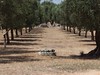
<< Our Photo Pages >> Stabile Dolmen - Burial Chamber or Dolmen in Italy in Puglia
Submitted by AlexHunger on Saturday, 22 October 2016 Page Views: 6319
Neolithic and Bronze AgeSite Name: Stabile Dolmen Alternative Name: QuattromacineCountry: Italy Region: Puglia Type: Burial Chamber or Dolmen
Nearest Town: Lecce Nearest Village: Giurdignano
Latitude: 40.121813N Longitude: 18.409692E
Condition:
| 5 | Perfect |
| 4 | Almost Perfect |
| 3 | Reasonable but with some damage |
| 2 | Ruined but still recognisable as an ancient site |
| 1 | Pretty much destroyed, possibly visible as crop marks |
| 0 | No data. |
| -1 | Completely destroyed |
| 5 | Superb |
| 4 | Good |
| 3 | Ordinary |
| 2 | Not Good |
| 1 | Awful |
| 0 | No data. |
| 5 | Can be driven to, probably with disabled access |
| 4 | Short walk on a footpath |
| 3 | Requiring a bit more of a walk |
| 2 | A long walk |
| 1 | In the middle of nowhere, a nightmare to find |
| 0 | No data. |
| 5 | co-ordinates taken by GPS or official recorded co-ordinates |
| 4 | co-ordinates scaled from a detailed map |
| 3 | co-ordinates scaled from a bad map |
| 2 | co-ordinates of the nearest village |
| 1 | co-ordinates of the nearest town |
| 0 | no data |
Internal Links:
External Links:
")
You may be viewing yesterday's version of this page. To see the most up to date information please register for a free account.
Do not use the above information on other web sites or publications without permission of the contributor.
davidmorgan has found this location on Google Street View:
Nearby Images from Flickr

The above images may not be of the site on this page, but were taken nearby. They are loaded from Flickr so please click on them for image credits.
Click here to see more info for this site
Nearby sites
Click here to view sites on an interactive map of the areaKey: Red: member's photo, Blue: 3rd party photo, Yellow: other image, Green: no photo - please go there and take one, Grey: site destroyed
Download sites to:
KML (Google Earth)
GPX (GPS waypoints)
CSV (Garmin/Navman)
CSV (Excel)
To unlock full downloads you need to sign up as a Contributory Member. Otherwise downloads are limited to 50 sites.
Turn off the page maps and other distractions
Nearby sites listing. In the following links * = Image available
1.0km E 82° Vicinanze II Standing stone* Standing Stone (Menhir)
1.3km SE 142° Grassi Dolmen* Burial Chamber or Dolmen
1.3km E 85° Vicinanze I Standing stone* Standing Stone (Menhir)
1.4km SE 126° Chiancuse Dolmen* Burial Chamber or Dolmen
1.6km E 93° San Paolo Standing stone* Standing Stone (Menhir)
1.7km E 85° Vico Nuovo Menhirs* Standing Stones
1.8km E 92° San Vincenzo Standing stone* Standing Stone (Menhir)
2.1km E 97° Madonna di Costantinopoli Standing stone* Standing Stone (Menhir)
2.1km ENE 76° Fausa Standing Stone* Standing Stone (Menhir)
2.2km SE 126° Orfine Dolmen* Burial Chamber or Dolmen
2.2km E 86° Madonna del Rosario Menhir* Standing Stone (Menhir)
2.2km NNE 13° Palanzano Standing stone* Standing Stone (Menhir)
2.3km ESE 120° Peschio Dolmen* Burial Chamber or Dolmen
2.5km NNW 332° Monte Vergine standing stone* Standing Stone (Menhir)
3.5km SE 146° Scusi Dolmen* Burial Chamber or Dolmen
3.9km NNW 334° Santu Lasi Standing stone Standing Stone (Menhir)
4.2km WSW 238° Polisano Standing stone* Standing Stone (Menhir)
4.3km SSE 147° Monticelli Standing stone* Standing Stone (Menhir)
5.0km SE 144° San Giovanni Malcantone Standing stone Standing Stone (Menhir)
5.4km WSW 242° Croce di Sant'Antonio* Standing Stone (Menhir)
6.2km WSW 244° Giallini Standing Stone Standing Stone (Menhir)
6.3km WNW 286° Spruno Standing stone Standing Stone (Menhir)
6.3km WNW 301° Bagnolo Standing Stone* Standing Stone (Menhir)
6.5km WSW 246° Largo Trice standing stone* Standing Stone (Menhir)
6.6km SSE 165° Croce Standing Stone* Standing Stone (Menhir)
View more nearby sites and additional images


 We would like to know more about this location. Please feel free to add a brief description and any relevant information in your own language.
 Wir möchten mehr über diese Stätte erfahren. Bitte zögern Sie nicht, eine kurze Beschreibung und relevante Informationen in Deutsch hinzuzufügen.
 Nous aimerions en savoir encore un peu sur les lieux. S'il vous plaît n'hesitez pas à ajouter une courte description et tous les renseignements pertinents dans votre propre langue.
 Quisieramos informarnos un poco más de las lugares. No dude en añadir una breve descripción y otros datos relevantes en su propio idioma.