<< Our Photo Pages >> Magdalenenbergle - Round Barrow(s) in Germany in Baden-Wuerttemberg
Submitted by AlexHunger on Friday, 14 October 2011 Page Views: 7648
Neolithic and Bronze AgeSite Name: MagdalenenbergleCountry: Germany Land: Baden-Wuerttemberg Type: Round Barrow(s)
Nearest Town: Freiburg Nearest Village: Villingen
Latitude: 48.044300N Longitude: 8.443700E
Condition:
| 5 | Perfect |
| 4 | Almost Perfect |
| 3 | Reasonable but with some damage |
| 2 | Ruined but still recognisable as an ancient site |
| 1 | Pretty much destroyed, possibly visible as crop marks |
| 0 | No data. |
| -1 | Completely destroyed |
| 5 | Superb |
| 4 | Good |
| 3 | Ordinary |
| 2 | Not Good |
| 1 | Awful |
| 0 | No data. |
| 5 | Can be driven to, probably with disabled access |
| 4 | Short walk on a footpath |
| 3 | Requiring a bit more of a walk |
| 2 | A long walk |
| 1 | In the middle of nowhere, a nightmare to find |
| 0 | No data. |
| 5 | co-ordinates taken by GPS or official recorded co-ordinates |
| 4 | co-ordinates scaled from a detailed map |
| 3 | co-ordinates scaled from a bad map |
| 2 | co-ordinates of the nearest village |
| 1 | co-ordinates of the nearest town |
| 0 | no data |
Internal Links:
External Links:
I have visited· I would like to visit
Andy B has visited here
")
It lies at the southwestern tip of the Black Forest, in Germany. The nobleman who is buried there ware part of the Hallstatt culture. With a volume of 33.000 cubic metres it is the biggest grave from that time in Central Europe.
Note: Possible Iron Age calendar construction discovered in tomb of Magdalenenberg
You may be viewing yesterday's version of this page. To see the most up to date information please register for a free account.
")
")
Do not use the above information on other web sites or publications without permission of the contributor.
Nearby Images from Flickr

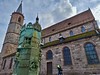

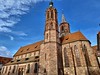
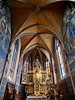
The above images may not be of the site on this page, but were taken nearby. They are loaded from Flickr so please click on them for image credits.
Click here to see more info for this site
Nearby sites
Click here to view sites on an interactive map of the areaKey: Red: member's photo, Blue: 3rd party photo, Yellow: other image, Green: no photo - please go there and take one, Grey: site destroyed
Download sites to:
KML (Google Earth)
GPX (GPS waypoints)
CSV (Garmin/Navman)
CSV (Excel)
To unlock full downloads you need to sign up as a Contributory Member. Otherwise downloads are limited to 50 sites.
Turn off the page maps and other distractions
Nearby sites listing. In the following links * = Image available
2.0km NNE 30° Franziskanermuseum Museum
3.5km SW 216° Eggwald Grabhügelgruppe Barrow Cemetery
6.5km E 80° Schwenningen Grabhügelgruppe Barrow Cemetery
8.7km N 7° Judenbühl Grabhügel Round Barrow(s)
11.0km SE 143° Oberer Schiessbühl Grabhügelgruppe Barrow Cemetery
11.2km NE 52° Kehlwald Grabhügelgruppe Barrow Cemetery
11.4km SE 143° Unterer Schiessbühl Grabhügelgruppe Barrow Cemetery
12.9km SE 140° Buckhäule Grabhügelgruppe Barrow Cemetery
14.8km SSW 193° Guldenen Grabhügelgruppe Barrow Cemetery
16.9km E 97° Zeugenberg Vorgeschichtlich Siedlung Ancient Village or Settlement
17.6km NNW 344° Tennenbronn Hinkelstein* Standing Stone (Menhir)
18.8km NW 314° Schalensteine Gremmelsbach* Rock Art
19.0km E 81° Steinerden Bruck Höhensiedlung Ancient Village or Settlement
19.1km E 80° Sheerers Allmand Keltische Viereckschanze Ancient Village or Settlement
19.3km E 81° Steinerden Bruck Grabhügelgruppe Barrow Cemetery
19.6km NE 34° Eichwald Grabhügelgruppe Barrow Cemetery
21.2km WNW 301° Schalensteinpfad Schonach* Sculptured Stone
21.4km WNW 303° Summstein Schonach* Modern Stone Circle etc
24.2km E 81° Dreifaltigkeitsberg Spaichingen Hillfort
26.5km SSW 197° Summstein Bonndorf Modern Stone Circle etc
26.6km NE 45° Kohlplätzle Keltische Viereckschanze Ancient Village or Settlement
26.6km NE 45° Heidenstädtle Keltische Viereckschanze Ancient Village or Settlement
26.8km SSE 154° Blauer Stein Natural Stone / Erratic / Other Natural Feature
26.9km NNE 18° Oberndorf Keltische Viereckschanze Ancient Village or Settlement
29.0km ENE 76° Steintaler Bühle Steinhügelgruppe Cairn
View more nearby sites and additional images


 We would like to know more about this location. Please feel free to add a brief description and any relevant information in your own language.
 Wir möchten mehr über diese Stätte erfahren. Bitte zögern Sie nicht, eine kurze Beschreibung und relevante Informationen in Deutsch hinzuzufügen.
 Nous aimerions en savoir encore un peu sur les lieux. S'il vous plaît n'hesitez pas à ajouter une courte description et tous les renseignements pertinents dans votre propre langue.
 Quisieramos informarnos un poco más de las lugares. No dude en añadir una breve descripción y otros datos relevantes en su propio idioma.