

<< Text Pages >> Hexerwiesen Grabhügelgruppe - Barrow Cemetery in Germany in Baden-Wuerttemberg
Submitted by AlexHunger on Tuesday, 13 September 2005 Page Views: 2681
Neolithic and Bronze AgeSite Name: Hexerwiesen Grabhügelgruppe Alternative Name: Hätzerwiesen GrabhügelgruppeCountry: Germany Land: Baden-Wuerttemberg Type: Barrow Cemetery
Nearest Town: Freiburg Nearest Village: Neuhausen ob Eck
Latitude: 47.979710N Longitude: 8.958270E
Condition:
| 5 | Perfect |
| 4 | Almost Perfect |
| 3 | Reasonable but with some damage |
| 2 | Ruined but still recognisable as an ancient site |
| 1 | Pretty much destroyed, possibly visible as crop marks |
| 0 | No data. |
| -1 | Completely destroyed |
| 5 | Superb |
| 4 | Good |
| 3 | Ordinary |
| 2 | Not Good |
| 1 | Awful |
| 0 | No data. |
| 5 | Can be driven to, probably with disabled access |
| 4 | Short walk on a footpath |
| 3 | Requiring a bit more of a walk |
| 2 | A long walk |
| 1 | In the middle of nowhere, a nightmare to find |
| 0 | No data. |
| 5 | co-ordinates taken by GPS or official recorded co-ordinates |
| 4 | co-ordinates scaled from a detailed map |
| 3 | co-ordinates scaled from a bad map |
| 2 | co-ordinates of the nearest village |
| 1 | co-ordinates of the nearest town |
| 0 | no data |
Internal Links:
External Links:
Tumuli in Baden-Württemberg
IMPORTANT NOTE: Site believed to be near this position. 21 Iron age tumuli of up to 15 Meter Diameter
You may be viewing yesterday's version of this page. To see the most up to date information please register for a free account.
Do not use the above information on other web sites or publications without permission of the contributor.
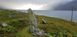
Nearby Images from Flickr
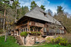
The above images may not be of the site on this page, but were taken nearby. They are loaded from Flickr so please click on them for image credits.
Click here to see more info for this site
Nearby sites
Click here to view sites on an interactive map of the areaKey: Red: member's photo, Blue: 3rd party photo, Yellow: other image, Green: no photo - please go there and take one, Grey: site destroyed
Download sites to:
KML (Google Earth)
GPX (GPS waypoints)
CSV (Garmin/Navman)
CSV (Excel)
To unlock full downloads you need to sign up as a Contributory Member. Otherwise downloads are limited to 50 sites.
Turn off the page maps and other distractions
Nearby sites listing. In the following links * = Image available
5.7km N 5° Jägerhaushöhle Cave or Rock Shelter
6.2km NE 44° Leibertingen Keltische Viereckschanze Ancient Village or Settlement
7.6km NNE 12° Petershöhle Cave or Rock Shelter
7.7km SW 226° Henneleh Grabhügelgruppe Barrow Cemetery
9.3km ENE 75° Messkirch Keltische Viereckschanze Ancient Village or Settlement
12.9km SSE 163° Heidenhöhlen Stockach Cave or Rock Shelter
15.5km SW 222° Ziegelhau Grabhügelgruppe Barrow Cemetery
16.2km S 172° Bogental Grabhügelgruppe Barrow Cemetery
16.5km ENE 59° Vilsingen Fürstengrabhügel Artificial Mound
17.3km NE 52° Dietfurth Burghöhle Cave or Rock Shelter
17.4km SW 221° Petersfels* Rock Outcrop
17.5km NW 325° Steintaler Bühle Steinhügelgruppe Cairn
18.1km NW 307° Dreifaltigkeitsberg Spaichingen Hillfort
18.8km NNW 332° Heidentor Natural Stone / Erratic / Other Natural Feature
19.4km SSE 162° Bodman-Schachen/Löchle Crannog
19.7km ESE 119° Gertholz Wald Keltische Viereckschanze Ancient Village or Settlement
21.8km WNW 298° Steinerden Bruck Grabhügelgruppe Barrow Cemetery
22.0km WNW 298° Steinerden Bruck Höhensiedlung Ancient Village or Settlement
22.1km WNW 298° Sheerers Allmand Keltische Viereckschanze Ancient Village or Settlement
22.1km WNW 283° Zeugenberg Vorgeschichtlich Siedlung Ancient Village or Settlement
23.5km SSE 152° Sipplingen Pfahlbausiedlungen Crannog
24.1km SW 220° Ertenhag Grabhügelgruppe Barrow Cemetery
24.4km SSE 159° Hals Höhensiedlung Hillfort
26.7km SSE 166° Heidenbühl Grabhügel Artificial Mound
27.6km NNW 342° Lochenstein Hillfort
View more nearby sites and additional images


 We would like to know more about this location. Please feel free to add a brief description and any relevant information in your own language.
 Wir möchten mehr über diese Stätte erfahren. Bitte zögern Sie nicht, eine kurze Beschreibung und relevante Informationen in Deutsch hinzuzufügen.
 Nous aimerions en savoir encore un peu sur les lieux. S'il vous plaît n'hesitez pas à ajouter une courte description et tous les renseignements pertinents dans votre propre langue.
 Quisieramos informarnos un poco más de las lugares. No dude en añadir una breve descripción y otros datos relevantes en su propio idioma.