


<< Our Photo Pages >> Dolmen du Mas d'Arjac - Burial Chamber or Dolmen in France in Midi:Lot (46)
Submitted by TheCaptain on Saturday, 16 April 2005 Page Views: 4170
Neolithic and Bronze AgeSite Name: Dolmen du Mas d'Arjac Alternative Name: Dolmen du Puech d'AlcayreCountry: France Département: Midi:Lot (46) Type: Burial Chamber or Dolmen
Nearest Town: Cahors Nearest Village: Cabrerets
Latitude: 44.502910N Longitude: 1.674740E
Condition:
| 5 | Perfect |
| 4 | Almost Perfect |
| 3 | Reasonable but with some damage |
| 2 | Ruined but still recognisable as an ancient site |
| 1 | Pretty much destroyed, possibly visible as crop marks |
| 0 | No data. |
| -1 | Completely destroyed |
| 5 | Superb |
| 4 | Good |
| 3 | Ordinary |
| 2 | Not Good |
| 1 | Awful |
| 0 | No data. |
| 5 | Can be driven to, probably with disabled access |
| 4 | Short walk on a footpath |
| 3 | Requiring a bit more of a walk |
| 2 | A long walk |
| 1 | In the middle of nowhere, a nightmare to find |
| 0 | No data. |
| 5 | co-ordinates taken by GPS or official recorded co-ordinates |
| 4 | co-ordinates scaled from a detailed map |
| 3 | co-ordinates scaled from a bad map |
| 2 | co-ordinates of the nearest village |
| 1 | co-ordinates of the nearest town |
| 0 | no data |
Internal Links:
External Links:
I have visited· I would like to visit
DrewParsons would like to visit
johnstone visited on 2nd Jul 2016 - their rating: Cond: 4 Amb: 4 Access: 5
")
Capstone : 3.15 m x 2.85 m x 0.35 m
Tumulus diameter : 21 m
Base Mérimée (Historic Monument)
You may be viewing yesterday's version of this page. To see the most up to date information please register for a free account.
")
")
")
")
Do not use the above information on other web sites or publications without permission of the contributor.
Nearby Images from Flickr
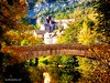


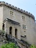
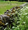

The above images may not be of the site on this page, but were taken nearby. They are loaded from Flickr so please click on them for image credits.
Click here to see more info for this site
Nearby sites
Click here to view sites on an interactive map of the areaKey: Red: member's photo, Blue: 3rd party photo, Yellow: other image, Green: no photo - please go there and take one, Grey: site destroyed
Download sites to:
KML (Google Earth)
GPX (GPS waypoints)
CSV (Garmin/Navman)
CSV (Excel)
To unlock full downloads you need to sign up as a Contributory Member. Otherwise downloads are limited to 50 sites.
Turn off the page maps and other distractions
Nearby sites listing. In the following links * = Image available
13m SSW 194° Les Quatre Routes dolmen* Burial Chamber or Dolmen
31m SE 139° les Quatre Routes Menhir* Standing Stone (Menhir)
1.1km E 80° Dolmen du Cloup del Prioun* Burial Chamber or Dolmen
1.6km WNW 286° Grotte du Cantal Cave or Rock Shelter
1.6km W 276° Musée Préhistoire Amédée-Lémozie* Museum
1.7km WNW 290° Dolmen du Pech de Tibouyé 3 Burial Chamber or Dolmen
2.0km WSW 239° Grottes de Marcenac* Cave or Rock Shelter
2.5km WNW 282° Grotte de Pech-Merle* Cave or Rock Shelter
2.7km S 171° Dolmen des Carbonnières* Burial Chamber or Dolmen
3.1km SW 234° Grotte Carriot* Cave or Rock Shelter
3.1km SW 218° Grotte Christian Cave or Rock Shelter
3.8km SSW 212° Grotte du Moulin (Saint-Cirq-Lapopie) Cave or Rock Shelter
3.9km SE 125° Dolmen de Nougayrac Burial Chamber or Dolmen
4.8km NE 55° Dolmen du Mas de Galdot * Burial Chamber or Dolmen
5.2km WSW 254° Grotte de Pargouzet Cave or Rock Shelter
5.5km ENE 74° Dolmen dit la Pierre Levée (Sauliac-Sur-Célé)* Burial Chamber or Dolmen
5.8km NNW 336° Dolmen des Bouygues Burial Chamber or Dolmen
6.0km NNW 339° Dolmen dit la Pierre-Levée (Lentillac)* Burial Chamber or Dolmen
6.0km ESE 101° Dolmen de Lalbrade Burial Chamber or Dolmen
6.2km E 101° Dolmen du Mas de Jantou 1* Burial Chamber or Dolmen
6.3km E 101° Dolmen Peyre Cotado* Burial Chamber or Dolmen
6.3km E 101° Dolmen du Mas de Jantou 3 Burial Chamber or Dolmen
6.3km E 101° Dolmen du Mas de Jantou 4 Burial Chamber or Dolmen
6.7km W 277° Dolmen du Pech de la Barre Burial Chamber or Dolmen
7.0km ENE 64° Les Mazuquals Burial Chamber or Dolmen
View more nearby sites and additional images


 We would like to know more about this location. Please feel free to add a brief description and any relevant information in your own language.
 Wir möchten mehr über diese Stätte erfahren. Bitte zögern Sie nicht, eine kurze Beschreibung und relevante Informationen in Deutsch hinzuzufügen.
 Nous aimerions en savoir encore un peu sur les lieux. S'il vous plaît n'hesitez pas à ajouter une courte description et tous les renseignements pertinents dans votre propre langue.
 Quisieramos informarnos un poco más de las lugares. No dude en añadir una breve descripción y otros datos relevantes en su propio idioma.