


<< Our Photo Pages >> Moneydig - Passage Grave in Ireland (Northern)
Submitted by Anthony_Weir on Monday, 14 October 2002 Page Views: 8939
Neolithic and Bronze AgeSite Name: Moneydig Alternative Name: The Daff StoneCountry: Ireland (Northern) Type: Passage Grave
Nearest Town: Garvagh
Discoverer Map Number: D8
Latitude: 54.988517N Longitude: 6.611276W
Condition:
| 5 | Perfect |
| 4 | Almost Perfect |
| 3 | Reasonable but with some damage |
| 2 | Ruined but still recognisable as an ancient site |
| 1 | Pretty much destroyed, possibly visible as crop marks |
| 0 | No data. |
| -1 | Completely destroyed |
| 5 | Superb |
| 4 | Good |
| 3 | Ordinary |
| 2 | Not Good |
| 1 | Awful |
| 0 | No data. |
| 5 | Can be driven to, probably with disabled access |
| 4 | Short walk on a footpath |
| 3 | Requiring a bit more of a walk |
| 2 | A long walk |
| 1 | In the middle of nowhere, a nightmare to find |
| 0 | No data. |
| 5 | co-ordinates taken by GPS or official recorded co-ordinates |
| 4 | co-ordinates scaled from a detailed map |
| 3 | co-ordinates scaled from a bad map |
| 2 | co-ordinates of the nearest village |
| 1 | co-ordinates of the nearest town |
| 0 | no data |
Internal Links:
External Links:
")
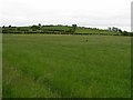
In a field to the W of Moneydig crossroads, this small, “degenerate”, passageless passage-tomb is still covered with small cairn-stones and soil to a height of 1.5 metres. The chamber is covered with a single large capstone and is walled by tall slabs fitting very neatly together. A low slab on the NE side marks the entrance.
You may be viewing yesterday's version of this page. To see the most up to date information please register for a free account.
Do not use the above information on other web sites or publications without permission of the contributor.
coldrum has found this location on Google Street View:
Nearby Images from Geograph Britain and Ireland:
©2008(licence)
©2008(licence)
©2008(licence)
©2008(licence)
©2008(licence)
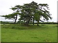
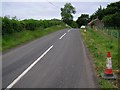
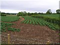
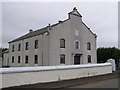
The above images may not be of the site on this page, they are loaded from Geograph.
Please Submit an Image of this site or go out and take one for us!
Click here to see more info for this site
Nearby sites
Click here to view sites on an interactive map of the areaKey: Red: member's photo, Blue: 3rd party photo, Yellow: other image, Green: no photo - please go there and take one, Grey: site destroyed
Download sites to:
KML (Google Earth)
GPX (GPS waypoints)
CSV (Garmin/Navman)
CSV (Excel)
To unlock full downloads you need to sign up as a Contributory Member. Otherwise downloads are limited to 50 sites.
Turn off the page maps and other distractions
Nearby sites listing. In the following links * = Image available
5.2km WSW 258° Garvagh Pyramid* Modern Stone Circle etc
7.3km SW 235° Cuilbane Stone Circle (C8304812206)
7.4km SW 235° Tamney Cromlech* Stone Circle (NV988719)
7.9km SW 226° Calleen Braigs Standing Stones (C8333010950)
8.0km NNW 328° Grey Stone (Crevolea)* Portal Tomb (NW014828)
8.4km SW 223° Tamnyrankin* Court Tomb
8.5km E 86° Craigs Lower Passage Grave* Passage Grave (C9739617278)
8.8km E 81° Craigs Standing Stone 1* Standing Stone (Menhir) (NW139765)
8.9km E 81° Craigs Standing Stone 2* Standing Stone (Menhir) (NW140766)
8.9km E 85° The Broad Stone (Craigs)* Court Tomb (C978175)
9.0km E 80° Craigs Standing Stone Hill* Standing Stone (Menhir) (NW141767)
9.8km NNW 329° Grey Stone (Co. Derry)* Standing Stone (Menhir) (NW007845)
10.6km SW 223° Knockoneill* Court Tomb (C819086)
12.5km N 353° Camus Cross (Co. Derry)* Ancient Cross (C871289)
13.3km SSW 202° Drumlamph Wood* Modern Stone Circle etc
13.3km E 84° Ballymacaldrack* Court Tomb (D02161830)
14.6km NNW 347° Mountsandel Fort* Hillfort (NW027901)
15.1km NE 54° Lisboy* Standing Stone (Menhir) (NW180837)
15.6km SSW 200° Tirnony* Portal Tomb (C840017)
16.4km NE 51° Drumaqueran Carved Cross* Ancient Cross (NW1867185144)
17.0km SE 145° Slievenagh* Stone Circle (C9895602726)
17.2km ENE 69° Knockahollet motte and Bailey* Hillfort (NW2160380827)
17.4km WNW 302° Gortcorbies SW Stone Circle (C74012551)
17.4km WNW 302° Gortcorbies NE Stone Circle (C739254)
17.9km NE 44° Stranocum Fort* Hillfort (NW184878)
View more nearby sites and additional images


 We would like to know more about this location. Please feel free to add a brief description and any relevant information in your own language.
 Wir möchten mehr über diese Stätte erfahren. Bitte zögern Sie nicht, eine kurze Beschreibung und relevante Informationen in Deutsch hinzuzufügen.
 Nous aimerions en savoir encore un peu sur les lieux. S'il vous plaît n'hesitez pas à ajouter une courte description et tous les renseignements pertinents dans votre propre langue.
 Quisieramos informarnos un poco más de las lugares. No dude en añadir una breve descripción y otros datos relevantes en su propio idioma.