<< Our Photo Pages >> Achany Stone Circle - Stone Circle in Scotland in Highlands
Submitted by Anonymous on Tuesday, 09 July 2002 Page Views: 8306
Neolithic and Bronze AgeSite Name: Achany Stone CircleCountry: Scotland County: Highlands Type: Stone Circle
Map Ref: NC560029 Landranger Map Number: 16
Latitude: 57.991928N Longitude: 4.43755W
Condition:
| 5 | Perfect |
| 4 | Almost Perfect |
| 3 | Reasonable but with some damage |
| 2 | Ruined but still recognisable as an ancient site |
| 1 | Pretty much destroyed, possibly visible as crop marks |
| 0 | No data. |
| -1 | Completely destroyed |
| 5 | Superb |
| 4 | Good |
| 3 | Ordinary |
| 2 | Not Good |
| 1 | Awful |
| 0 | No data. |
| 5 | Can be driven to, probably with disabled access |
| 4 | Short walk on a footpath |
| 3 | Requiring a bit more of a walk |
| 2 | A long walk |
| 1 | In the middle of nowhere, a nightmare to find |
| 0 | No data. |
| 5 | co-ordinates taken by GPS or official recorded co-ordinates |
| 4 | co-ordinates scaled from a detailed map |
| 3 | co-ordinates scaled from a bad map |
| 2 | co-ordinates of the nearest village |
| 1 | co-ordinates of the nearest town |
| 0 | no data |
Internal Links:
External Links:
")
Have you visited this site? Please contribute a description or any thoughts by adding a comment.
You may be viewing yesterday's version of this page. To see the most up to date information please register for a free account.
Do not use the above information on other web sites or publications without permission of the contributor.
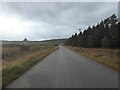
Nearby Images from Geograph Britain and Ireland:
©2009(licence)
©2009(licence)
©2010(licence)
©2019(licence)
©2022(licence)
The above images may not be of the site on this page, they are loaded from Geograph.
Please Submit an Image of this site or go out and take one for us!
Click here to see more info for this site
Nearby sites
Key: Red: member's photo, Blue: 3rd party photo, Yellow: other image, Green: no photo - please go there and take one, Grey: site destroyed
Download sites to:
KML (Google Earth)
GPX (GPS waypoints)
CSV (Garmin/Navman)
CSV (Excel)
To unlock full downloads you need to sign up as a Contributory Member. Otherwise downloads are limited to 50 sites.
Turn off the page maps and other distractions
Nearby sites listing. In the following links * = Image available
36m NE 54° Druim Baile Fuir North Cairn (NC56030292)
219m W 265° Druim Baile Fuir West Ancient Village or Settlement (NC55780289)
262m NE 48° Gruids Wood Cairn (NC56200307)
1.4km SE 127° Achany Chambered Cairn* Chambered Cairn (NC57100200)
2.9km NE 34° The Ord* Ancient Village or Settlement (NC577052)
2.9km NE 45° River Shin NW* Stone Circle (NC58150493)
3.0km NE 46° Shin River* Stone Circle (NC582049)
3.0km NE 46° River Shin SE Stone Circle (NC58220492)
3.2km SE 128° Auchinduich* Stone Circle (NC58450084)
4.0km SSW 200° Linsidemore* Stone Circle (NH54509918)
4.1km NNE 15° Ferry Wood* Broch or Nuraghe (NC57190679)
5.8km W 263° Durcha Broch or Nuraghe (NC50170239)
6.3km NNE 28° Saval Cairn Cairn (NC59220837)
6.3km NNE 20° Savalmore Burnt Mound Artificial Mound (NC58350881)
6.4km SSE 163° Invershin Farm* Standing Stone (Menhir) (NH5760796742)
6.4km NNW 348° Sallachadh Broch* Broch or Nuraghe (NC549092)
7.1km SW 230° Carn Mor 3 Broch or Nuraghe (NH50399853)
7.2km ENE 72° Allt Na Meirle Broch or Nuraghe (NC63000484)
7.8km WSW 240° Carn Mor 2 Broch or Nuraghe (NH49039926)
8.0km NNE 21° Broch in Dalchork Wood* Broch or Nuraghe (NC591103)
12.1km S 183° Gruinards Broch or Nuraghe (NH549908)
12.8km NNW 343° Shinness* Broch or Nuraghe (NC52731526)
13.0km SSE 148° Loch Migdale Henge (NH62429160)
13.2km SSE 165° Carn Deasgan Broch or Nuraghe (NH5990)
14.2km ENE 63° West Langwell Ancient Village or Settlement (NC68880888)
View more nearby sites and additional images


 We would like to know more about this location. Please feel free to add a brief description and any relevant information in your own language.
 Wir möchten mehr über diese Stätte erfahren. Bitte zögern Sie nicht, eine kurze Beschreibung und relevante Informationen in Deutsch hinzuzufügen.
 Nous aimerions en savoir encore un peu sur les lieux. S'il vous plaît n'hesitez pas à ajouter une courte description et tous les renseignements pertinents dans votre propre langue.
 Quisieramos informarnos un poco más de las lugares. No dude en añadir una breve descripción y otros datos relevantes en su propio idioma.