

<< Our Photo Pages >> White Hill Plantation Barrow - Round Barrow(s) in England in Dorset
Submitted by Bladup on Monday, 15 April 2024 Page Views: 12
Neolithic and Bronze AgeSite Name: White Hill Plantation BarrowCountry: England County: Dorset Type: Round Barrow(s)
Nearest Town: Dorchester Nearest Village: Abbotsbury
Map Ref: SY58298642
Latitude: 50.675938N Longitude: 2.591662W
Condition:
| 5 | Perfect |
| 4 | Almost Perfect |
| 3 | Reasonable but with some damage |
| 2 | Ruined but still recognisable as an ancient site |
| 1 | Pretty much destroyed, possibly visible as crop marks |
| 0 | No data. |
| -1 | Completely destroyed |
| 5 | Superb |
| 4 | Good |
| 3 | Ordinary |
| 2 | Not Good |
| 1 | Awful |
| 0 | No data. |
| 5 | Can be driven to, probably with disabled access |
| 4 | Short walk on a footpath |
| 3 | Requiring a bit more of a walk |
| 2 | A long walk |
| 1 | In the middle of nowhere, a nightmare to find |
| 0 | No data. |
| 5 | co-ordinates taken by GPS or official recorded co-ordinates |
| 4 | co-ordinates scaled from a detailed map |
| 3 | co-ordinates scaled from a bad map |
| 2 | co-ordinates of the nearest village |
| 1 | co-ordinates of the nearest town |
| 0 | no data |
Internal Links:
External Links:
")
A Bronze Age bowl barrow situated in woodland. It's 29 feet in diameter with a mound about 2½ feet high
You may be viewing yesterday's version of this page. To see the most up to date information please register for a free account.
")
Do not use the above information on other web sites or publications without permission of the contributor.
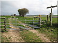
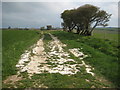
Nearby Images from Geograph Britain and Ireland:
©2016(licence)
©2016(licence)
©2016(licence)
©2012(licence)
©2012(licence)
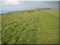
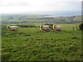
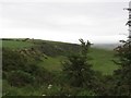
The above images may not be of the site on this page, they are loaded from Geograph.
Please Submit an Image of this site or go out and take one for us!
Click here to see more info for this site
Nearby sites
Key: Red: member's photo, Blue: 3rd party photo, Yellow: other image, Green: no photo - please go there and take one, Grey: site destroyed
Download sites to:
KML (Google Earth)
GPX (GPS waypoints)
CSV (Garmin/Navman)
CSV (Excel)
To unlock full downloads you need to sign up as a Contributory Member. Otherwise downloads are limited to 50 sites.
Turn off the page maps and other distractions
Nearby sites listing. In the following links * = Image available
523m NE 48° White Hill Tumulus* Round Barrow(s) (SY58688677)
648m N 8° Grey Mare and her Colts* Long Barrow (SY58398706)
711m NNE 17° Grey Mare Processional Way* Multiple Stone Rows / Avenue (SY585871)
800m SE 130° Bishops Limekiln Car Park* Standing Stone (Menhir) (SY589859)
1.3km E 86° Hampton Down row Multiple Stone Rows / Avenue (SY596865)
1.3km E 86° Hampton Down* Stone Circle (SY59618650)
1.5km NNW 340° Kingston Russell Circle* Stone Circle (SY57798783)
1.7km NE 54° Valley of Stones circle* Stone Circle (SY59668738)
1.7km W 263° Wears Hill Tumuli* Barrow Cemetery (SY56608624)
1.8km NE 36° Crow Hill Enclosure* Ancient Village or Settlement (SY59368786)
1.9km NNW 344° Tenants Hill enclosure* Ancient Village or Settlement (SY5777688219)
1.9km NNW 330° Kingston Russell Barrow* Round Barrow(s) (SY57358810)
2.0km NE 46° Valley of Stones polisher* Polissoir (SY59758778)
2.0km NE 43° Valley of Stones quarry* Ancient Mine, Quarry or other Industry (SY59708788)
2.0km E 99° Portesham Stone 7 Standing Stone (Menhir) (SY603861)
2.0km ESE 110° Portesham Stone 9 Standing Stone (Menhir) (SY602857)
2.1km ESE 107° Portesham Stone 8 Standing Stone (Menhir) (SY603858)
2.3km E 83° Hellstone* Long Barrow (SY60588670)
2.4km ENE 75° Portesham Stone 1 Standing Stone (Menhir) (SY606870)
2.4km E 85° Portesham Stone 12 Standing Stone (Menhir) (SY607866)
2.4km E 83° Portesham Stone 11 Standing Stone (Menhir) (SY607867)
2.5km ENE 76° Portesham Stone 2* Standing Stone (Menhir) (SY607870)
2.5km ENE 76° Jeffrey & Joan (Portesham) Standing Stones (SY60708701)
2.5km E 81° Portesham Stone 3* Standing Stone (Menhir) (SY608868)
2.6km NE 54° Black Down Barrows (Dorset)* Barrow Cemetery (SY604879)
View more nearby sites and additional images


 We would like to know more about this location. Please feel free to add a brief description and any relevant information in your own language.
 Wir möchten mehr über diese Stätte erfahren. Bitte zögern Sie nicht, eine kurze Beschreibung und relevante Informationen in Deutsch hinzuzufügen.
 Nous aimerions en savoir encore un peu sur les lieux. S'il vous plaît n'hesitez pas à ajouter une courte description et tous les renseignements pertinents dans votre propre langue.
 Quisieramos informarnos un poco más de las lugares. No dude en añadir una breve descripción y otros datos relevantes en su propio idioma.