

, Aubrey Burl")
<< Our Photo Pages >> La Peyre de Fonpeyre - Stone Circle in France in Aquitaine:Dordogne (24)
Submitted by LaDragonne on Sunday, 10 March 2024 Page Views: 60
Neolithic and Bronze AgeSite Name: La Peyre de FonpeyreCountry: France Département: Aquitaine:Dordogne (24) Type: Stone Circle
Nearest Town: Bergerac
Latitude: 44.851210N Longitude: 0.483760E
Condition:
| 5 | Perfect |
| 4 | Almost Perfect |
| 3 | Reasonable but with some damage |
| 2 | Ruined but still recognisable as an ancient site |
| 1 | Pretty much destroyed, possibly visible as crop marks |
| 0 | No data. |
| -1 | Completely destroyed |
| 5 | Superb |
| 4 | Good |
| 3 | Ordinary |
| 2 | Not Good |
| 1 | Awful |
| 0 | No data. |
| 5 | Can be driven to, probably with disabled access |
| 4 | Short walk on a footpath |
| 3 | Requiring a bit more of a walk |
| 2 | A long walk |
| 1 | In the middle of nowhere, a nightmare to find |
| 0 | No data. |
| 5 | co-ordinates taken by GPS or official recorded co-ordinates |
| 4 | co-ordinates scaled from a detailed map |
| 3 | co-ordinates scaled from a bad map |
| 2 | co-ordinates of the nearest village |
| 1 | co-ordinates of the nearest town |
| 0 | no data |
Internal Links:
External Links:
")
Les archives nous indiquent l'existence de monuments mégalithiques sur l'emprise actuelle de la ville de Bergerac. Cette dernière a vu son extension progressive supprimer ces menhirs et dolmen.
Nous avons retrouvé à 5m près leur emplacement initial.
Une stèle devait signaler l'emplacement d'un point d'eau rue St James à proximité de la rue des Fontaines. Le spot concerne un bâtiment actuel, donc plus aucune trace archéologique.
You may be viewing yesterday's version of this page. To see the most up to date information please register for a free account.
Do not use the above information on other web sites or publications without permission of the contributor.
Nearby Images from Flickr

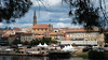

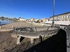
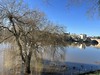
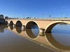
The above images may not be of the site on this page, but were taken nearby. They are loaded from Flickr so please click on them for image credits.
Click here to see more info for this site
Nearby sites
Click here to view sites on an interactive map of the areaKey: Red: member's photo, Blue: 3rd party photo, Yellow: other image, Green: no photo - please go there and take one, Grey: site destroyed
Download sites to:
KML (Google Earth)
GPX (GPS waypoints)
CSV (Garmin/Navman)
CSV (Excel)
To unlock full downloads you need to sign up as a Contributory Member. Otherwise downloads are limited to 50 sites.
Turn off the page maps and other distractions
Nearby sites listing. In the following links * = Image available
116m SSW 206° Peyre Levade Intramuros* Burial Chamber or Dolmen
875m NE 42° La Peyre du Pont de la Peyre* Standing Stone (Menhir)
4.1km ENE 64° Dolmen Peyrelevade de Pecharmant* Burial Chamber or Dolmen
4.1km ENE 65° Menhir Peyrelevade de Pecharmant* Standing Stone (Menhir)
6.6km E 86° Gisements de Creysse Cave or Rock Shelter
6.6km S 174° Dolmen Peyrelevade de Monbazillac* Burial Chamber or Dolmen
8.7km E 81° Dolmen de Saint Sauveur Burial Chamber or Dolmen
10.3km N 1° Le rocher pointu* Standing Stone (Menhir)
10.6km SSE 151° Dolmen Peyrelevade de Conne de Labarde* Burial Chamber or Dolmen
11.7km ESE 119° Dolmen Peyrelevade* Burial Chamber or Dolmen
12.3km SE 142° Allée couverte de St Cernin de Labarde Passage Grave
12.5km N 3° Pierre Teule* Marker Stone
13.2km ESE 123° Dolmen de Campguilhem* Burial Chamber or Dolmen
13.2km SE 143° Dolmen des Saintongers* Burial Chamber or Dolmen
13.4km ESE 122° Dolmen de la Robertie* Burial Chamber or Dolmen
13.8km N 2° Le Roc del Cayre* Natural Stone / Erratic / Other Natural Feature
13.9km N 2° Dolmen Le Cayre de Beleymas* Burial Chamber or Dolmen
14.3km ENE 73° Rochers de la Vierge* Natural Stone / Erratic / Other Natural Feature
14.5km ENE 73° Dolmen Roc Leva* Burial Chamber or Dolmen
15.0km SSE 160° Dolmen Terme du Pendu* Burial Chamber or Dolmen
15.5km E 88° Faux Menhir de La Borie Neuve* Natural Stone / Erratic / Other Natural Feature
15.6km ESE 120° Dolmen le Roc del Ser (Faux)* Burial Chamber or Dolmen
16.0km E 91° Dolmen de Baneuil* Burial Chamber or Dolmen
16.7km E 94° Menhir Tranche de Saumon Standing Stone (Menhir)
16.8km SSE 152° Les neuf pierres* Stone Circle
View more nearby sites and additional images


 We would like to know more about this location. Please feel free to add a brief description and any relevant information in your own language.
 Wir möchten mehr über diese Stätte erfahren. Bitte zögern Sie nicht, eine kurze Beschreibung und relevante Informationen in Deutsch hinzuzufügen.
 Nous aimerions en savoir encore un peu sur les lieux. S'il vous plaît n'hesitez pas à ajouter une courte description et tous les renseignements pertinents dans votre propre langue.
 Quisieramos informarnos un poco más de las lugares. No dude en añadir una breve descripción y otros datos relevantes en su propio idioma.