<< Our Photo Pages >> Borough Cairn - Cairn in England in Isles of Scilly
Submitted by Bladup on Saturday, 14 January 2023 Page Views: 453
Neolithic and Bronze AgeSite Name: Borough CairnCountry: England County: Isles of Scilly Type: Cairn
Map Ref: SV89761491
Latitude: 49.953580N Longitude: 6.326662W
Condition:
| 5 | Perfect |
| 4 | Almost Perfect |
| 3 | Reasonable but with some damage |
| 2 | Ruined but still recognisable as an ancient site |
| 1 | Pretty much destroyed, possibly visible as crop marks |
| 0 | No data. |
| -1 | Completely destroyed |
| 5 | Superb |
| 4 | Good |
| 3 | Ordinary |
| 2 | Not Good |
| 1 | Awful |
| 0 | No data. |
| 5 | Can be driven to, probably with disabled access |
| 4 | Short walk on a footpath |
| 3 | Requiring a bit more of a walk |
| 2 | A long walk |
| 1 | In the middle of nowhere, a nightmare to find |
| 0 | No data. |
| 5 | co-ordinates taken by GPS or official recorded co-ordinates |
| 4 | co-ordinates scaled from a detailed map |
| 3 | co-ordinates scaled from a bad map |
| 2 | co-ordinates of the nearest village |
| 1 | co-ordinates of the nearest town |
| 0 | no data |
Internal Links:
External Links:
")
You may be viewing yesterday's version of this page. To see the most up to date information please register for a free account.
")
Do not use the above information on other web sites or publications without permission of the contributor.
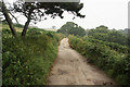
Nearby Images from Geograph Britain and Ireland:
©2012(licence)
©2012(licence)
©2011(licence)
©2012(licence)
©2010(licence)
The above images may not be of the site on this page, they are loaded from Geograph.
Please Submit an Image of this site or go out and take one for us!
Click here to see more info for this site
Nearby sites
Key: Red: member's photo, Blue: 3rd party photo, Yellow: other image, Green: no photo - please go there and take one, Grey: site destroyed
Download sites to:
KML (Google Earth)
GPX (GPS waypoints)
CSV (Garmin/Navman)
CSV (Excel)
To unlock full downloads you need to sign up as a Contributory Member. Otherwise downloads are limited to 50 sites.
Turn off the page maps and other distractions
Nearby sites listing. In the following links * = Image available
465m NW 312° Middle Down Cairn* Cairn (SV89431524)
724m WNW 289° Vane Hill Cairns* Barrow Cemetery (SV89091519)
902m SW 215° Roman Altar at Tresco Gardens* Sculptured Stone (SV892142)
927m SW 226° Abbey Hill Cairns* Barrow Cemetery (SV89051431)
1.1km NW 305° Dials Rocks Settlement* Ancient Village or Settlement (SV88911559)
1.3km WNW 295° New Grimsby Cairn* Cairn (SV88601553)
1.4km S 191° Bathinghouse Porth prehistoric field system and hut circle settlement* Ancient Village or Settlement (SV8942013561)
1.5km NW 304° Castle Down, Tresco* Chambered Tomb (SV886158)
1.5km SSW 203° Appletree Bay prehistoric field system* Ancient Village or Settlement (SV89101358)
1.6km NNE 23° Old Man Entrance Grave* Chambered Cairn (SV90471632)
1.6km NNE 29° West Porth Cairn* Cairn (SV90631627)
1.7km NW 318° Tregarthen Hill* Passage Grave (SV8865516272)
1.8km WSW 258° Green Bay Prehistoric field system and Cist* Ancient Village or Settlement (SV87951465)
1.9km NW 321° Tregarthen Hill Settlement* Ancient Village or Settlement (SV88631646)
1.9km WSW 247° Bonfire Carn, Bryher* Chambered Cairn (SV87931424)
2.0km NW 322° Piper's Hole* Cave or Rock Shelter (SV88621654)
2.0km WSW 255° Hillside Farm, Bryher* Chambered Tomb (SV878145)
2.0km NNE 33° Tean Great Hill Chambered Cairn* Chambered Cairn (SV90981655)
2.1km WSW 248° Top Rock Entrance Grave and Cairn* Chambered Cairn (SV8779914266)
2.1km WSW 247° Samson Hill, Bryher* Chambered Tomb (SV878142)
2.1km WSW 245° Works Carn, Bryher* Chambered Cairn (SV87821413)
2.2km WNW 285° Shipman Head Down cairn cemetery* Cairn (SV877156)
2.2km W 280° Shipman Head Chambered Cairn* Chambered Cairn (SV87621540)
2.4km WNW 295° Shipman Head Down, Bryher* Hillfort (SV87601605)
2.5km WSW 254° Heathy Hill Settlement* Ancient Village or Settlement (SV87361437)
View more nearby sites and additional images


 We would like to know more about this location. Please feel free to add a brief description and any relevant information in your own language.
 Wir möchten mehr über diese Stätte erfahren. Bitte zögern Sie nicht, eine kurze Beschreibung und relevante Informationen in Deutsch hinzuzufügen.
 Nous aimerions en savoir encore un peu sur les lieux. S'il vous plaît n'hesitez pas à ajouter une courte description et tous les renseignements pertinents dans votre propre langue.
 Quisieramos informarnos un poco más de las lugares. No dude en añadir una breve descripción y otros datos relevantes en su propio idioma.