


<< Our Photo Pages >> Homannhaugen - Cairn in Norway in Hordaland
Submitted by kenntha88 on Wednesday, 19 October 2022 Page Views: 262
Neolithic and Bronze AgeSite Name: HomannhaugenCountry: Norway Fylke: Hordaland Type: Cairn
Nearest Town: Voss Nearest Village: Øvre Årdal
Latitude: 61.190585N Longitude: 7.625789E
Condition:
| 5 | Perfect |
| 4 | Almost Perfect |
| 3 | Reasonable but with some damage |
| 2 | Ruined but still recognisable as an ancient site |
| 1 | Pretty much destroyed, possibly visible as crop marks |
| 0 | No data. |
| -1 | Completely destroyed |
| 5 | Superb |
| 4 | Good |
| 3 | Ordinary |
| 2 | Not Good |
| 1 | Awful |
| 0 | No data. |
| 5 | Can be driven to, probably with disabled access |
| 4 | Short walk on a footpath |
| 3 | Requiring a bit more of a walk |
| 2 | A long walk |
| 1 | In the middle of nowhere, a nightmare to find |
| 0 | No data. |
| 5 | co-ordinates taken by GPS or official recorded co-ordinates |
| 4 | co-ordinates scaled from a detailed map |
| 3 | co-ordinates scaled from a bad map |
| 2 | co-ordinates of the nearest village |
| 1 | co-ordinates of the nearest town |
| 0 | no data |
Internal Links:
External Links:
")
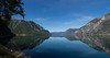
Homannhaugen is a large cairn located at the edge of a natural grassy plateau with a beautiful over the Årdalsfjord. The ambience is a beautiful example of a West Norwegian fjord landscape. The small local road to the farm Hovland is going just east of the cairn.
The cairn is 15 metres in diameter and 2 metres in height. The cairn is overgrown with high grass and large trees and it looks more like a barrow than a cairn. In the center it is a small crater. The cairn is believed to be older than some of the nearby barrows like the barrow cemetery at Hovland.
You may be viewing yesterday's version of this page. To see the most up to date information please register for a free account.
")
")
")
Do not use the above information on other web sites or publications without permission of the contributor.
Nearby Images from Flickr

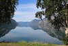


The above images may not be of the site on this page, but were taken nearby. They are loaded from Flickr so please click on them for image credits.
Click here to see more info for this site
Nearby sites
Click here to view sites on an interactive map of the areaKey: Red: member's photo, Blue: 3rd party photo, Yellow: other image, Green: no photo - please go there and take one, Grey: site destroyed
Download sites to:
KML (Google Earth)
GPX (GPS waypoints)
CSV (Garmin/Navman)
CSV (Excel)
To unlock full downloads you need to sign up as a Contributory Member. Otherwise downloads are limited to 50 sites.
Turn off the page maps and other distractions
Nearby sites listing. In the following links * = Image available
178m SSE 157° Hovland* Barrow Cemetery
440m NNW 334° Skjorahaugen* Barrow Cemetery
15.2km S 170° Bjørkum* Ancient Village or Settlement
15.8km S 181° Ljøsne-Øst Cairn* Cairn
16.0km S 182° Øvre Ljøsne* Barrow Cemetery
16.3km SSW 199° Mosvegen* Cairn
17.6km NE 37° Ytre Moa* Ancient Village or Settlement
18.0km SSE 154° Nedre Kvame Gravfelt* Barrow Cemetery
18.6km SE 130° Spenning Cairn and Standing Stone* Standing Stone (Menhir)
19.2km W 267° Amla Runestone* Carving
19.5km SE 131° Turkestovhaugen* Cairn
20.5km NW 306° Urnes Standing Stone* Standing Stone (Menhir)
20.5km NW 306° Ragnvaldshaug* Round Barrow(s)
23.4km W 275° Nordnes standing stone* Standing Stone (Menhir)
24.4km WNW 300° Borhaug* Standing Stone (Menhir)
28.6km W 278° Stedje Runestone* Carving
31.2km W 280° Eggja Runestone* Carving
39.2km SW 216° Skuleveien* Round Barrow(s)
39.3km SW 215° Kaffihaugen-Ospehaugen* Round Barrow(s)
39.3km SW 216° Sogn Hagebruksskule* Round Barrow(s)
39.6km SW 217° Leikarvollen* Round Barrow(s)
41.7km W 270° Henjavegen-Krosshaug* Round Barrow(s)
41.9km W 270° Henjahaugane* Barrow Cemetery
42.4km W 270° Nybø* Standing Stone (Menhir)
44.0km W 269° Baldershagen* Barrow Cemetery
View more nearby sites and additional images


 We would like to know more about this location. Please feel free to add a brief description and any relevant information in your own language.
 Wir möchten mehr über diese Stätte erfahren. Bitte zögern Sie nicht, eine kurze Beschreibung und relevante Informationen in Deutsch hinzuzufügen.
 Nous aimerions en savoir encore un peu sur les lieux. S'il vous plaît n'hesitez pas à ajouter une courte description et tous les renseignements pertinents dans votre propre langue.
 Quisieramos informarnos un poco más de las lugares. No dude en añadir una breve descripción y otros datos relevantes en su propio idioma.