<< Our Photo Pages >> Clavering's Cross - Ancient Cross in England in Northumberland
Submitted by Anne T on Monday, 28 May 2018 Page Views: 2341
Early Medieval (Dark Age)Site Name: Clavering's Cross Alternative Name: Netherwitton Cross (Stanton); Claverings CrossCountry: England County: Northumberland Type: Ancient Cross
Nearest Town: Morpeth Nearest Village: Stanton
Map Ref: NZ1359691047
Latitude: 55.213480N Longitude: 1.787871W
Condition:
| 5 | Perfect |
| 4 | Almost Perfect |
| 3 | Reasonable but with some damage |
| 2 | Ruined but still recognisable as an ancient site |
| 1 | Pretty much destroyed, possibly visible as crop marks |
| 0 | No data. |
| -1 | Completely destroyed |
| 5 | Superb |
| 4 | Good |
| 3 | Ordinary |
| 2 | Not Good |
| 1 | Awful |
| 0 | No data. |
| 5 | Can be driven to, probably with disabled access |
| 4 | Short walk on a footpath |
| 3 | Requiring a bit more of a walk |
| 2 | A long walk |
| 1 | In the middle of nowhere, a nightmare to find |
| 0 | No data. |
| 5 | co-ordinates taken by GPS or official recorded co-ordinates |
| 4 | co-ordinates scaled from a detailed map |
| 3 | co-ordinates scaled from a bad map |
| 2 | co-ordinates of the nearest village |
| 1 | co-ordinates of the nearest town |
| 0 | no data |
Be the first person to rate this site - see the 'Contribute!' box in the right hand menu.
Internal Links:
External Links:
I have visited· I would like to visit
Anne T visited on 26th May 2018 - their rating: Cond: 3 Amb: 4 Access: 4 Clavering's Cross, Stanton: Disappointed by the third cairn, which we were really unsure of, I’d spotted this cross on the OS map, and as it wasn’t too far away, we thought we go on our way to Ewesley.
Parking on the verge just north of the farmhouse, there were roadworks being set up and a very large, yellow skip had been placed by the gate into the field. As there was a large ditch to its south, there was a very narrow piece of land to walk across, and with the side of the skip looming above my left hand side, I managed the two steps across, because I really wanted to see this cross.
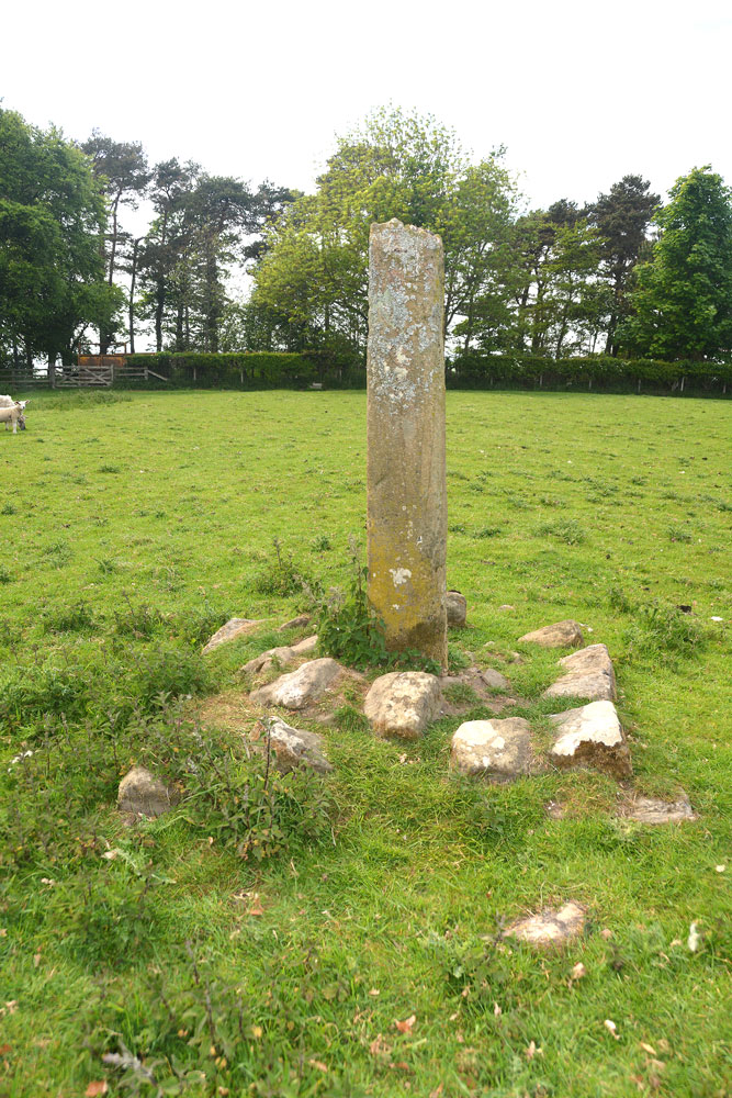
We had to shoo the lovely, fat hens out of the way to open the gate, and spent a few minutes walking round and taking photographs. The steps were in a sorry state, which is unusual - Pastscape tells us the cross has (within living memory) been relocated back to the site where it originally stood, so perhaps the steps weren't built properly during the relocation.
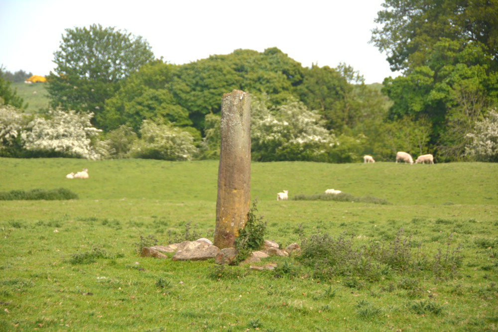
This village or churchyard cross is recorded as Historic England List ID 1370644 and Pastscape Monument No. 23516.
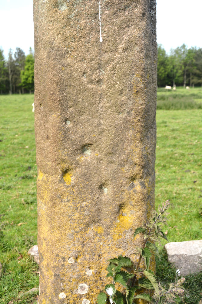
Sitting on the 'Limekilnflat' in Clavering's Field, the Pastscape entry tells us this cross shaft stands 1.6m high, and in cross-section measures 0.3 x 0.25m. "Midway down the south face is a faint incised line, possibly the remains of a design. The top step of the base has disintegrated. The bottom step measures 1.6m square at ground level. The cross head is entirely missing, and the shaft ends in a rough fracture at the top." The Historic England entry says the "cross head is reputed to be buried in the dike on the west side of the field."
According to local legend, there are two stories as to how this cross got its name. The first says the cross was "set up in memory of a gentleman of the name of Clavering being slain on the spot, in an encounter with a party of Scots"; the second: "it may have obtained its name from the fact that on 10 April 1517 Edward Horsley sought immunity at Durham cathedral for a felonious attack on Chr. Clavering at Goorfen between Morpeth and Horsley."
The cross is believed to be much older than 1517. It is known to have been relocated at some time in its past, though in more recent years has been resited as close to its original location as possible.
We did not see any traces of carvings referred to in the Pastscape entry, nor did we find the missing head in the dike.
Please note this cross is located on private land.
You may be viewing yesterday's version of this page. To see the most up to date information please register for a free account.



Do not use the above information on other web sites or publications without permission of the contributor.
Click here to see more info for this site
Nearby sites
Key: Red: member's photo, Blue: 3rd party photo, Yellow: other image, Green: no photo - please go there and take one, Grey: site destroyed
Download sites to:
KML (Google Earth)
GPX (GPS waypoints)
CSV (Garmin/Navman)
CSV (Excel)
To unlock full downloads you need to sign up as a Contributory Member. Otherwise downloads are limited to 50 sites.
Turn off the page maps and other distractions
Nearby sites listing. In the following links * = Image available
3.5km WSW 256° Netherwitton Hall* Round Cairn (NZ1022990218)
4.0km W 269° Netherwitton B* Round Cairn (NZ0956390932)
4.0km W 264° Five Ashes Cairn (Netherwitton)* Round Cairn (NZ0956490611)
4.2km W 269° Netherwitton A* Round Cairn (NZ0938090925)
6.2km SE 145° St Cuthbert's Well (Mitford)* Holy Well or Sacred Spring (NZ1720685990)
7.7km NNW 347° Brinklaw Camp* Promontory Fort / Cliff Castle (NZ11789850)
7.9km WNW 282° Ewesley Enclosure* Misc. Earthwork (NZ0583092681)
8.7km NW 307° Blueburn Farm (Rothbury) Rock Art (NZ0666096270)
9.0km WNW 286° Fontburn N01 Rock Art (NZ0489793466)
9.5km SSW 207° St Andrew's Church (Bolam)* Ancient Cross (NZ0924482601)
9.7km E 83° Ulgham Cross* Ancient Cross (NZ2321892308)
9.7km WSW 255° Rothley Crags* Hillfort (NZ04228850)
9.8km SSW 206° Bolam Round Cairn (Northumberland)* Round Cairn (NZ0940082226)
9.8km WNW 283° Fontburn N02* Rock Art (NZ0395993186)
10.0km NNW 334° Pauperhaugh Farm Rock Art (NU0920000000)
10.5km NW 326° Pike House Camp* Ancient Village or Settlement (NZ07679968)
10.5km WNW 283° Fontburn B* Rock Art (NZ0328093376)
10.6km WNW 286° Fontburn e Rock Art (NZ0336593941)
10.6km WNW 284° Fontburn c(ii) Rock Art (NZ0325693650)
10.6km WNW 284° Fontburn Four-Poster* Stone Circle (NZ0325493646)
10.7km WNW 283° Fontburn N03 Rock Art (NZ0317793419)
10.7km WNW 283° Fontburn D* Rock Art (NZ0310993518)
10.8km SSW 208° Bolam Rock Art Panel Rock Art (NZ0850081500)
10.9km NW 316° Garleigh Moor East 1 Rock Art (NZ0595098859)
10.9km NW 316° Garleigh Moor East 2 Rock Art (NZ0598598902)
View more nearby sites and additional images




 We would like to know more about this location. Please feel free to add a brief description and any relevant information in your own language.
 Wir möchten mehr über diese Stätte erfahren. Bitte zögern Sie nicht, eine kurze Beschreibung und relevante Informationen in Deutsch hinzuzufügen.
 Nous aimerions en savoir encore un peu sur les lieux. S'il vous plaît n'hesitez pas à ajouter une courte description et tous les renseignements pertinents dans votre propre langue.
 Quisieramos informarnos un poco más de las lugares. No dude en añadir una breve descripción y otros datos relevantes en su propio idioma.